
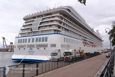
MARINA
Passengers Ship
Current Trip
| Time Travelled | 14 h, 54 mins |
|---|---|
| Remaining Time | --- |
| Distance Travelled | 248.91 nm |
| Remaining Distance | --- |
| AVG Speed | 17.6 Knots |
| MAX Speed | 19.2 Knots |
| AVG Wind | 11.6 knots |
| MAX Wind | 20 knots |
| MIN Temp | 17.1°C / 62.78°F |
| MAX Temp | 20.1°C / 68.18°F |
| Draught | 7.4 m |
| Position Received | 3 m ago |
Current Position
| Longitude | 6.63938° |
|---|---|
| Latitude | 43.28100° |
| Status | At anchor |
| Speed | 0.5 Knots |
| Course | 8° |
| Area | Mediterranean Sea - Western Basin |
| Station | T-AIS |
| Position Received | 3 m ago |
Info
Information
The current position of MARINA is in Mediterranean Sea - Western Basin with coordinates 43.28100° / 6.63938° as reported on 2024-06-02 07:14 by AIS to our vessel tracker app. The vessel's current speed is 0.5 Knots
The vessel MARINA (IMO: 9438066, MMSI: 538003668) is a Passengers Ship that was built in 2011 ( 13 years old ). It's sailing under the flag of [MH] Marshall Is.
In this page you can find informations about the vessels current position, last detected port calls, and current voyage information. If the vessels is not in coverage by AIS you will find the latest position.
The current position of MARINA is detected by our AIS receivers and we are not responsible for the reliability of the data. The last position was recorded while the vessel was in Coverage by the Ais receivers of our vessel tracking app.
The current draught of MARINA as reported by AIS is 7.4 meters
Weather
| Temperature | 17.7°C / 63.86°F |
|---|---|
| Wind Speed | 13 knots |
| Direction | 38° NE |
| Pressure | 1014.5 hPa |
| Humidity | 79 % |
| Cloud Coverage | 5 % |
Featured Company
Last Port Calls
| Port | Arrival | Departure | Time In Port |
|---|---|---|---|
| 2024-06-01 03:15 | 2024-06-01 16:24 | 13 h | |
| 2024-05-30 04:45 | 2024-05-30 16:15 | 11 h | |
| 2024-05-28 03:03 | 2024-05-28 16:05 | 13 h | |
| 2024-05-27 07:19 | 2024-05-27 17:25 | 10 h | |
| 2024-05-26 04:25 | 2024-05-26 13:12 | 8 h | |
| 2024-05-25 07:51 | 2024-05-25 17:02 | 9 h | |
| 2024-05-24 04:42 | 2024-05-24 14:14 | 9 h | |
| 2024-05-23 06:08 | 2024-05-23 18:03 | 11 h | |
| 2024-05-22 04:48 | 2024-05-22 16:32 | 11 h | |
| 2024-05-20 05:15 | 2024-05-20 18:17 | 13 h |
Most Visited Ports (Last year)
| Port | Arrivals | |
|---|---|---|
| 4 | ||
| 4 | ||
| 4 | ||
| 4 | ||
| 3 | ||
| 3 |
Last Trips
| Origin | Departure | Destination | Arrival | Distance | |
|---|---|---|---|---|---|
| 2024-05-30 18:15 | 2024-06-01 05:15 | 341.60 nm | |||
| 2024-05-28 19:05 | 2024-05-30 06:45 | 499.60 nm | |||
| 2024-05-27 20:25 | 2024-05-28 06:03 | 130.42 nm | |||
| 2024-05-26 16:12 | 2024-05-27 10:19 | 318.59 nm | |||
| 2024-05-25 20:02 | 2024-05-26 07:25 | 112.06 nm | |||
| 2024-05-24 16:14 | 2024-05-25 10:51 | 317.51 nm | |||
| 2024-05-23 20:03 | 2024-05-24 06:42 | 103.46 nm | |||
| 2024-05-22 17:32 | 2024-05-23 08:08 | 232.21 nm | |||
| 2024-05-20 20:17 | 2024-05-22 05:48 | 439.84 nm | |||
| 2024-05-19 18:33 | 2024-05-20 07:15 | 142.71 nm |
Events
| Time | Event | Details | Position / Dest | Info |
|---|---|---|---|---|
| 2024-06-02 07:02 | Status Changed | At anchor Default |
43.28104 / 6.64127
FR STP
|
Speed: Course: -1° |
| 2024-06-02 06:56 | Status Changed | Default At anchor |
43.28167 / 6.64167
FR STP
|
Speed: 0.2 kn Course: 7° |
| 2024-06-02 06:26 | Status Changed | At anchor Under way using engine |
43.28145 / 6.64063
FR STP
|
Speed: Course: 345° |
| 2024-06-02 06:23 | STOP Moving | 0.6 nm, North East of SAINT TROPEZ |
43.28120 / 6.64082
FR STP
|
Speed: 0.3 kn Course: 337° |
| 2024-06-02 03:35 | Change Sea Area | French part of the Mediterranean Sea - Western Basin Mon�gasque part of the Mediterranean Sea - Western Basin |
43.24190 / 7.60275
Mediterranean Sea - Western Basin
FR STP
|
Speed: 19.1 kn Course: 275.4° |
| 2024-06-02 03:32 | Change Sea Area | Mon�gasque part of the Mediterranean Sea - Western Basin French part of the Mediterranean Sea - Western Basin |
43.24037 / 7.62520
Mediterranean Sea - Western Basin
FR STP
|
Speed: 19.1 kn Course: 275.4° |
| 2024-06-02 03:11 | Change Sea Area | French part of the Mediterranean Sea - Western Basin Italian part of the Mediterranean Sea - Western Basin |
43.22980 / 7.77833
Mediterranean Sea - Western Basin
FR STP
|
Speed: 19.2 kn Course: 275.6° |
| 2024-06-02 02:02 | Change Sea Area | Italian part of the Mediterranean Sea - Western Basin French part of the Mediterranean Sea - Western Basin |
43.19892 / 8.26717
Mediterranean Sea - Western Basin
FR STP
|
Speed: 18.3 kn Course: 274.1° |
| 2024-06-02 00:05 | Change Sea Area | French part of the Mediterranean Sea - Western Basin French part of the Ligurian Sea |
43.14722 / 9.07837
Mediterranean Sea - Western Basin
FR STP
|
Speed: 18.5 kn Course: 274.1° |
| 2024-06-01 23:11 | Change Sea Area | French part of the Ligurian Sea French part of the Tyrrhenian Sea |
43.11443 / 9.45290
Ligurian Sea
FR STP
|
Speed: 18.1 kn Course: 280.7° |