
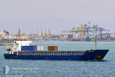
MARION ANITA
General Cargo
Current Trip
| Time Travelled | 2 days |
|---|---|
| Remaining Time | 4 h, 10 mins |
| Distance Travelled | 449.58 nm |
| Remaining Distance | 28.65 nm |
| AVG Speed | 9.1 Knots |
| MAX Speed | 12.4 Knots |
| AVG Wind | 19.1 knots |
| MAX Wind | 30.3 knots |
| MIN Temp | 10.4°C / 50.72°F |
| MAX Temp | 18.4°C / 65.12°F |
| Draught | 5.4 m |
| Position Received | 1 m ago |
Current Position
| Longitude | 9.16177° |
|---|---|
| Latitude | 57.71326° |
| Status | Under way using engine |
| Speed | 7 Knots |
| Course | 99.4° |
| Area | Skaggerak |
| Station | T-AIS |
| Position Received | 1 m ago |
Info
Information
The current position of MARION ANITA is in Skaggerak with coordinates 57.71326° / 9.16177° as reported on 2024-06-13 02:13 by AIS to our vessel tracker app. The vessel's current speed is 7 Knots and is heading at the port of HIRTSHALS. The estimated time of arrival as calculated by vessel tracking app is 2024-06-13 06:24 LT
The vessel MARION ANITA (IMO: 9006291, MMSI: 257088370) is a General Cargo that was built in 1992 ( 32 years old ). It's sailing under the flag of [NO] Norway.
In this page you can find informations about the vessels current position, last detected port calls, and current voyage information. If the vessels is not in coverage by AIS you will find the latest position.
The current position of MARION ANITA is detected by our AIS receivers and we are not responsible for the reliability of the data. The last position was recorded while the vessel was in Coverage by the Ais receivers of our vessel tracking app.
The current draught of MARION ANITA as reported by AIS is 5.4 meters
Weather
| Temperature | 11.4°C / 52.52°F |
|---|---|
| Wind Speed | 21 knots |
| Direction | 260° W |
| Pressure | 1006.4 hPa |
| Humidity | 74.1 % |
| Cloud Coverage | 52 % |
Featured Company
Last Port Calls
| Port | Arrival | Departure | Time In Port |
|---|---|---|---|
| 2024-06-10 00:41 | 2024-06-10 14:17 | 13 h | |
| 2024-06-08 03:28 | 2024-06-08 16:16 | 12 h | |
| 2024-06-06 21:22 | 2024-06-07 10:22 | 13 h | |
| 2024-06-03 07:02 | 2024-06-04 12:47 | 1 d | |
| 2024-06-01 16:42 | 2024-06-02 00:29 | 7 h | |
| 2024-05-29 22:02 | 2024-05-30 13:58 | 15 h | |
| 2024-05-24 16:10 | 2024-05-25 20:55 | 1 d | |
| 2024-05-22 21:57 | 2024-05-23 07:46 | 9 h | |
| 2024-05-20 17:26 | 2024-05-21 13:39 | 20 h | |
| 2024-05-18 15:18 | 2024-05-19 15:51 | 1 d |
Last Trips
| Origin | Departure | Destination | Arrival | Distance | |
|---|---|---|---|---|---|
| 2024-06-08 18:16 | 2024-06-10 02:41 | 292.10 nm | |||
| 2024-06-07 12:22 | 2024-06-08 05:28 | 63.20 nm | |||
| 2024-06-04 14:47 | 2024-06-06 23:22 | 310.17 nm | |||
| 2024-06-02 02:29 | 2024-06-03 09:02 | 299.43 nm | |||
| 2024-05-30 15:58 | 2024-06-01 18:42 | 253.99 nm | |||
| 2024-05-25 22:55 | 2024-05-30 00:02 | 514.44 nm | |||
| 2024-05-23 09:46 | 2024-05-24 18:10 | 292.63 nm | |||
| 2024-05-21 15:39 | 2024-05-22 23:57 | 226.36 nm | |||
| 2024-05-19 16:51 | 2024-05-20 19:26 | 282.58 nm | |||
| 2024-05-17 18:29 | 2024-05-18 16:18 | 229.94 nm |
Events
| Time | Event | Details | Position / Dest | Info |
|---|---|---|---|---|
| 2024-06-13 01:16 | Change Sea Area | Danish part of the Skaggerak Norwegian part of the Skaggerak |
57.73382 / 8.96264
Skaggerak
HIRTSHALS
|
Speed: 6.7 kn Course: 100.9° |
| 2024-06-12 18:14 | ETA Changed | 2024/06/13 09:00 2024/06/13 07:00 |
57.90583 / 7.55972
HIRTSHALS
|
Speed: 8 kn Course: 105.1° |
| 2024-06-12 16:29 | Detected in Sea | Norwegian part of the Skaggerak |
57.94767 / 7.08933
Skaggerak
HIRTSHALS
|
Speed: 9.2 kn Course: 109.9° |
| 2024-06-12 08:39 | Destination Changed | HIRTSHALS PORSGRUNN |
58.75349 / 5.43837
HIRTSHALS
|
Speed: 9.1 kn Course: 159.8° |
| 2024-06-12 06:17 | START Moving | 1.99 nm, North East of DUSANIK |
59.01843 / 5.72270
PORSGRUNN
|
Speed: 3.7 kn Course: 275° |
| 2024-06-12 06:13 | Status Changed | Under way using engine At anchor |
59.01816 / 5.72489
PORSGRUNN
|
Speed: 1 kn Course: 354° |
| 2024-06-12 05:43 | Draught Changed | 5.4 3.8 |
59.01911 / 5.72492
PORSGRUNN
|
Speed: Course: 347° |
| 2024-06-12 05:43 | ETA Changed | 2024/06/13 07:00 2024/06/11 21:00 |
59.01911 / 5.72492
PORSGRUNN
|
Speed: Course: 347° |
| 2024-06-12 05:36 | Destination Changed | PORSGRUNN AAMOEYFJORD |
59.01901 / 5.72483
PORSGRUNN
|
Speed: 0.1 kn Course: 351° |
| 2024-06-12 04:38 | Status Changed | At anchor Default |
59.01946 / 5.72218
AAMOEYFJORD
|
Speed: 0.1 kn Course: 26° |