
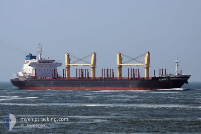
MARITEC
Bulk Carrier
Current Trip
GY GE0
| Time Travelled | 42 days |
|---|---|
| Remaining Time | --- |
| Distance Travelled | 9102.09 nm |
| Remaining Distance | --- |
| AVG Speed | 11.7 Knots |
| MAX Speed | 17 Knots |
| AVG Wind | 12.2 knots |
| MAX Wind | 28 knots |
| MIN Temp | 11.5°C / 52.7°F |
| MAX Temp | 32.4°C / 90.32°F |
| Draught | 8.3 m |
| Position Received | 1 d ago |
Current Position
| Longitude | 18.18440° |
|---|---|
| Latitude | -34.50551° |
| Status | Under way using engine |
| Speed | 14.1 Knots |
| Course | 297.1° |
| Area | South Atlantic Ocean |
| Station | T-AIS |
| Position Received | 1 d ago |
Info
Information
The current position of MARITEC is in South Atlantic Ocean with coordinates -34.50551° / 18.18440° as reported on 2024-06-16 01:49 by AIS to our vessel tracker app. The vessel's current speed is 14.1 Knots
The vessel MARITEC (IMO: 9473391, MMSI: 477189500) is a Bulk Carrier that was built in 2009 ( 15 years old ). It's sailing under the flag of [HK] Hong Kong.
In this page you can find informations about the vessels current position, last detected port calls, and current voyage information. If the vessels is not in coverage by AIS you will find the latest position.
The current position of MARITEC is detected by our AIS receivers and we are not responsible for the reliability of the data. The last position was recorded while the vessel was in Coverage by the Ais receivers of our vessel tracking app.
The current draught of MARITEC as reported by AIS is 8.3 meters
Weather
| Temperature | 17.3°C / 63.14°F |
|---|---|
| Wind Speed | 13 knots |
| Direction | 260° W |
| Pressure | 1018.3 hPa |
| Humidity | 71.3 % |
| Cloud Coverage | 24 % |
Featured Company
Last Trips
| Origin | Departure | Destination | Arrival | Distance |
|---|
Events
| Time | Event | Details | Position / Dest | Info |
|---|---|---|---|---|
| 2024-06-16 01:55 | Status Changed | Default Under way using engine |
-34.49333 / 18.15833
GY GE0
|
Speed: 14.1 kn Course: 297.1° |
| 2024-06-16 01:49 | Status Changed | Under way using engine Default |
-34.50551 / 18.18440
GY GE0
|
Speed: 13.7 kn Course: 297° |
| 2024-06-16 01:49 | OUT of Coverage |
-34.50551 / 18.18440
South Atlantic Ocean
GY GE0
|
Speed: 14.1 kn Course: 297.1° |
|
| 2024-06-16 01:46 | Status Changed | Default Under way using engine |
-34.51118 / 18.19723
GY GE0
|
Speed: 13.9 kn Course: 297.6° |
| 2024-06-16 01:28 | Status Changed | Under way using engine Default |
-34.54518 / 18.27066
GY GE0
|
Speed: 13 kn Course: 298° |
| 2024-06-16 01:04 | Status Changed | Default Under way using engine |
-34.59333 / 18.36167
GY GE0
|
Speed: 13.5 kn Course: 308.1° |
| 2024-06-16 00:10 | Change Sea Area | South African part of the South Atlantic Ocean Indonesian part of the Singapore Strait |
-34.69766 / 18.56358
South Atlantic Ocean
GY GE0
|
Speed: 12.8 kn Course: 305.9° |
| 2024-06-16 00:10 | Status Changed | Under way using engine Default |
-34.69766 / 18.56358
GY GE0
|
Speed: 13 kn Course: 295° |
| 2024-06-16 00:01 | IN Coverage |
-34.69766 / 18.56358
South Atlantic Ocean
GY GE0
|
Speed: 12.8 kn Course: 305.9° |