
MARSHAL VASILEVSKIY
Tanker D
Current Trip
FOR ORDERS
| Time Travelled | --- |
|---|---|
| Remaining Time | --- |
| Distance Travelled | 0.10 nm |
| Remaining Distance | --- |
| AVG Speed | --- |
| MAX Speed | --- |
| AVG Wind | 6.1 knots |
| MAX Wind | 9.3 knots |
| MIN Temp | 1.2°C / 34.16°F |
| MAX Temp | 7.2°C / 44.96°F |
| Draught | 11.9 m |
| Position Received | 2 d ago |
Current Position
| Longitude | 18.50201° |
|---|---|
| Latitude | -34.85583° |
| Status | Under way using engine |
| Speed | 17 Knots |
| Course | 106.9° |
| Area | South Atlantic Ocean |
| Station | T-AIS |
| Position Received | 2 d ago |
Info
Information
The current position of MARSHAL VASILEVSKIY is in South Atlantic Ocean with coordinates -34.85583° / 18.50201° as reported on 2024-05-29 21:56 by AIS to our vessel tracker app. The vessel's current speed is 17 Knots
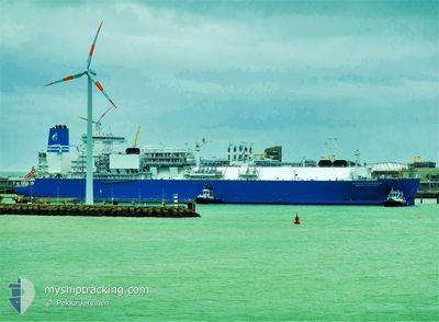
The vessel MARSHAL VASILEVSKIY (IMO: 9778313, MMSI: 273437230) is a Tanker D It's sailing under the flag of [RU] Russia.
In this page you can find informations about the vessels current position, last detected port calls, and current voyage information. If the vessels is not in coverage by AIS you will find the latest position.
The current position of MARSHAL VASILEVSKIY is detected by our AIS receivers and we are not responsible for the reliability of the data. The last position was recorded while the vessel was in Coverage by the Ais receivers of our vessel tracking app.
The current draught of MARSHAL VASILEVSKIY as reported by AIS is 11.9 meters
Weather
| Temperature | --- |
|---|---|
| Wind Speed | --- |
| Direction | --- |
| Pressure | --- |
| Humidity | --- |
| Cloud Coverage | --- |
Featured Company
Last Port Calls
Most Visited Ports (Last year)
| Port | Arrivals |
|---|
Last Trips
| Origin | Departure | Destination | Arrival | Distance |
|---|
Events
| Time | Event | Details | Position / Dest | Info |
|---|---|---|---|---|
| 2024-05-29 21:56 | OUT of Coverage |
-34.85583 / 18.50201
South Atlantic Ocean
FOR ORDERS
|
Speed: 17 kn Course: 106.9° |
|
| 2024-05-29 19:44 | IN Coverage |
-34.45349 / 17.93845
South Atlantic Ocean
FOR ORDERS
|
Speed: 17.1 kn Course: 131.3° |
|
| 2024-05-29 02:55 | OUT of Coverage |
-30.78300 / 14.37796
South Atlantic Ocean
FOR ORDERS
|
Speed: 17.2 kn Course: 140.1° |
|
| 2024-05-29 02:41 | Change Sea Area | South African part of the South Atlantic Ocean Spanish (Canary Islands) part of the North Atlantic Ocean |
-30.72988 / 14.33122
South Atlantic Ocean
FOR ORDERS
|
Speed: 16.8 kn Course: 142.5° |
| 2024-05-29 02:40 | IN Coverage |
-30.72988 / 14.33122
South Atlantic Ocean
FOR ORDERS
|
Speed: 16.8 kn Course: 142.5° |