
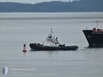
MARSHALL FOSS
Tug
Current Trip
NEAH BAY
| Time Travelled | 5 days |
|---|---|
| Remaining Time | --- |
| Distance Travelled | 161.40 nm |
| Remaining Distance | --- |
| AVG Speed | 8.6 Knots |
| MAX Speed | 12.7 Knots |
| AVG Wind | 13.7 knots |
| MAX Wind | 23.8 knots |
| MIN Temp | 6.4°C / 43.52°F |
| MAX Temp | 12.2°C / 53.96°F |
| Draught | 5.4 m |
| Position Received | Now |
Current Position
| Longitude | -124.61313° |
|---|---|
| Latitude | 48.36850° |
| Status | Moored |
| Speed | |
| Course | 345° |
| Area | The Coastal Waters of Southeast Alaska and British Columbia |
| Station | T-AIS |
| Position Received | Now |
Info
Information
The current position of MARSHALL FOSS is in The Coastal Waters of Southeast Alaska and British Columbia with coordinates 48.36850° / -124.61313° as reported on 2024-05-18 06:30 by AIS to our vessel tracker app. The vessel's current speed is 0 Knots
The vessel MARSHALL FOSS (IMO: 8971877, MMSI: 366982320) is a Tug that was built in 2001 ( 23 years old ). It's sailing under the flag of [US] USA.
In this page you can find informations about the vessels current position, last detected port calls, and current voyage information. If the vessels is not in coverage by AIS you will find the latest position.
The current position of MARSHALL FOSS is detected by our AIS receivers and we are not responsible for the reliability of the data. The last position was recorded while the vessel was in Coverage by the Ais receivers of our vessel tracking app.
The current draught of MARSHALL FOSS as reported by AIS is 5.4 meters
Weather
| Temperature | 6.1°C / 42.98°F |
|---|---|
| Wind Speed | 4 knots |
| Direction | 248° WSW |
| Pressure | 1020.8 hPa |
| Humidity | 93.9 % |
| Cloud Coverage | 69 % |
Featured Company
Last Port Calls
| Port | Arrival | Departure | Time In Port |
|---|---|---|---|
| 2024-05-13 00:41 | 2024-05-13 01:38 | 56 m | |
| 2024-05-12 03:17 | 2024-05-12 18:11 | 14 h | |
| 2024-05-11 14:02 | 2024-05-12 00:56 | 10 h | |
| 2024-05-10 21:36 | 2024-05-11 05:13 | 7 h | |
| 2024-05-10 19:59 | 2024-05-10 21:09 | 1 h | |
| 2024-05-10 17:36 | 2024-05-10 18:52 | 1 h | |
| 2024-05-10 01:09 | 2024-05-10 17:24 | 16 h | |
| 2024-05-09 23:50 | 2024-05-10 00:47 | 57 m | |
| 2024-05-09 20:55 | 2024-05-09 21:51 | 56 m | |
| 2024-05-09 15:41 | 2024-05-09 16:47 | 1 h |
Most Visited Ports (Last year)
| Port | Arrivals | |
|---|---|---|
| 359 | ||
| 78 | ||
| 78 | ||
| 69 | ||
| 62 | ||
| 60 |
Last Trips
| Origin | Departure | Destination | Arrival | Distance | |
|---|---|---|---|---|---|
| 2024-05-12 11:11 | 2024-05-12 17:41 | 66.38 nm | |||
| 2024-05-11 17:56 | 2024-05-11 20:17 | 23.67 nm | |||
| 2024-05-10 22:13 | 2024-05-11 07:02 | 83.55 nm | |||
| 2024-05-10 14:09 | 2024-05-10 14:36 | 2.81 nm | |||
| 2024-05-10 11:52 | 2024-05-10 12:59 | 2.66 nm | |||
| 2024-05-10 10:24 | 2024-05-10 10:36 | 1.09 nm | |||
| 2024-05-09 17:47 | 2024-05-09 18:09 | 2.38 nm | |||
| 2024-05-09 14:51 | 2024-05-09 16:50 | 5.95 nm | |||
| 2024-05-09 09:47 | 2024-05-09 13:55 | 41.66 nm | |||
| 2024-05-08 22:34 | 2024-05-09 08:41 | 60.94 nm |
Events
| Time | Event | Details | Position / Dest | Info |
|---|---|---|---|---|
| 2024-05-18 04:15 | Status Changed | Moored Default |
48.36850 / -124.61313
NEAH BAY
|
Speed: Course: -1° |
| 2024-05-18 04:13 | Status Changed | Default Moored |
48.36833 / -124.61166
NEAH BAY
|
Speed: Course: 345° |
| 2024-05-18 02:03 | Status Changed | Moored Default |
48.36849 / -124.61314
NEAH BAY
|
Speed: Course: -1° |
| 2024-05-18 02:01 | Status Changed | Default Moored |
48.36833 / -124.61166
NEAH BAY
|
Speed: Course: 345° |
| 2024-05-17 20:30 | Status Changed | Moored Under way using engine |
48.36851 / -124.61314
NEAH BAY
|
Speed: Course: 345° |
| 2024-05-17 13:11 | STOP Moving |
48.36845 / -124.61318
NEAH BAY
|
Speed: 0.3 kn Course: 353° |
|
| 2024-05-17 13:00 | Status Changed | Under way using engine Default |
48.37725 / -124.59029
NEAH BAY
|
Speed: 8.2 kn Course: 277° |
| 2024-05-17 12:56 | Status Changed | Default Under way using engine |
48.37826 / -124.57670
NEAH BAY
|
Speed: 10.4 kn Course: 288.1° |
| 2024-05-17 12:50 | Status Changed | Under way using engine Default |
48.37668 / -124.55496
NEAH BAY
|
Speed: 10.5 kn Course: 290° |
| 2024-05-17 11:46 | OUT of Coverage |
48.31035 / -124.30882
The Coastal Waters of Southeast Alaska and British Columbia
|
Speed: 9 kn Course: 288.2° |