
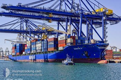
MARTHA A
Container Ship
Current Trip
| Time Travelled | 3 days |
|---|---|
| Remaining Time | 1 day |
| Distance Travelled | 1135.04 nm |
| Remaining Distance | 529.91 nm |
| AVG Speed | 14.6 Knots |
| MAX Speed | 15.8 Knots |
| AVG Wind | 7.1 knots |
| MAX Wind | 24 knots |
| MIN Temp | 18.9°C / 66.02°F |
| MAX Temp | 23°C / 73.4°F |
| Draught | 11.1 m |
| Position Received | 16 h, 19 m ago |
Current Position
| Longitude | 9.78856° |
|---|---|
| Latitude | 37.62800° |
| Status | Under way using engine |
| Speed | 14.4 Knots |
| Course | 270° |
| Area | Mediterranean Sea - Western Basin |
| Station | T-AIS |
| Position Received | 16 h, 19 m ago |
Info
Information
The current position of MARTHA A is in Mediterranean Sea - Western Basin with coordinates 37.62800° / 9.78856° as reported on 2024-05-25 06:47 by AIS to our vessel tracker app. The vessel's current speed is 14.4 Knots and is heading at the port of ALGECIRAS. The estimated time of arrival as calculated by vessel tracking app is 2024-05-27 13:45 LT
The vessel MARTHA A (IMO: 9299484, MMSI: 271044070) is a Container Ship that was built in 2005 ( 19 years old ). It's sailing under the flag of [TR] Turkey.
In this page you can find informations about the vessels current position, last detected port calls, and current voyage information. If the vessels is not in coverage by AIS you will find the latest position.
The current position of MARTHA A is detected by our AIS receivers and we are not responsible for the reliability of the data. The last position was recorded while the vessel was in Coverage by the Ais receivers of our vessel tracking app.
The current draught of MARTHA A as reported by AIS is 11.1 meters
Weather
| Temperature | 20.6°C / 69.08°F |
|---|---|
| Wind Speed | 5 knots |
| Direction | 97° E |
| Pressure | 1018.4 hPa |
| Humidity | 76.1 % |
| Cloud Coverage | 54 % |
Featured Company
Last Port Calls
| Port | Arrival | Departure | Time In Port |
|---|---|---|---|
| 2024-05-21 23:04 | 2024-05-22 16:51 | 17 h | |
| 2024-05-19 07:31 | 2024-05-20 09:32 | 1 d | |
| 2024-05-17 23:58 | 2024-05-18 17:25 | 17 h | |
| 2024-05-16 22:02 | 2024-05-17 12:45 | 14 h | |
| 2024-05-14 21:51 | 2024-05-16 00:16 | 1 d | |
| 2024-05-08 18:08 | 2024-05-09 16:45 | 22 h | |
| 2024-05-07 07:11 | 2024-05-07 18:45 | 11 h | |
| 2024-05-05 01:39 | 2024-05-05 23:22 | 21 h | |
| 2024-05-02 23:31 | 2024-05-03 11:01 | 11 h | |
| 2024-04-27 03:28 | 2024-04-27 18:09 | 14 h |
Last Trips
| Origin | Departure | Destination | Arrival | Distance | |
|---|---|---|---|---|---|
| 2024-05-20 12:32 | 2024-05-22 02:04 | 616.99 nm | |||
| 2024-05-18 20:25 | 2024-05-19 10:31 | 106.39 nm | |||
| 2024-05-17 15:45 | 2024-05-18 02:58 | 139.55 nm | |||
| 2024-05-16 02:16 | 2024-05-17 01:02 | 370.95 nm | |||
| 2024-05-09 18:45 | 2024-05-14 23:51 | 1360.30 nm | |||
| 2024-05-07 20:45 | 2024-05-08 20:08 | 368.28 nm | |||
| 2024-05-06 01:22 | 2024-05-07 09:11 | 190.23 nm | |||
| 2024-05-03 13:01 | 2024-05-05 03:39 | 425.96 nm | |||
| 2024-04-27 21:09 | 2024-05-03 01:31 | 1774.01 nm | |||
| 2024-04-25 15:28 | 2024-04-27 06:28 | 628.12 nm |
Events
| Time | Event | Details | Position / Dest | Info |
|---|---|---|---|---|
| 2024-05-25 06:52 | Status Changed | Default Under way using engine |
37.62805 / 9.76665
ESALG
|
Speed: 14.4 kn Course: 270° |
| 2024-05-25 06:47 | Status Changed | Under way using engine Default |
37.62800 / 9.78856
ESALG
|
Speed: 14.4 kn Course: 269° |
| 2024-05-25 06:47 | OUT of Coverage |
37.62800 / 9.78856
Mediterranean Sea - Western Basin
ESALG
|
Speed: 14.4 kn Course: 270° |
|
| 2024-05-25 06:40 | Status Changed | Default Under way using engine |
37.62848 / 9.82490
ESALG
|
Speed: 14.3 kn Course: 268° |
| 2024-05-25 06:20 | Status Changed | Under way using engine Default |
37.63200 / 9.92560
ESALG
|
Speed: 14.2 kn Course: 268° |
| 2024-05-25 06:17 | Status Changed | Default Under way using engine |
37.63268 / 9.94356
ESALG
|
Speed: 14.2 kn Course: 268° |
| 2024-05-25 05:44 | Status Changed | Under way using engine Default |
37.63119 / 10.10743
ESALG
|
Speed: 14.1 kn Course: 272° |
| 2024-05-25 05:30 | Status Changed | Default Under way using engine |
37.62913 / 10.17630
ESALG
|
Speed: 14.1 kn Course: 271.2° |
| 2024-05-25 00:55 | Change Sea Area | Tunisian part of the Mediterranean Sea - Western Basin Tunisian part of the Mediterranean Sea - Eastern Basin |
37.31860 / 11.48546
Mediterranean Sea - Western Basin
ESALG
|
Speed: 14.9 kn Course: 304° |
| 2024-05-24 23:42 | Status Changed | Under way using engine Default |
37.16613 / 11.80440
ESALG
|
Speed: 14.1 kn Course: 309° |