
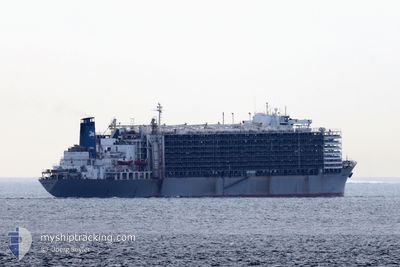
MAWASHI EXPRESS
Livestock Carrier
Current Trip
Unknown
| Time Travelled | 20 days |
|---|---|
| Remaining Time | --- |
| Distance Travelled | 1850.92 nm |
| Remaining Distance | --- |
| AVG Speed | 13 Knots |
| MAX Speed | 14.7 Knots |
| AVG Wind | 13.7 knots |
| MAX Wind | 26 knots |
| MIN Temp | 13°C / 55.4°F |
| MAX Temp | 25.9°C / 78.62°F |
| Draught | 0 m |
| Position Received | 6 d ago |
Current Position
| Longitude | -52.10176° |
|---|---|
| Latitude | -32.09535° |
| Status | Default |
| Speed | |
| Course | 194° |
| Area | South Atlantic Ocean |
| Station | T-AIS |
| Position Received | 6 d ago |
Info
Information
The current position of MAWASHI EXPRESS is in South Atlantic Ocean with coordinates -32.09535° / -52.10176° as reported on 2024-06-19 13:27 by AIS to our vessel tracker app. The vessel's current speed is 0 Knots
The vessel MAWASHI EXPRESS (IMO: 7326893, MMSI: 371632000) is a Livestock Carrier that was built in 1973 ( 51 years old ). It's sailing under the flag of [PA] Panama.
In this page you can find informations about the vessels current position, last detected port calls, and current voyage information. If the vessels is not in coverage by AIS you will find the latest position.
The current position of MAWASHI EXPRESS is detected by our AIS receivers and we are not responsible for the reliability of the data. The last position was recorded while the vessel was in Coverage by the Ais receivers of our vessel tracking app.
Weather
| Temperature | 25.6°C / 78.08°F |
|---|---|
| Wind Speed | 9 knots |
| Direction | 118° ESE |
| Pressure | 1018.2 hPa |
| Humidity | 70.7 % |
| Cloud Coverage | 7 % |
Featured Company
Last Port Calls
| Port | Arrival | Departure | Time In Port |
|---|---|---|---|
| 2024-06-04 06:04 | 2024-06-06 06:16 | 2 d | |
| 2024-05-06 15:19 | |||
| 2024-04-04 02:41 | 2024-04-07 14:34 | 3 d |
Most Visited Ports (Last year)
| Port | Arrivals | |
|---|---|---|
| 2 | ||
| 2 | ||
| 2 | ||
| 1 | ||
| 1 | ||
| 1 |
Last Trips
| Origin | Departure | Destination | Arrival | Distance | |
|---|---|---|---|---|---|
| 2024-05-06 19:19 | 2024-06-04 03:04 | 8782.77 nm | |||
| 2024-03-04 02:26 | 2024-04-04 05:41 | 9680.98 nm |
Events
| Time | Event | Details | Position / Dest | Info |
|---|---|---|---|---|
| 2024-06-21 19:22 | START Moving | 4.26 nm, South of RIO GRANDE |
-32.09834 / -52.09959
|
Speed: 5.4 kn Course: 179° |
| 2024-06-19 13:27 | OUT of Coverage |
-32.09535 / -52.10176
South Atlantic Ocean
|
Speed: Course: 194° |
|
| 2024-06-19 11:22 | IN Coverage |
-32.09522 / -52.10172
South Atlantic Ocean
|
Speed: Course: 194° |
|
| 2024-06-17 19:27 | OUT of Coverage |
-32.09523 / -52.10175
South Atlantic Ocean
|
Speed: Course: 194° |
|
| 2024-06-17 16:25 | Status Changed | Default Under way using engine |
-32.09527 / -52.10173
|
Speed: 96 kn Course: 194° |
| 2024-06-17 16:25 | Status Changed | Under way using engine Default |
-32.09526 / -52.10174
|
Speed: Course: 194° |
| 2024-06-17 15:39 | Status Changed | Default Under way using engine |
-32.09528 / -52.10175
|
Speed: 96 kn Course: 194° |
| 2024-06-17 15:39 | Status Changed | Under way using engine Default |
-32.09528 / -52.10175
|
Speed: Course: 194° |
| 2024-06-17 14:47 | Draught Changed | 0 9.1 |
-32.09518 / -52.10176
|
Speed: Course: 194° |
| 2024-06-17 14:17 | Status Changed | Default Moored |
-32.09524 / -52.10174
RIG BR
|
Speed: Course: 194° |