
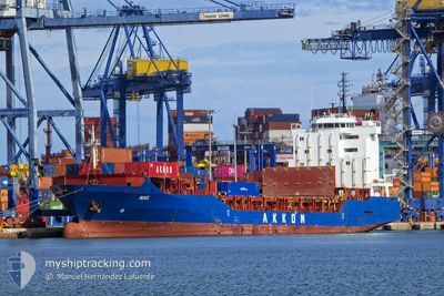
MAX
General Cargo
Current Trip
| Trip Time | 1 day |
|---|---|
| Trip Distance | 510.93 nm |
| AVG Speed | 14.4 Knots |
| MAX Speed | 15.6 Knots |
| Draught | 7.3 m |
| AVG Wind | 8.3 knots |
| MAX Wind | 17.8 knots |
| MIN Temp | 16.2°C / 61.16°F |
| MAX Temp | 27.2°C / 80.96°F |
| Position Received | 1 d ago |
Current Position
| Longitude | 15.46495° |
|---|---|
| Latitude | 35.79676° |
| Status | Under way using engine |
| Speed | 15.3 Knots |
| Course | 181.7° |
| Area | Mediterranean Sea - Eastern Basin |
| Station | T-AIS |
| Position Received | 1 d ago |
Info
Information
The current position of MAX is in Mediterranean Sea - Eastern Basin with coordinates 35.79676° / 15.46495° as reported on 2024-05-17 07:00 by AIS to our vessel tracker app. The vessel's current speed is 15.3 Knots and is currently inside the port of MISURATA.
The vessel MAX (IMO: 9351098, MMSI: 636020515) is a General Cargo that was built in 2006 ( 18 years old ). It's sailing under the flag of [LR] Liberia.
In this page you can find informations about the vessels current position, last detected port calls, and current voyage information. If the vessels is not in coverage by AIS you will find the latest position.
The current position of MAX is detected by our AIS receivers and we are not responsible for the reliability of the data. The last position was recorded while the vessel was in Coverage by the Ais receivers of our vessel tracking app.
The current draught of MAX as reported by AIS is 7.3 meters
Weather
| Temperature | 23.3°C / 73.94°F |
|---|---|
| Wind Speed | 7 knots |
| Direction | 315° NW |
| Pressure | 1009.9 hPa |
| Humidity | 66.5 % |
| Cloud Coverage | 100 % |
Featured Company
Last Port Calls
| Port | Arrival | Departure | Time In Port |
|---|---|---|---|
| 2024-05-17 22:06 | |||
| 2024-05-16 04:12 | 2024-05-16 10:11 | 5 h | |
| 2024-05-14 10:28 | 2024-05-14 22:33 | 12 h | |
| 2024-05-12 14:09 | 2024-05-12 23:20 | 9 h | |
| 2024-05-12 02:26 | 2024-05-12 10:35 | 8 h | |
| 2024-05-09 19:56 | 2024-05-10 06:15 | 10 h | |
| 2024-05-03 19:23 | 2024-05-06 06:13 | 2 d | |
| 2024-04-24 05:50 | 2024-04-28 11:38 | 4 d | |
| 2024-04-22 15:49 | 2024-04-22 21:45 | 5 h | |
| 2024-04-19 05:49 | 2024-04-20 08:44 | 1 d |
Last Trips
| Origin | Departure | Destination | Arrival | Distance | |
|---|---|---|---|---|---|
| 2024-05-16 12:11 | 2024-05-18 00:06 | 510.93 nm | |||
| 2024-05-15 00:33 | 2024-05-16 06:12 | 372.22 nm | |||
| 2024-05-13 01:20 | 2024-05-14 12:28 | 485.51 nm | |||
| 2024-05-12 12:35 | 2024-05-12 16:09 | 45.87 nm | |||
| 2024-05-10 07:15 | 2024-05-12 04:26 | 595.59 nm | |||
| 2024-05-06 07:13 | 2024-05-09 20:56 | 609.67 nm | |||
| 2024-04-28 12:38 | 2024-05-03 20:23 | 535.35 nm | |||
| 2024-04-22 23:45 | 2024-04-24 06:50 | 317.04 nm | |||
| 2024-04-20 11:44 | 2024-04-22 17:49 | 789.11 nm | |||
| 2024-04-18 10:13 | 2024-04-19 08:49 | 269.40 nm |
Events
| Time | Event | Details | Position / Dest | Info |
|---|---|---|---|---|
| 2024-05-17 22:06 | PORT ARRIVAL |
|
32.36762 / 15.21758
[LY] MISURATA
|
Speed: 4.4 kn Course: 264° |
| 2024-05-17 07:07 | Status Changed | Default Under way using engine |
35.77017 / 15.46336
LYMRA
|
Speed: 15.3 kn Course: 181.7° |
| 2024-05-17 07:00 | OUT of Coverage |
35.79676 / 15.46495
Mediterranean Sea - Eastern Basin
LYMRA
|
Speed: 15.3 kn Course: 181.7° |
|
| 2024-05-17 06:17 | Change Sea Area | Maltese part of the Mediterranean Sea - Eastern Basin Italian part of the Mediterranean Sea - Eastern Basin |
35.97796 / 15.47686
Mediterranean Sea - Eastern Basin
LYMRA
|
Speed: 14.5 kn Course: 182° |
| 2024-05-17 03:38 | Change Sea Area | Italian part of the Mediterranean Sea - Eastern Basin Italian part of the Ionian Sea |
36.62359 / 15.51381
Mediterranean Sea - Eastern Basin
LYMRA
|
Speed: 14.6 kn Course: 178.4° |
| 2024-05-17 02:58 | Status Changed | Under way using engine Default |
36.78375 / 15.52102
LYMRA
|
Speed: 14.6 kn Course: 183° |
| 2024-05-17 02:52 | Status Changed | Default Under way using engine |
36.80885 / 15.52221
LYMRA
|
Speed: 14.5 kn Course: 183.5° |
| 2024-05-17 00:59 | Status Changed | Under way using engine Default |
37.25357 / 15.44299
LYMRA
|
Speed: 14.5 kn Course: 165° |
| 2024-05-17 00:57 | Status Changed | Default Under way using engine |
37.26342 / 15.43988
LYMRA
|
Speed: 14.4 kn Course: 166.9° |
| 2024-05-17 00:12 | Status Changed | Under way using engine Default |
37.43762 / 15.39034
LYMRA
|
Speed: 14.3 kn Course: 172° |