
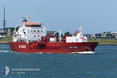
MAYOURY
Tanker
Current Trip
| Time Travelled | 2 days |
|---|---|
| Remaining Time | 59 mins |
| Distance Travelled | 441.53 nm |
| Remaining Distance | 9.27 nm |
| AVG Speed | 9.3 Knots |
| MAX Speed | 11 Knots |
| AVG Wind | 12.4 knots |
| MAX Wind | 26 knots |
| MIN Temp | 17.8°C / 64.04°F |
| MAX Temp | 20.1°C / 68.18°F |
| Draught | 5 m |
| Position Received | 1 m ago |
Current Position
| Longitude | -5.46039° |
|---|---|
| Latitude | 35.95276° |
| Status | Under way using engine |
| Speed | 10 Knots |
| Course | 74.8° |
| Area | Strait of Gibraltar |
| Station | T-AIS |
| Position Received | 1 m ago |
Info
Information
The current position of MAYOURY is in Strait of Gibraltar with coordinates 35.95276° / -5.46039° as reported on 2024-06-01 09:37 by AIS to our vessel tracker app. The vessel's current speed is 10 Knots and is heading at the port of CEUTA. The estimated time of arrival as calculated by vessel tracking app is 2024-06-01 10:38 LT
The vessel MAYOURY (IMO: 9777541, MMSI: 256775000) is a Tanker It's sailing under the flag of [MT] Malta.
In this page you can find informations about the vessels current position, last detected port calls, and current voyage information. If the vessels is not in coverage by AIS you will find the latest position.
The current position of MAYOURY is detected by our AIS receivers and we are not responsible for the reliability of the data. The last position was recorded while the vessel was in Coverage by the Ais receivers of our vessel tracking app.
The current draught of MAYOURY as reported by AIS is 5 meters
Weather
| Temperature | 18.4°C / 65.12°F |
|---|---|
| Wind Speed | 17 knots |
| Direction | 76° ENE |
| Pressure | 1013.8 hPa |
| Humidity | 91 % |
| Cloud Coverage | 90 % |
Featured Company
Last Port Calls
| Port | Arrival | Departure | Time In Port |
|---|---|---|---|
| 2024-05-29 00:33 | 2024-05-30 09:27 | 1 d | |
| 2024-05-24 13:11 | 2024-05-25 23:44 | 1 d | |
| 2024-05-21 10:53 | 2024-05-21 16:35 | 5 h | |
| 2024-05-16 08:29 | 2024-05-17 07:42 | 23 h | |
| 2024-05-06 10:47 | 2024-05-06 15:45 | 4 h | |
| 2024-05-03 19:29 | 2024-05-04 17:04 | 21 h | |
| 2024-04-24 22:22 | 2024-04-25 02:50 | 4 h | |
| 2024-04-22 20:43 | 2024-04-23 19:33 | 22 h | |
| 2024-04-18 08:12 | 2024-04-19 05:31 | 21 h | |
| 2024-04-06 07:43 | 2024-04-06 13:09 | 5 h |
Most Visited Ports (Last year)
| Port | Arrivals | |
|---|---|---|
| 7 | ||
| 7 | ||
| 3 | ||
| 2 |
Last Trips
| Origin | Departure | Destination | Arrival | Distance | |
|---|---|---|---|---|---|
| 2024-05-26 01:44 | 2024-05-29 01:33 | 700.51 nm | |||
| 2024-05-21 18:35 | 2024-05-24 15:11 | 258.33 nm | |||
| 2024-05-17 08:42 | 2024-05-21 12:53 | 971.54 nm | |||
| 2024-05-06 17:45 | 2024-05-16 09:29 | 1020.87 nm | |||
| 2024-05-04 19:04 | 2024-05-06 12:47 | 251.58 nm | |||
| 2024-04-25 04:50 | 2024-05-03 21:29 | 1667.25 nm | |||
| 2024-04-23 21:33 | 2024-04-25 00:22 | 254.86 nm | |||
| 2024-04-19 06:31 | 2024-04-22 22:43 | 697.99 nm | |||
| 2024-04-06 15:09 | 2024-04-18 09:12 | 1036.86 nm | |||
| 2024-04-05 06:25 | 2024-04-06 09:43 | 255.73 nm |
Events
| Time | Event | Details | Position / Dest | Info |
|---|---|---|---|---|
| 2024-06-01 09:07 | ETA Changed | 2025/01/06 10:45 2024/06/01 09:00 |
35.92971 / -5.55727
CEUTA
|
Speed: 9 kn Course: 75.2° |
| 2024-06-01 07:52 | Status Changed | Under way using engine Default |
35.91309 / -5.75124
CEUTA
|
Speed: 7.5 kn Course: 87° |
| 2024-06-01 07:39 | Status Changed | Default Under way using engine |
35.90996 / -5.78280
CEUTA
|
Speed: 7.2 kn Course: 89.2° |
| 2024-06-01 07:15 | Status Changed | Under way using engine Default |
35.90875 / -5.84291
CEUTA
|
Speed: 7.4 kn Course: 87° |
| 2024-06-01 06:51 | Status Changed | Default Under way using engine |
35.90574 / -5.90390
CEUTA
|
Speed: 7.7 kn Course: 84.3° |
| 2024-06-01 06:43 | Change Sea Area | Moroccan part of the Strait of Gibraltar Moroccan part of the North Atlantic Ocean |
35.90422 / -5.92560
Strait of Gibraltar
CEUTA
|
Speed: 7.7 kn Course: 83.7° |
| 2024-06-01 06:43 | Status Changed | Under way using engine Default |
35.90422 / -5.92560
CEUTA
|
Speed: 7.4 kn Course: 86° |
| 2024-06-01 06:04 | Status Changed | Default Under way using engine |
35.89941 / -6.02887
CEUTA
|
Speed: 8 kn Course: 87.2° |
| 2024-06-01 05:52 | Status Changed | Under way using engine Default |
35.89791 / -6.06004
CEUTA
|
Speed: 8.1 kn Course: 87° |
| 2024-06-01 05:52 | IN Coverage |
35.89791 / -6.06004
North Atlantic Ocean
CEUTA
|
Speed: 8.2 kn Course: 86.8° |