
MBA FUTURE
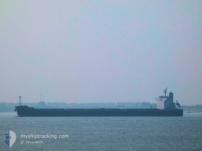
Bulk Carrier
Current Trip
| Time Travelled | 23 days |
|---|---|
| Remaining Time | 1 day |
| Distance Travelled | 5885.74 nm |
| Remaining Distance | 475.64 nm |
| AVG Speed | 10.2 Knots |
| MAX Speed | 14 Knots |
| AVG Wind | 11.3 knots |
| MAX Wind | 27 knots |
| MIN Temp | 20.4°C / 68.72°F |
| MAX Temp | 30.3°C / 86.54°F |
| Draught | 14.5 m |
| Position Received | 2 d ago |
Current Position
| Longitude | 105.36536° |
|---|---|
| Latitude | 3.05464° |
| Status | Under way using engine |
| Speed | 10 Knots |
| Course | 22° |
| Area | South China Sea |
| Station | T-AIS |
| Position Received | 2 d ago |
Info
Information
The current position of MBA FUTURE is in South China Sea with coordinates 3.05464° / 105.36536° as reported on 2024-06-14 07:02 by AIS to our vessel tracker app. The vessel's current speed is 10 Knots and is heading at the port of HON GAI. The estimated time of arrival as calculated by vessel tracking app is 2024-06-18 19:41 LT
The vessel MBA FUTURE (IMO: 9494084, MMSI: 247276600) is a Bulk Carrier that was built in 2009 ( 15 years old ). It's sailing under the flag of [IT] Italy.
In this page you can find informations about the vessels current position, last detected port calls, and current voyage information. If the vessels is not in coverage by AIS you will find the latest position.
The current position of MBA FUTURE is detected by our AIS receivers and we are not responsible for the reliability of the data. The last position was recorded while the vessel was in Coverage by the Ais receivers of our vessel tracking app.
The current draught of MBA FUTURE as reported by AIS is 14.5 meters
Weather
| Temperature | 28.9°C / 84.02°F |
|---|---|
| Wind Speed | 14 knots |
| Direction | 190° S |
| Pressure | 1007 hPa |
| Humidity | 79 % |
| Cloud Coverage | 75 % |
Featured Company
Last Port Calls
| Port | Arrival | Departure | Time In Port |
|---|---|---|---|
| 2024-05-23 07:03 | 2024-05-24 18:07 | 1 d | |
| 2024-05-08 04:28 | 2024-05-10 12:00 | 2 d | |
| 2024-04-18 07:53 | 2024-04-22 23:47 | 4 d |
Most Visited Ports (Last year)
| Port | Arrivals | |
|---|---|---|
| 3 | ||
| 3 | ||
| 2 | ||
| 2 | ||
| 1 | ||
| 1 |
Last Trips
| Origin | Departure | Destination | Arrival | Distance | |
|---|---|---|---|---|---|
| 2024-05-10 17:30 | 2024-05-23 09:03 | 3676.95 nm | |||
| 2024-04-23 01:47 | 2024-05-08 09:58 | 3682.83 nm | |||
| 2024-03-26 11:39 | 2024-04-18 09:53 | 4417.90 nm |
Events
| Time | Event | Details | Position / Dest | Info |
|---|---|---|---|---|
| 2024-06-14 07:10 | Status Changed | Default Under way using engine |
3.07833 / 105.37500
HON GAI
|
Speed: 10 kn Course: 22° |
| 2024-06-14 07:02 | OUT of Coverage |
3.05464 / 105.36536
South China Sea
HON GAI
|
Speed: 10 kn Course: 22° |
|
| 2024-06-14 06:36 | Status Changed | Under way using engine Default |
2.98334 / 105.33504
HON GAI
|
Speed: 10 kn Course: 23° |
| 2024-06-14 06:31 | Status Changed | Default Under way using engine |
2.97167 / 105.32833
HON GAI
|
Speed: 10 kn Course: 23° |
| 2024-06-14 06:27 | Status Changed | Under way using engine Default |
2.95825 / 105.32397
HON GAI
|
Speed: 10 kn Course: 23° |
| 2024-06-14 05:55 | Status Changed | Default Under way using engine |
2.87167 / 105.28667
HON GAI
|
Speed: 10 kn Course: 23° |
| 2024-06-14 05:42 | Status Changed | Under way using engine Default |
2.83568 / 105.27184
HON GAI
|
Speed: 10 kn Course: 22° |
| 2024-06-14 05:34 | Status Changed | Default Under way using engine |
2.81333 / 105.26166
HON GAI
|
Speed: 10 kn Course: 22° |
| 2024-06-14 05:31 | Change Sea Area | Indonesian part of the South China Sea Malaysian part of the Singapore Strait |
2.80289 / 105.25844
South China Sea
HON GAI
|
Speed: 10 kn Course: 22° |
| 2024-06-14 05:31 | Status Changed | Under way using engine Default |
2.80289 / 105.25844
HON GAI
|
Speed: 10 kn Course: 21° |