
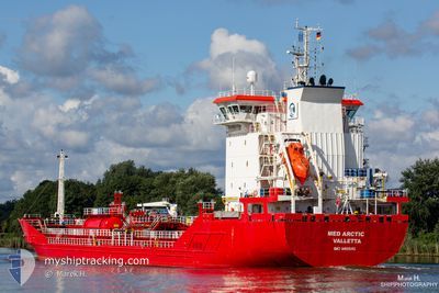
MED ARCTIC
Oil/Chemical Tanker
Current Trip
FRFOS
| Time Travelled | 6 h, 29 mins |
|---|---|
| Remaining Time | --- |
| Distance Travelled | 22.40 nm |
| Remaining Distance | --- |
| AVG Speed | 11.9 Knots |
| MAX Speed | 12.4 Knots |
| AVG Wind | 3.4 knots |
| MAX Wind | 4.5 knots |
| MIN Temp | 18°C / 64.4°F |
| MAX Temp | 19.1°C / 66.38°F |
| Draught | 5.4 m |
| Position Received | 4 h, 46 m ago |
Current Position
| Longitude | 5.04547° |
|---|---|
| Latitude | 43.07225° |
| Status | Under way using engine |
| Speed | 12.4 Knots |
| Course | 174.9° |
| Area | Mediterranean Sea - Western Basin |
| Station | T-AIS |
| Position Received | 4 h, 46 m ago |
Info
Information
The current position of MED ARCTIC is in Mediterranean Sea - Western Basin with coordinates 43.07225° / 5.04547° as reported on 2024-05-19 21:30 by AIS to our vessel tracker app. The vessel's current speed is 12.4 Knots
The vessel MED ARCTIC (IMO: 9410545, MMSI: 248054000) is a Oil/Chemical Tanker that was built in 2009 ( 15 years old ). It's sailing under the flag of [MT] Malta.
In this page you can find informations about the vessels current position, last detected port calls, and current voyage information. If the vessels is not in coverage by AIS you will find the latest position.
The current position of MED ARCTIC is detected by our AIS receivers and we are not responsible for the reliability of the data. The last position was recorded while the vessel was in Coverage by the Ais receivers of our vessel tracking app.
The current draught of MED ARCTIC as reported by AIS is 5.4 meters
Weather
| Temperature | 17.4°C / 63.32°F |
|---|---|
| Wind Speed | 2 knots |
| Direction | 177° S |
| Pressure | 1009.8 hPa |
| Humidity | 79 % |
| Cloud Coverage | 100 % |
Featured Company
Last Port Calls
| Port | Arrival | Departure | Time In Port |
|---|---|---|---|
| 2024-05-18 18:48 | 2024-05-19 19:48 | 1 d | |
| 2024-05-13 17:34 | 2024-05-14 17:15 | 23 h | |
| 2024-05-08 20:17 | 2024-05-09 18:38 | 22 h | |
| 2024-05-03 13:21 | 2024-05-04 09:15 | 19 h | |
| 2024-04-29 19:35 | 2024-05-01 04:48 | 1 d | |
| 2024-04-24 07:10 | 2024-04-25 09:40 | 1 d | |
| 2024-04-20 07:44 | 2024-04-21 11:34 | 1 d | |
| 2024-04-17 10:29 | 2024-04-18 08:38 | 22 h | |
| 2024-04-13 16:42 | 2024-04-14 15:01 | 22 h | |
| 2024-04-09 02:18 | 2024-04-09 23:52 | 21 h |
Last Trips
| Origin | Departure | Destination | Arrival | Distance | |
|---|---|---|---|---|---|
| 2024-05-14 19:15 | 2024-05-18 20:48 | 633.48 nm | |||
| 2024-05-09 20:38 | 2024-05-13 19:34 | 383.97 nm | |||
| 2024-05-04 11:15 | 2024-05-08 22:17 | 1025.98 nm | |||
| 2024-05-01 06:48 | 2024-05-03 15:21 | 648.46 nm | |||
| 2024-04-25 11:40 | 2024-04-29 21:35 | 650.51 nm | |||
| 2024-04-21 13:34 | 2024-04-24 09:10 | 684.29 nm | |||
| 2024-04-18 10:38 | 2024-04-20 09:44 | 257.08 nm | |||
| 2024-04-14 17:01 | 2024-04-17 12:29 | 382.93 nm | |||
| 2024-04-10 01:52 | 2024-04-13 18:42 | 379.49 nm | |||
| 2024-04-07 20:13 | 2024-04-09 04:18 | 378.66 nm |
Events
| Time | Event | Details | Position / Dest | Info |
|---|---|---|---|---|
| 2024-05-19 21:36 | Status Changed | Default Under way using engine |
43.05001 / 5.04803
FRFOS
|
Speed: 12.4 kn Course: 174.9° |
| 2024-05-19 21:30 | OUT of Coverage |
43.07225 / 5.04547
Mediterranean Sea - Western Basin
|
Speed: 12.4 kn Course: 174.9° |
|
| 2024-05-19 20:57 | Status Changed | Under way using engine Default |
43.18244 / 5.02306
FRFOS
|
Speed: 12.2 kn Course: 167° |
| 2024-05-19 20:45 | Status Changed | Default Under way using engine |
43.22357 / 5.01002
FRFOS
|
Speed: 12 kn Course: 166.3° |
| 2024-05-19 20:23 | Status Changed | Under way using engine Default |
43.29504 / 4.98543
FRFOS
|
Speed: 12 kn Course: 166° |
| 2024-05-19 20:20 | Status Changed | Default Under way using engine |
43.30210 / 4.98296
FRFOS
|
Speed: 12.1 kn Course: 165.6° |
| 2024-05-19 20:06 | Status Changed | Under way using engine Default |
43.34850 / 4.96648
FRFOS
|
Speed: 11.8 kn Course: 169° |
| 2024-05-19 20:06 | IN Coverage |
43.34209 / 4.96870
Mediterranean Sea - Western Basin
|
Speed: 11.9 kn Course: 164.5° |
|
| 2024-05-19 19:48 | PORT DEPARTURE |
|
43.38567 / 4.93666
FRFOS
|
Speed: 11.7 kn Course: 119° |
| 2024-05-19 19:33 | START Moving |
43.41172 / 4.88090
[FR] FOS
|
Speed: 9.5 kn Course: 163° |