
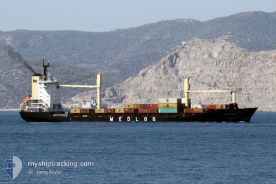
MED DENIZLI
Container Ship
Current Trip
| Time Travelled | 1 day |
|---|---|
| Remaining Time | 3 h, 1 mins |
| Distance Travelled | 407.04 nm |
| Remaining Distance | 67.22 nm |
| AVG Speed | 10.4 Knots |
| MAX Speed | 12.8 Knots |
| AVG Wind | 7 knots |
| MAX Wind | 11 knots |
| MIN Temp | 22.6°C / 72.68°F |
| MAX Temp | 25.8°C / 78.44°F |
| Draught | 7 m |
| Position Received | 12 m ago |
Current Position
| Longitude | 30.03178° |
|---|---|
| Latitude | 31.61708° |
| Status | Under way using engine |
| Speed | 10.6 Knots |
| Course | 226.1° |
| Area | Mediterranean Sea - Eastern Basin |
| Station | T-AIS |
| Position Received | 12 m ago |
Info
Information
The current position of MED DENIZLI is in Mediterranean Sea - Eastern Basin with coordinates 31.61708° / 30.03178° as reported on 2024-06-03 08:12 by AIS to our vessel tracker app. The vessel's current speed is 10.6 Knots and is heading at the port of ALEXANDRIA. The estimated time of arrival as calculated by vessel tracking app is 2024-06-03 11:25 LT
The vessel MED DENIZLI (IMO: 9106493, MMSI: 271044398) is a Container Ship that was built in 1996 ( 28 years old ). It's sailing under the flag of [TR] Turkey.
In this page you can find informations about the vessels current position, last detected port calls, and current voyage information. If the vessels is not in coverage by AIS you will find the latest position.
The current position of MED DENIZLI is detected by our AIS receivers and we are not responsible for the reliability of the data. The last position was recorded while the vessel was in Coverage by the Ais receivers of our vessel tracking app.
The current draught of MED DENIZLI as reported by AIS is 7 meters
Weather
| Temperature | 23.9°C / 75.02°F |
|---|---|
| Wind Speed | 8 knots |
| Direction | 348° NNW |
| Pressure | 1013 hPa |
| Humidity | 74.5 % |
| Cloud Coverage | --- |
Featured Company
Last Port Calls
| Port | Arrival | Departure | Time In Port |
|---|---|---|---|
| 2024-05-31 23:14 | 2024-06-01 16:14 | 16 h | |
| 2024-05-28 23:44 | 2024-05-30 04:27 | 1 d | |
| 2024-05-24 17:40 | 2024-05-25 04:05 | 10 h | |
| 2024-05-22 22:37 | 2024-05-23 08:23 | 9 h | |
| 2024-05-21 14:03 | 2024-05-22 16:44 | 1 d | |
| 2024-05-20 02:07 | 2024-05-21 03:44 | 1 d | |
| 2024-05-14 12:27 | 2024-05-15 15:35 | 1 d | |
| 2024-05-10 21:16 | 2024-05-12 00:12 | 1 d | |
| 2024-05-09 15:00 | 2024-05-10 06:32 | 15 h | |
| 2024-05-07 02:12 | 2024-05-07 23:40 | 21 h |
Last Trips
| Origin | Departure | Destination | Arrival | Distance | |
|---|---|---|---|---|---|
| 2024-05-30 06:27 | 2024-06-01 02:14 | 439.57 nm | |||
| 2024-05-25 07:05 | 2024-05-29 01:44 | 527.70 nm | |||
| 2024-05-23 11:23 | 2024-05-24 20:40 | 374.43 nm | |||
| 2024-05-22 19:44 | 2024-05-23 01:37 | 60.43 nm | |||
| 2024-05-21 06:44 | 2024-05-21 17:03 | 102.18 nm | |||
| 2024-05-15 18:35 | 2024-05-20 05:07 | 231.35 nm | |||
| 2024-05-12 03:12 | 2024-05-14 15:27 | 611.28 nm | |||
| 2024-05-10 09:32 | 2024-05-11 00:16 | 127.81 nm | |||
| 2024-05-08 02:40 | 2024-05-09 18:00 | 315.37 nm | |||
| 2024-05-03 10:16 | 2024-05-07 05:12 | 445.64 nm |
Events
| Time | Event | Details | Position / Dest | Info |
|---|---|---|---|---|
| 2024-06-03 08:13 | Status Changed | Default Under way using engine |
31.61429 / 30.02840
EGALY
|
Speed: 10.6 kn Course: 226.1° |
| 2024-06-03 08:12 | Status Changed | Under way using engine Default |
31.61708 / 30.03178
EGALY
|
Speed: 10.6 kn Course: 227° |
| 2024-06-03 08:12 | IN Coverage |
31.61708 / 30.03178
Mediterranean Sea - Eastern Basin
EGALY
|
Speed: 10.6 kn Course: 226.1° |
|
| 2024-06-03 04:43 | Status Changed | Default Under way using engine |
32.03657 / 30.54918
EGALY
|
Speed: 9.6 kn Course: 232.1° |
| 2024-06-03 04:37 | OUT of Coverage |
32.04614 / 30.56371
Mediterranean Sea - Eastern Basin
EGALY
|
Speed: 9.6 kn Course: 232.1° |
|
| 2024-06-03 03:58 | Status Changed | Under way using engine Default |
32.11537 / 30.65713
EGALY
|
Speed: 10 kn Course: 226° |
| 2024-06-03 03:51 | Status Changed | Default Under way using engine |
32.12908 / 30.67305
EGALY
|
Speed: 9.9 kn Course: 219.2° |
| 2024-06-03 03:14 | Status Changed | Under way using engine Default |
32.20878 / 30.74522
EGALY
|
Speed: 9.8 kn Course: 219° |
| 2024-06-03 03:14 | IN Coverage |
32.20408 / 30.74093
Mediterranean Sea - Eastern Basin
EGALY
|
Speed: 9.8 kn Course: 217.6° |
|
| 2024-06-03 02:12 | OUT of Coverage |
32.33063 / 30.88469
Mediterranean Sea - Eastern Basin
EGALY
|
Speed: 9.9 kn Course: 239° |