
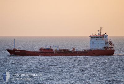
MED PAKIZE
Tanker
Current Trip
| Time Travelled | 1 day |
|---|---|
| Remaining Time | 17 h, 22 mins |
| Distance Travelled | 216.73 nm |
| Remaining Distance | 168.63 nm |
| AVG Speed | 9 Knots |
| MAX Speed | 12.9 Knots |
| AVG Wind | 10.7 knots |
| MAX Wind | 16 knots |
| MIN Temp | 18.8°C / 65.84°F |
| MAX Temp | 19.7°C / 67.46°F |
| Draught | 5.5 m |
| Position Received | 1 h, 48 m ago |
Current Position
| Longitude | -9.39227° |
|---|---|
| Latitude | 35.81512° |
| Status | Under way using engine |
| Speed | 9.3 Knots |
| Course | 71.6° |
| Area | North Atlantic Ocean |
| Station | T-AIS |
| Position Received | 1 h, 48 m ago |
Info
Information
The current position of MED PAKIZE is in North Atlantic Ocean with coordinates 35.81512° / -9.39227° as reported on 2024-06-07 00:15 by AIS to our vessel tracker app. The vessel's current speed is 9.3 Knots and is heading at the port of HUELVA. The estimated time of arrival as calculated by vessel tracking app is 2024-06-07 19:26 LT
The vessel MED PAKIZE (IMO: 9830604, MMSI: 215486000) is a Tanker It's sailing under the flag of [MT] Malta.
In this page you can find informations about the vessels current position, last detected port calls, and current voyage information. If the vessels is not in coverage by AIS you will find the latest position.
The current position of MED PAKIZE is detected by our AIS receivers and we are not responsible for the reliability of the data. The last position was recorded while the vessel was in Coverage by the Ais receivers of our vessel tracking app.
The current draught of MED PAKIZE as reported by AIS is 5.5 meters
Weather
| Temperature | 18.8°C / 65.84°F |
|---|---|
| Wind Speed | 12 knots |
| Direction | 289° WNW |
| Pressure | 1011.3 hPa |
| Humidity | 83.6 % |
| Cloud Coverage | 100 % |
Featured Company
Last Port Calls
| Port | Arrival | Departure | Time In Port |
|---|---|---|---|
| 2024-06-01 21:22 | 2024-06-05 23:45 | 4 d | |
| 2024-05-25 13:51 | 2024-05-27 16:35 | 2 d | |
| 2024-05-21 16:22 | 2024-05-22 02:30 | 10 h | |
| 2024-05-19 13:47 | 2024-05-21 15:19 | 2 d | |
| 2024-05-04 11:16 | 2024-05-08 21:20 | 4 d | |
| 2024-04-29 10:23 | 2024-04-30 02:53 | 16 h | |
| 2024-04-27 06:41 | 2024-04-28 13:35 | 1 d | |
| 2024-04-23 10:22 | 2024-04-23 16:34 | 6 h | |
| 2024-04-17 01:28 | 2024-04-18 08:50 | 1 d | |
| 2024-04-13 03:33 | 2024-04-16 16:27 | 3 d |
Most Visited Ports (Last year)
| Port | Arrivals | |
|---|---|---|
| 7 | ||
| 4 | ||
| 3 | ||
| 2 | ||
| 2 | ||
| 2 |
Last Trips
| Origin | Departure | Destination | Arrival | Distance | |
|---|---|---|---|---|---|
| 2024-05-27 18:35 | 2024-06-01 22:22 | 1033.87 nm | |||
| 2024-05-22 04:30 | 2024-05-25 15:51 | 806.07 nm | |||
| 2024-05-21 17:19 | 2024-05-21 18:22 | 11.30 nm | |||
| 2024-05-08 23:20 | 2024-05-19 15:47 | 2490.19 nm | |||
| 2024-04-30 04:53 | 2024-05-04 13:16 | 311.48 nm | |||
| 2024-04-28 15:35 | 2024-04-29 12:23 | 159.25 nm | |||
| 2024-04-23 18:34 | 2024-04-27 08:41 | 1006.30 nm | |||
| 2024-04-18 10:50 | 2024-04-23 12:22 | 1441.69 nm | |||
| 2024-04-16 18:27 | 2024-04-17 03:28 | 97.14 nm | |||
| 2024-04-12 13:28 | 2024-04-13 05:33 | 172.81 nm |
Events
| Time | Event | Details | Position / Dest | Info |
|---|---|---|---|---|
| 2024-06-07 00:15 | OUT of Coverage |
35.81512 / -9.39227
North Atlantic Ocean
ESHUV
|
Speed: 9.3 kn Course: 71.6° |
|
| 2024-06-06 23:56 | IN Coverage |
35.80206 / -9.44185
North Atlantic Ocean
ESHUV
|
Speed: 9.3 kn Course: 71.6° |
|
| 2024-06-06 22:51 | OUT of Coverage |
35.74874 / -9.64769
North Atlantic Ocean
ESHUV
|
Speed: 9.2 kn Course: 75.5° |
|
| 2024-06-06 19:46 | IN Coverage |
35.42375 / -9.90597
North Atlantic Ocean
ESHUV
|
Speed: 8.7 kn Course: 357.8° |
|
| 2024-06-06 18:15 | OUT of Coverage |
35.19991 / -9.89999
North Atlantic Ocean
ESHUV
|
Speed: 8.8 kn Course: 358.4° |
|
| 2024-06-06 18:12 | Change Sea Area | Portuguese part of the North Atlantic Ocean Moroccan part of the North Atlantic Ocean |
35.19207 / -9.89978
North Atlantic Ocean
ESHUV
|
Speed: 8.9 kn Course: 359.1° |
| 2024-06-06 18:12 | IN Coverage |
35.19207 / -9.89978
North Atlantic Ocean
ESHUV
|
Speed: 8.9 kn Course: 359.1° |
|
| 2024-06-06 16:08 | OUT of Coverage |
34.88720 / -9.88444
North Atlantic Ocean
ESHUV
|
Speed: 8.8 kn Course: 356.8° |
|
| 2024-06-06 16:01 | IN Coverage |
34.86923 / -9.88325
North Atlantic Ocean
ESHUV
|
Speed: 8.8 kn Course: 357.3° |
|
| 2024-06-06 02:29 | OUT of Coverage |
33.90566 / -7.85635
North Atlantic Ocean
ESHUV
|
Speed: 9.9 kn Course: 295.6° |