
MEDITERRANEA
Passengers Ship
Current Trip
| Time Travelled | 2 days |
|---|---|
| Remaining Time | 7 mins |
| Distance Travelled | 779.69 nm |
| Remaining Distance | 391.42 nm |
| AVG Speed | 17 Knots |
| MAX Speed | 19.5 Knots |
| AVG Wind | 8.9 knots |
| MAX Wind | 20 knots |
| MIN Temp | 16.6°C / 61.88°F |
| MAX Temp | 21.3°C / 70.34°F |
| Draught | 8 m |
| Position Received | 21 h, 13 m ago |
Current Position
| Longitude | 124.03822° |
|---|---|
| Latitude | 35.70062° |
| Status | Under way using engine |
| Speed | 18.3 Knots |
| Course | 337.9° |
| Area | Yellow Sea |
| Station | T-AIS |
| Position Received | 21 h, 13 m ago |
Info
Information
The current position of MEDITERRANEA is in Yellow Sea with coordinates 35.70062° / 124.03822° as reported on 2024-06-01 22:21 by AIS to our vessel tracker app. The vessel's current speed is 18.3 Knots and is heading at the port of TIANJIN. The estimated time of arrival as calculated by vessel tracking app is 2024-06-02 19:42 LT
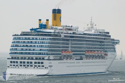
The vessel MEDITERRANEA (IMO: 9237345, MMSI: 311001086) is a Passengers Ship that was built in 2003 ( 21 years old ). It's sailing under the flag of [BS] Bahamas.
In this page you can find informations about the vessels current position, last detected port calls, and current voyage information. If the vessels is not in coverage by AIS you will find the latest position.
The current position of MEDITERRANEA is detected by our AIS receivers and we are not responsible for the reliability of the data. The last position was recorded while the vessel was in Coverage by the Ais receivers of our vessel tracking app.
The current draught of MEDITERRANEA as reported by AIS is 8 meters
Weather
| Temperature | 18.3°C / 64.94°F |
|---|---|
| Wind Speed | 5 knots |
| Direction | 13° NNE |
| Pressure | 1010.8 hPa |
| Humidity | 70.7 % |
| Cloud Coverage | 12 % |
Featured Company
Last Port Calls
| Port | Arrival | Departure | Time In Port |
|---|---|---|---|
| 2024-05-31 02:02 | 2024-05-31 12:17 | 10 h | |
| 2024-05-28 22:33 | 2024-05-29 07:38 | 9 h | |
| 2024-05-26 23:17 | 2024-05-27 07:19 | 8 h | |
| 2024-05-26 01:04 | 2024-05-26 11:22 | 10 h | |
| 2024-05-23 21:56 | 2024-05-24 07:59 | 10 h | |
| 2024-05-22 00:07 | 2024-05-22 09:53 | 9 h | |
| 2024-05-21 02:00 | 2024-05-21 12:27 | 10 h | |
| 2024-05-18 22:12 | 2024-05-19 08:04 | 9 h | |
| 2024-05-16 22:24 | 2024-05-17 09:02 | 10 h | |
| 2024-05-14 07:09 | 2024-05-14 15:50 | 8 h |
Last Trips
| Origin | Departure | Destination | Arrival | Distance | |
|---|---|---|---|---|---|
| 2024-05-29 15:38 | 2024-05-31 11:02 | 767.22 nm | |||
| 2024-05-27 16:19 | 2024-05-29 06:33 | 598.87 nm | |||
| 2024-05-26 20:22 | 2024-05-27 08:17 | 198.14 nm | |||
| 2024-05-24 15:59 | 2024-05-26 10:04 | 776.44 nm | |||
| 2024-05-22 18:53 | 2024-05-24 05:56 | 599.29 nm | |||
| 2024-05-21 21:27 | 2024-05-22 09:07 | 200.39 nm | |||
| 2024-05-19 16:04 | 2024-05-21 11:00 | 767.98 nm | |||
| 2024-05-17 18:02 | 2024-05-19 06:12 | 601.22 nm | |||
| 2024-05-14 23:50 | 2024-05-17 07:24 | 802.37 nm | |||
| 2024-05-11 23:56 | 2024-05-14 15:09 | 804.42 nm |
Events
| Time | Event | Details | Position / Dest | Info |
|---|---|---|---|---|
| 2024-06-01 22:26 | Status Changed | Default Under way using engine |
35.72382 / 124.02659
CNTSN
|
Speed: 18.3 kn Course: 337.9° |
| 2024-06-01 22:21 | OUT of Coverage |
35.70062 / 124.03822
Yellow Sea
CNTSN
|
Speed: 18.3 kn Course: 337.9° |
|
| 2024-06-01 20:46 | Destination Changed | CNTSN KRSPO |
35.24512 / 124.23948
CNTSN
|
Speed: 18 kn Course: 339.8° |
| 2024-06-01 20:46 | ETA Changed | 2024/06/02 22:00 2024/06/01 00:00 |
35.24512 / 124.23948
CNTSN
|
Speed: 18 kn Course: 339.8° |
| 2024-06-01 20:11 | Status Changed | Under way using engine Default |
35.08390 / 124.31264
KRSPO
|
Speed: 17.7 kn Course: 342° |
| 2024-06-01 20:06 | Status Changed | Default Under way using engine |
35.06044 / 124.32172
KRSPO
|
Speed: 17.7 kn Course: 339.4° |
| 2024-06-01 19:56 | Status Changed | Under way using engine Default |
35.01469 / 124.34218
KRSPO
|
Speed: 17.6 kn Course: 339° |
| 2024-06-01 19:50 | Status Changed | Default Under way using engine |
34.98525 / 124.35556
KRSPO
|
Speed: 17.6 kn Course: 343.5° |
| 2024-06-01 19:46 | Status Changed | Under way using engine Default |
34.96902 / 124.36229
KRSPO
|
Speed: 17.4 kn Course: 343° |
| 2024-06-01 18:38 | OUT of Coverage |
34.65508 / 124.47946
Yellow Sea
|
Speed: 17.2 kn Course: 340.4° |