
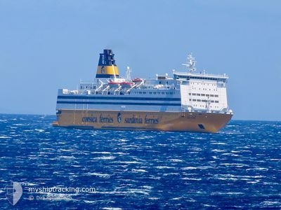
MEGA REGINA
Ro-Ro/Passenger Ship
Current Trip
| Time Travelled | 11 h, 4 mins |
|---|---|
| Remaining Time | 24 mins |
| Distance Travelled | 204.41 nm |
| Remaining Distance | 11.15 nm |
| AVG Speed | 18.9 Knots |
| MAX Speed | 19.4 Knots |
| AVG Wind | 7.6 knots |
| MAX Wind | 15.2 knots |
| MIN Temp | 22°C / 71.6°F |
| MAX Temp | 23.8°C / 74.84°F |
| Draught | 6.6 m |
| Position Received | Now |
Current Position
| Longitude | 9.43942° |
|---|---|
| Latitude | 41.54201° |
| Status | Under way using engine |
| Speed | 19.1 Knots |
| Course | 10.3° |
| Area | Tyrrhenian Sea |
| Station | T-AIS |
| Position Received | Now |
Info
Information
The current position of MEGA REGINA is in Tyrrhenian Sea with coordinates 41.54201° / 9.43942° as reported on 2024-06-29 03:09 by AIS to our vessel tracker app. The vessel's current speed is 19.1 Knots and is heading at the port of PORTO VECCHIO. The estimated time of arrival as calculated by vessel tracking app is 2024-06-29 03:34 LT
The vessel MEGA REGINA (IMO: 8320573, MMSI: 247436500) is a Ro-Ro/Passenger Ship that was built in 1985 ( 39 years old ). It's sailing under the flag of [IT] Italy.
In this page you can find informations about the vessels current position, last detected port calls, and current voyage information. If the vessels is not in coverage by AIS you will find the latest position.
The current position of MEGA REGINA is detected by our AIS receivers and we are not responsible for the reliability of the data. The last position was recorded while the vessel was in Coverage by the Ais receivers of our vessel tracking app.
The current draught of MEGA REGINA as reported by AIS is 6.6 meters
Weather
| Temperature | 23.5°C / 74.3°F |
|---|---|
| Wind Speed | 8 knots |
| Direction | 88° E |
| Pressure | 1015.1 hPa |
| Humidity | 77.6 % |
| Cloud Coverage | 2 % |
Featured Company
Last Port Calls
| Port | Arrival | Departure | Time In Port |
|---|---|---|---|
| 2024-06-28 13:40 | 2024-06-28 16:06 | 2 h | |
| 2024-06-28 04:09 | 2024-06-28 05:49 | 1 h | |
| 2024-06-27 05:20 | 2024-06-27 19:18 | 13 h | |
| 2024-06-26 17:20 | 2024-06-26 19:15 | 1 h | |
| 2024-06-26 11:29 | 2024-06-26 13:44 | 2 h | |
| 2024-06-26 05:21 | 2024-06-26 07:35 | 2 h | |
| 2024-06-25 04:44 | 2024-06-25 17:03 | 12 h | |
| 2024-06-24 18:10 | 2024-06-24 19:14 | 1 h | |
| 2024-06-24 08:11 | 2024-06-24 14:15 | 6 h | |
| 2024-06-24 03:52 | 2024-06-24 04:37 | 45 m |
Last Trips
| Origin | Departure | Destination | Arrival | Distance | |
|---|---|---|---|---|---|
| 2024-06-28 07:49 | 2024-06-28 15:40 | 142.63 nm | |||
| 2024-06-27 21:18 | 2024-06-28 06:09 | 139.58 nm | |||
| 2024-06-26 21:15 | 2024-06-27 07:20 | 187.62 nm | |||
| 2024-06-26 15:44 | 2024-06-26 19:20 | 65.59 nm | |||
| 2024-06-26 09:35 | 2024-06-26 13:29 | 65.59 nm | |||
| 2024-06-25 19:03 | 2024-06-26 07:21 | 186.20 nm | |||
| 2024-06-24 21:14 | 2024-06-25 06:44 | 153.15 nm | |||
| 2024-06-24 16:15 | 2024-06-24 20:10 | 66.94 nm | |||
| 2024-06-24 06:37 | 2024-06-24 10:11 | 68.76 nm | |||
| 2024-06-23 20:56 | 2024-06-24 05:52 | 142.62 nm |
Events
| Time | Event | Details | Position / Dest | Info |
|---|---|---|---|---|
| 2024-06-29 02:38 | Change Sea Area | French part of the Tyrrhenian Sea Italian part of the Tyrrhenian Sea |
41.38312 / 9.39067
Tyrrhenian Sea
FRPVO
|
Speed: 18.7 kn Course: 15.3° |
| 2024-06-29 02:17 | Change Sea Area | Italian part of the Tyrrhenian Sea French part of the Tyrrhenian Sea |
41.30575 / 9.29120
Tyrrhenian Sea
FRPVO
|
Speed: 18.9 kn Course: 53.4° |
| 2024-06-29 02:13 | Change Sea Area | French part of the Tyrrhenian Sea Italian part of the Tyrrhenian Sea |
41.29383 / 9.27017
Tyrrhenian Sea
FRPVO
|
Speed: 18.3 kn Course: 53.6° |
| 2024-06-29 01:59 | Change Sea Area | Italian part of the Tyrrhenian Sea Italian part of the Mediterranean Sea - Western Basin |
41.29485 / 9.17266
Tyrrhenian Sea
FRPVO
|
Speed: 18.3 kn Course: 94.2° |
| 2024-06-29 01:41 | Change Sea Area | Italian part of the Mediterranean Sea - Western Basin French part of the Mediterranean Sea - Western Basin |
41.30174 / 9.04969
Mediterranean Sea - Western Basin
FRPVO
|
Speed: 18.2 kn Course: 93.9° |
| 2024-06-29 01:17 | Status Changed | Under way using engine Default |
41.33631 / 8.90480
FRPVO
|
Speed: 17.9 kn Course: 129° |
| 2024-06-29 01:13 | Status Changed | Default Under way using engine |
41.34877 / 8.88433
FRPVO
|
Speed: 18.1 kn Course: 128.7° |
| 2024-06-29 00:37 | Status Changed | Under way using engine Default |
41.45618 / 8.69633
FRPVO
|
Speed: 18.1 kn Course: 127° |
| 2024-06-29 00:24 | Status Changed | Default Under way using engine |
41.49893 / 8.62297
FRPVO
|
Speed: 18.7 kn Course: 128.3° |
| 2024-06-28 19:08 | Status Changed | Under way using engine Default |
42.52282 / 6.82927
FRPVO
|
Speed: 19 kn Course: 126° |