
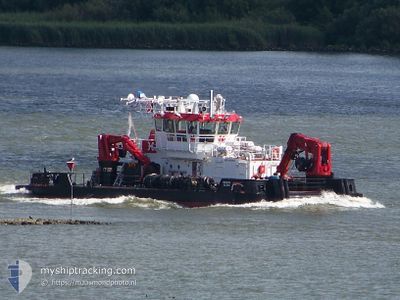
MEIBION ISLAND
Utility Vessel
Current Trip
NMDC
| Time Travelled | 44 days |
|---|---|
| Remaining Time | --- |
| Distance Travelled | 589.62 nm |
| Remaining Distance | --- |
| AVG Speed | 5.2 Knots |
| MAX Speed | 17.1 Knots |
| AVG Wind | 8 knots |
| MAX Wind | 34 knots |
| MIN Temp | 21.5°C / 70.7°F |
| MAX Temp | 32.9°C / 91.22°F |
| Draught | 3 m |
| Position Received | 1 m ago |
Current Position
| Longitude | 54.55132° |
|---|---|
| Latitude | 24.74052° |
| Status | Under way using engine |
| Speed | 0.1 Knots |
| Course | 15° |
| Area | Persian Gulf |
| Station | T-AIS |
| Position Received | 1 m ago |
Info
Information
The current position of MEIBION ISLAND is in Persian Gulf with coordinates 24.74052° / 54.55132° as reported on 2024-05-18 06:00 by AIS to our vessel tracker app. The vessel's current speed is 0.1 Knots
The vessel MEIBION ISLAND (IMO: 9496991, MMSI: 210592000) is a Utility Vessel that was built in 2012 ( 12 years old ). It's sailing under the flag of [CY] Cyprus.
In this page you can find informations about the vessels current position, last detected port calls, and current voyage information. If the vessels is not in coverage by AIS you will find the latest position.
The current position of MEIBION ISLAND is detected by our AIS receivers and we are not responsible for the reliability of the data. The last position was recorded while the vessel was in Coverage by the Ais receivers of our vessel tracking app.
The current draught of MEIBION ISLAND as reported by AIS is 3 meters
Weather
| Temperature | 30.5°C / 86.9°F |
|---|---|
| Wind Speed | 6 knots |
| Direction | 297° WNW |
| Pressure | 1008.1 hPa |
| Humidity | 62.8 % |
| Cloud Coverage | --- |
Featured Company
Events
| Time | Event | Details | Position / Dest | Info |
|---|---|---|---|---|
| 2024-05-18 05:27 | STOP Moving | 7.55 nm, South West of KHALIFA |
24.74003 / 54.55111
NMDC
|
Speed: 0.1 kn Course: 187° |
| 2024-05-18 05:18 | START Moving | 7.37 nm, South West of KHALIFA |
24.74577 / 54.55106
NMDC
|
Speed: 3.1 kn Course: 153° |
| 2024-05-18 04:23 | STOP Moving | 7.49 nm, South West of KHALIFA |
24.74502 / 54.54914
NMDC
|
Speed: 0.3 kn Course: 177° |
| 2024-05-18 04:17 | START Moving | 7.23 nm, South West of KHALIFA |
24.74510 / 54.55450
NMDC
|
Speed: 3.6 kn Course: 288° |
| 2024-05-18 04:12 | STOP Moving | 7.17 nm, South West of KHALIFA |
24.74414 / 54.55643
NMDC
|
Speed: 0.3 kn Course: 332° |
| 2024-05-18 04:09 | START Moving | 7.17 nm, South West of KHALIFA |
24.74581 / 54.55546
NMDC
|
Speed: 5.7 kn Course: 257.3° |
| 2024-05-18 03:41 | STOP Moving | 7.16 nm, South West of KHALIFA |
24.74426 / 54.55662
NMDC
|
Speed: 0.3 kn Course: 148° |
| 2024-05-18 03:36 | START Moving | 7.09 nm, South West of KHALIFA |
24.74594 / 54.55698
NMDC
|
Speed: 3.4 kn Course: 203° |
| 2024-05-18 01:43 | STOP Moving | 6.98 nm, South West of KHALIFA |
24.74679 / 54.55876
NMDC
|
Speed: 0.3 kn Course: 199° |
| 2024-05-18 01:34 | START Moving | 7.68 nm, South West of KHALIFA |
24.73825 / 54.54962
NMDC
|
Speed: 5.5 kn Course: 40.4° |