
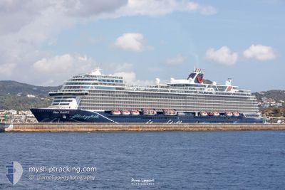
MEIN SCHIFF 2
Passenger
Current Trip
| Time Travelled | 17 h, 22 mins |
|---|---|
| Remaining Time | 10 h, 14 mins |
| Distance Travelled | 253.47 nm |
| Remaining Distance | 343.07 nm |
| AVG Speed | 18.1 Knots |
| MAX Speed | 20 Knots |
| AVG Wind | 7.9 knots |
| MAX Wind | 16.7 knots |
| MIN Temp | 18.6°C / 65.48°F |
| MAX Temp | 23.5°C / 74.3°F |
| Draught | 8 m |
| Position Received | 7 h, 15 m ago |
Current Position
| Longitude | 9.67383° |
|---|---|
| Latitude | 38.53102° |
| Status | Under way using engine |
| Speed | 19.5 Knots |
| Course | 273.7° |
| Area | Mediterranean Sea - Western Basin |
| Station | T-AIS |
| Position Received | 7 h, 15 m ago |
Info
Information
The current position of MEIN SCHIFF 2 is in Mediterranean Sea - Western Basin with coordinates 38.53102° / 9.67383° as reported on 2024-06-01 03:22 by AIS to our vessel tracker app. The vessel's current speed is 19.5 Knots and is heading at the port of PALMA DE MALLORCA. The estimated time of arrival as calculated by vessel tracking app is 2024-06-01 20:51 LT
The vessel MEIN SCHIFF 2 (IMO: 9783576, MMSI: 248956000) is a Passenger It's sailing under the flag of [MT] Malta.
In this page you can find informations about the vessels current position, last detected port calls, and current voyage information. If the vessels is not in coverage by AIS you will find the latest position.
The current position of MEIN SCHIFF 2 is detected by our AIS receivers and we are not responsible for the reliability of the data. The last position was recorded while the vessel was in Coverage by the Ais receivers of our vessel tracking app.
The current draught of MEIN SCHIFF 2 as reported by AIS is 8 meters
Weather
| Temperature | 20°C / 68°F |
|---|---|
| Wind Speed | 9 knots |
| Direction | 22° NNE |
| Pressure | 1016.5 hPa |
| Humidity | 68.4 % |
| Cloud Coverage | 100 % |
Featured Company
Last Port Calls
| Port | Arrival | Departure | Time In Port |
|---|---|---|---|
| 2024-05-31 04:39 | 2024-05-31 17:15 | 12 h | |
| 2024-05-30 05:44 | 2024-05-30 17:35 | 11 h | |
| 2024-05-29 04:00 | 2024-05-29 18:19 | 14 h | |
| 2024-05-26 00:47 | 2024-05-26 21:10 | 20 h | |
| 2024-05-25 04:12 | 2024-05-25 17:12 | 12 h | |
| 2024-05-23 05:26 | 2024-05-23 19:08 | 13 h | |
| 2024-05-22 04:59 | 2024-05-22 18:57 | 13 h | |
| 2024-05-21 04:53 | 2024-05-21 17:19 | 12 h | |
| 2024-05-19 01:11 | 2024-05-19 20:37 | 19 h | |
| 2024-05-18 05:12 | 2024-05-18 16:05 | 10 h |
Most Visited Ports (Last year)
| Port | Arrivals | |
|---|---|---|
| 20 | ||
| 19 | ||
| 16 | ||
| 16 | ||
| 16 | ||
| 11 |
Last Trips
| Origin | Departure | Destination | Arrival | Distance | |
|---|---|---|---|---|---|
| 2024-05-30 19:35 | 2024-05-31 06:39 | 164.93 nm | |||
| 2024-05-29 20:19 | 2024-05-30 07:44 | 189.64 nm | |||
| 2024-05-26 23:10 | 2024-05-29 06:00 | 535.41 nm | |||
| 2024-05-25 19:12 | 2024-05-26 02:47 | 134.67 nm | |||
| 2024-05-23 20:08 | 2024-05-25 06:12 | 550.66 nm | |||
| 2024-05-22 20:57 | 2024-05-23 06:26 | 76.71 nm | |||
| 2024-05-21 19:19 | 2024-05-22 06:59 | 145.91 nm | |||
| 2024-05-19 22:37 | 2024-05-21 06:53 | 415.70 nm | |||
| 2024-05-18 18:05 | 2024-05-19 03:11 | 142.64 nm | |||
| 2024-05-15 19:33 | 2024-05-18 07:12 | 568.55 nm |
Events
| Time | Event | Details | Position / Dest | Info |
|---|---|---|---|---|
| 2024-06-01 03:25 | Status Changed | Default Under way using engine |
38.53167 / 9.65667
ES PMI
|
Speed: 19.5 kn Course: 273.7° |
| 2024-06-01 03:22 | OUT of Coverage |
38.53102 / 9.67383
Mediterranean Sea - Western Basin
ES PMI
|
Speed: 19.5 kn Course: 273.7° |
|
| 2024-06-01 03:13 | Change Sea Area | Italian part of the Mediterranean Sea - Western Basin Italian part of the Tyrrhenian Sea |
38.52794 / 9.73431
Mediterranean Sea - Western Basin
ES PMI
|
Speed: 19.5 kn Course: 273.8° |
| 2024-06-01 03:12 | Status Changed | Under way using engine Default |
38.52735 / 9.74535
ES PMI
|
Speed: 20 kn Course: 275° |
| 2024-06-01 02:28 | Status Changed | Default Under way using engine |
38.50864 / 10.04198
ES PMI
|
Speed: 19.4 kn Course: 274.9° |
| 2024-06-01 01:56 | Status Changed | Under way using engine Default |
38.49512 / 10.26505
ES PMI
|
Speed: 20 kn Course: 273° |
| 2024-06-01 01:51 | Status Changed | Default Under way using engine |
38.49333 / 10.29833
ES PMI
|
Speed: 19.4 kn Course: 272.6° |
| 2024-05-31 23:58 | Status Changed | Under way using engine Default |
38.46764 / 11.07342
ES PMI
|
Speed: 19.3 kn Course: 272° |
| 2024-05-31 23:32 | Status Changed | Default Under way using engine |
38.46198 / 11.25378
ES PMI
|
Speed: 19.7 kn Course: 275.6° |
| 2024-05-31 22:38 | Status Changed | Under way using engine Default |
38.42795 / 11.62260
ES PMI
|
Speed: 19 kn Course: 273° |