
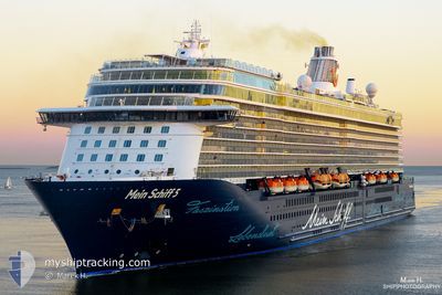
MEIN SCHIFF 5
Passenger
Current Trip
| Time Travelled | 2 days |
|---|---|
| Remaining Time | 14 h, 42 mins |
| Distance Travelled | 1245.49 nm |
| Remaining Distance | 269.39 nm |
| AVG Speed | 19.1 Knots |
| MAX Speed | 22.9 Knots |
| AVG Wind | 8.9 knots |
| MAX Wind | 21.3 knots |
| MIN Temp | 20.1°C / 68.18°F |
| MAX Temp | 30°C / 86°F |
| Draught | 8.2 m |
| Position Received | 4 m ago |
Current Position
| Longitude | 20.03389° |
|---|---|
| Latitude | 35.97751° |
| Status | Under way using engine |
| Speed | 17 Knots |
| Course | 96.1° |
| Area | Mediterranean Sea - Eastern Basin |
| Station | T-AIS |
| Position Received | 4 m ago |
Info
Information
The current position of MEIN SCHIFF 5 is in Mediterranean Sea - Eastern Basin with coordinates 35.97751° / 20.03389° as reported on 2024-06-20 12:10 by AIS to our vessel tracker app. The vessel's current speed is 17 Knots and is heading at the port of HERACLIO. The estimated time of arrival as calculated by vessel tracking app is 2024-06-21 02:56 LT
The vessel MEIN SCHIFF 5 (IMO: 9753193, MMSI: 256235000) is a Passenger It's sailing under the flag of [MT] Malta.
In this page you can find informations about the vessels current position, last detected port calls, and current voyage information. If the vessels is not in coverage by AIS you will find the latest position.
The current position of MEIN SCHIFF 5 is detected by our AIS receivers and we are not responsible for the reliability of the data. The last position was recorded while the vessel was in Coverage by the Ais receivers of our vessel tracking app.
The current draught of MEIN SCHIFF 5 as reported by AIS is 8.2 meters
Weather
| Temperature | 25.4°C / 77.72°F |
|---|---|
| Wind Speed | 8 knots |
| Direction | 335° NNW |
| Pressure | 1013.7 hPa |
| Humidity | 81 % |
| Cloud Coverage | --- |
Featured Company
Last Port Calls
| Port | Arrival | Departure | Time In Port |
|---|---|---|---|
| 2024-06-17 09:30 | 2024-06-17 19:11 | 9 h | |
| 2024-06-04 07:27 | 2024-06-06 16:19 | 2 d | |
| 2024-05-22 09:07 | 2024-05-24 08:21 | 1 d | |
| 2024-05-20 19:00 | 2024-05-21 14:12 | 19 h | |
| 2024-05-16 01:00 | 2024-05-16 16:04 | 15 h | |
| 2024-05-15 00:47 | 2024-05-15 15:01 | 14 h | |
| 2024-05-09 21:40 | 2024-05-10 10:56 | 13 h | |
| 2024-05-06 22:43 | 2024-05-09 06:16 | 2 d | |
| 2024-05-04 00:11 | 2024-05-04 19:40 | 19 h | |
| 2024-04-23 19:03 | 2024-04-25 14:51 | 1 d |
Most Visited Ports (Last year)
| Port | Arrivals | |
|---|---|---|
| 8 | ||
| 8 | ||
| 8 | ||
| 8 | ||
| 7 | ||
| 7 |
Last Trips
| Origin | Departure | Destination | Arrival | Distance | |
|---|---|---|---|---|---|
| 2024-06-06 18:19 | 2024-06-17 11:30 | 5109.00 nm | |||
| 2024-05-24 12:21 | 2024-06-04 09:27 | 4839.57 nm | |||
| 2024-05-21 18:12 | 2024-05-22 13:07 | 350.29 nm | |||
| 2024-05-16 21:34 | 2024-05-20 23:00 | 1640.71 nm | |||
| 2024-05-15 20:31 | 2024-05-16 06:30 | 138.98 nm | |||
| 2024-05-10 18:56 | 2024-05-15 06:17 | 1348.82 nm | |||
| 2024-05-09 14:16 | 2024-05-10 05:40 | 202.24 nm | |||
| 2024-05-05 02:40 | 2024-05-07 06:43 | 796.27 nm | |||
| 2024-04-25 22:51 | 2024-05-04 07:11 | 2069.94 nm | |||
| 2024-04-18 19:19 | 2024-04-24 03:03 | 1384.47 nm |
Events
| Time | Event | Details | Position / Dest | Info |
|---|---|---|---|---|
| 2024-06-20 12:09 | Status Changed | Under way using engine Default |
35.97811 / 20.02695
GR HER
|
Speed: 17 kn Course: 96° |
| 2024-06-20 11:42 | Status Changed | Default Under way using engine |
35.99125 / 19.87374
GR HER
|
Speed: 17.2 kn Course: 96.2° |
| 2024-06-20 11:32 | Status Changed | Under way using engine Default |
35.99609 / 19.81727
GR HER
|
Speed: 17.2 kn Course: 96° |
| 2024-06-20 11:26 | Status Changed | Default Under way using engine |
35.99904 / 19.78271
GR HER
|
Speed: 17.2 kn Course: 96.5° |
| 2024-06-20 10:51 | Status Changed | Under way using engine Default |
36.01709 / 19.57802
GR HER
|
Speed: 16.9 kn Course: 97° |
| 2024-06-20 10:45 | Status Changed | Default Under way using engine |
36.02042 / 19.54444
GR HER
|
Speed: 16.9 kn Course: 97° |
| 2024-06-20 10:44 | Status Changed | Under way using engine Default |
36.02146 / 19.53359
GR HER
|
Speed: 17 kn Course: 97° |
| 2024-06-20 10:38 | Status Changed | Default Under way using engine |
36.02448 / 19.50355
GR HER
|
Speed: 17.1 kn Course: 97° |
| 2024-06-20 10:34 | Status Changed | Under way using engine Default |
36.02724 / 19.47566
GR HER
|
Speed: 17 kn Course: 97° |
| 2024-06-20 09:44 | Status Changed | Default Under way using engine |
36.05567 / 19.18876
GR HER
|
Speed: 17 kn Course: 97° |