
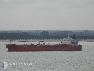
MELAHAT
Oil/Chemical Tanker
Current Trip
| Time Travelled | 22 days |
|---|---|
| Remaining Time | --- |
| Distance Travelled | 3241.97 nm |
| Remaining Distance | --- |
| AVG Speed | 10.6 Knots |
| MAX Speed | 14.7 Knots |
| AVG Wind | 12.1 knots |
| MAX Wind | 25 knots |
| MIN Temp | 9.6°C / 49.28°F |
| MAX Temp | 20.9°C / 69.62°F |
| Draught | 12 m |
| Position Received | 8 d ago |
Current Position
| Longitude | -15.24931° |
|---|---|
| Latitude | 27.57879° |
| Status | Under way using engine |
| Speed | 11.9 Knots |
| Course | 204.7° |
| Area | North Atlantic Ocean |
| Station | T-AIS |
| Position Received | 8 d ago |
Info
Information
The current position of MELAHAT is in North Atlantic Ocean with coordinates 27.57879° / -15.24931° as reported on 2024-06-07 03:38 by AIS to our vessel tracker app. The vessel's current speed is 11.9 Knots
The vessel MELAHAT (IMO: 9313462, MMSI: 352003660) is a Oil/Chemical Tanker that was built in 2007 ( 17 years old ). It's sailing under the flag of [PA] Panama.
In this page you can find informations about the vessels current position, last detected port calls, and current voyage information. If the vessels is not in coverage by AIS you will find the latest position.
The current position of MELAHAT is detected by our AIS receivers and we are not responsible for the reliability of the data. The last position was recorded while the vessel was in Coverage by the Ais receivers of our vessel tracking app.
The current draught of MELAHAT as reported by AIS is 12 meters
Weather
| Temperature | 20.5°C / 68.9°F |
|---|---|
| Wind Speed | 8 knots |
| Direction | 240° WSW |
| Pressure | 1015 hPa |
| Humidity | 90.8 % |
| Cloud Coverage | 40 % |
Featured Company
Events
| Time | Event | Details | Position / Dest | Info |
|---|---|---|---|---|
| 2024-06-07 03:38 | OUT of Coverage |
27.57879 / -15.24931
North Atlantic Ocean
GH TEM
|
Speed: 11.9 kn Course: 204.7° |
|
| 2024-06-06 17:46 | IN Coverage |
29.45483 / -14.62198
North Atlantic Ocean
GH TEM
|
Speed: 11.6 kn Course: 196.4° |
|
| 2024-06-06 15:59 | OUT of Coverage |
29.79361 / -14.52151
North Atlantic Ocean
GH TEM
|
Speed: 11.8 kn Course: 193.4° |
|
| 2024-06-06 13:06 | Detected in Sea | Spanish (Canary Islands) part of the North Atlantic Ocean |
30.34854 / -14.36374
North Atlantic Ocean
GH TEM
|
Speed: 11.7 kn Course: 193.5° |
| 2024-06-06 13:06 | IN Coverage |
30.34854 / -14.36374
North Atlantic Ocean
GH TEM
|
Speed: 11.7 kn Course: 193.5° |