
MENDELSSOHN
Cargo A
Current Trip
| Trip Time | 6 days |
|---|---|
| Trip Distance | 523.98 nm |
| AVG Speed | 9.8 Knots |
| MAX Speed | 12.7 Knots |
| Draught | 11.4 m |
| AVG Wind | 12.9 knots |
| MAX Wind | 18.8 knots |
| MIN Temp | 18.8°C / 65.84°F |
| MAX Temp | 29.5°C / 85.1°F |
| Position Received | 12 d ago |
Current Position
| Longitude | 54.78115° |
|---|---|
| Latitude | -21.13407° |
| Status | Under way using engine |
| Speed | 16.4 Knots |
| Course | 245° |
| Area | Indian Ocean |
| Station | T-AIS |
| Position Received | 12 d ago |
Info
Information
The current position of MENDELSSOHN is in Indian Ocean with coordinates -21.13407° / 54.78115° as reported on 2024-05-22 10:08 by AIS to our vessel tracker app. The vessel's current speed is 16.4 Knots and is currently inside the port of BEIRA.
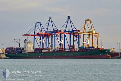
The vessel MENDELSSOHN (IMO: 9449106, MMSI: 636020361) is a Cargo A It's sailing under the flag of [LR] Liberia.
In this page you can find informations about the vessels current position, last detected port calls, and current voyage information. If the vessels is not in coverage by AIS you will find the latest position.
The current position of MENDELSSOHN is detected by our AIS receivers and we are not responsible for the reliability of the data. The last position was recorded while the vessel was in Coverage by the Ais receivers of our vessel tracking app.
The current draught of MENDELSSOHN as reported by AIS is 11.4 meters
Weather
| Temperature | 29°C / 84.2°F |
|---|---|
| Wind Speed | 9 knots |
| Direction | 93° E |
| Pressure | 1011 hPa |
| Humidity | 55.4 % |
| Cloud Coverage | --- |
Featured Company
Last Port Calls
| Port | Arrival | Departure | Time In Port |
|---|---|---|---|
| 2024-06-02 12:55 | |||
| 2024-05-25 16:51 | 2024-05-26 23:56 | 1 d | |
| 2024-05-21 01:21 | 2024-05-22 07:52 | 1 d | |
| 2024-05-10 11:08 | 2024-05-11 20:03 | 1 d | |
| 2024-05-08 06:04 | 2024-05-10 00:43 | 1 d | |
| 2024-04-21 22:35 | 2024-04-23 00:59 | 1 d | |
| 2024-04-12 17:58 | 2024-04-14 16:57 | 1 d | |
| 2024-04-08 06:56 | 2024-04-10 21:44 | 2 d |
Most Visited Ports (Last year)
| Port | Arrivals | |
|---|---|---|
| 8 | ||
| 8 | ||
| 7 | ||
| 7 | ||
| 7 | ||
| 7 |
Last Trips
| Origin | Departure | Destination | Arrival | Distance | |
|---|---|---|---|---|---|
| 2024-05-27 01:56 | 2024-06-02 14:55 | 523.98 nm | |||
| 2024-05-22 11:52 | 2024-05-25 18:51 | 1343.83 nm | |||
| 2024-05-12 04:03 | 2024-05-21 05:21 | 3465.75 nm | |||
| 2024-05-10 08:43 | 2024-05-10 19:08 | 33.91 nm | |||
| 2024-04-23 04:59 | 2024-05-08 14:04 | 3428.81 nm | |||
| 2024-04-14 18:57 | 2024-04-22 02:35 | 1524.20 nm | |||
| 2024-04-10 23:44 | 2024-04-12 19:58 | 512.62 nm | |||
| 2024-03-31 14:04 | 2024-04-08 08:56 | 1384.28 nm |
Events
| Time | Event | Details | Position / Dest | Info |
|---|---|---|---|---|
| 2024-06-02 12:55 | STOP Moving |
-19.81833 / 34.83333
[MZ] BEIRA
|
Speed: Course: -1° |
|
| 2024-06-02 12:55 | PORT ARRIVAL |
|
-19.81833 / 34.83333
[MZ] BEIRA
|
Speed: 1 kn Course: -1° |
| 2024-06-02 10:31 | START Moving | 11.54 nm, South East of BEIRA |
-19.90833 / 35.01167
MZMPM
|
Speed: 4 kn Course: -1° |
| 2024-06-02 10:19 | STOP Moving | 11.77 nm, South East of BEIRA |
-19.91333 / 35.01333
MZMPM
|
Speed: Course: -1° |
| 2024-06-02 09:11 | START Moving | 14.56 nm, South East of BEIRA |
-19.92332 / 35.06374
MZMPM
|
Speed: 3.6 kn Course: 297° |
| 2024-05-28 23:46 | STOP Moving | 14.67 nm, South East of BEIRA |
-19.92500 / 35.06500
MZMPM
|
Speed: Course: -1° |
| 2024-05-26 23:56 | PORT DEPARTURE |
|
-25.97966 / 32.56814
MZMPM
|
Speed: 5.1 kn Course: 130° |
| 2024-05-26 23:40 | START Moving |
-25.96713 / 32.55007
[MZ] MAPUTO
|
Speed: 3.2 kn Course: 118° |
|
| 2024-05-25 17:11 | STOP Moving |
-25.96226 / 32.54631
[MZ] MAPUTO
|
Speed: Course: 303° |
|
| 2024-05-25 16:51 | PORT ARRIVAL |
|
-25.96337 / 32.54636
[MZ] MAPUTO
|
Speed: 4.3 kn Course: 302° |