
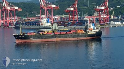
MERAIO
Bulk Carrier
Current Trip
TR-IST
| Time Travelled | 14 h, 2 mins |
|---|---|
| Remaining Time | --- |
| Distance Travelled | 8.13 nm |
| Remaining Distance | --- |
| AVG Speed | 6.2 Knots |
| MAX Speed | 9.7 Knots |
| AVG Wind | 12.3 knots |
| MAX Wind | 13.9 knots |
| MIN Temp | 13.1°C / 55.58°F |
| MAX Temp | 19.9°C / 67.82°F |
| Draught | 10.5 m |
| Position Received | 1 m ago |
Current Position
| Longitude | 28.86111° |
|---|---|
| Latitude | 40.95055° |
| Status | At anchor |
| Speed | |
| Course | 157° |
| Area | Sea of Marmara |
| Station | T-AIS |
| Position Received | 1 m ago |
Info
Information
The current position of MERAIO is in Sea of Marmara with coordinates 40.95055° / 28.86111° as reported on 2024-05-18 04:09 by AIS to our vessel tracker app. The vessel's current speed is 0 Knots
The vessel MERAIO (IMO: 9502817, MMSI: 312791000) is a Bulk Carrier that was built in 2011 ( 13 years old ). It's sailing under the flag of [BZ] Belize.
In this page you can find informations about the vessels current position, last detected port calls, and current voyage information. If the vessels is not in coverage by AIS you will find the latest position.
The current position of MERAIO is detected by our AIS receivers and we are not responsible for the reliability of the data. The last position was recorded while the vessel was in Coverage by the Ais receivers of our vessel tracking app.
The current draught of MERAIO as reported by AIS is 10.5 meters
Weather
| Temperature | 13.8°C / 56.84°F |
|---|---|
| Wind Speed | 6 knots |
| Direction | 47° NE |
| Pressure | 1017.5 hPa |
| Humidity | 81.3 % |
| Cloud Coverage | --- |
Featured Company
Last Port Calls
| Port | Arrival | Departure | Time In Port |
|---|---|---|---|
| 2024-05-17 12:55 | 2024-05-17 14:09 | 1 h | |
| 2024-05-12 07:31 | 2024-05-15 04:48 | 2 d | |
| 2024-05-10 11:27 | 2024-05-10 13:14 | 1 h | |
| 2024-04-26 05:15 | 2024-05-03 23:08 | 7 d | |
| 2024-04-16 03:58 | 2024-04-16 05:21 | 1 h | |
| 2024-04-09 08:16 | 2024-04-12 05:06 | 2 d | |
| 2024-03-29 03:05 | |||
| 2024-03-12 12:31 | 2024-03-12 13:46 | 1 h |
Last Trips
| Origin | Departure | Destination | Arrival | Distance | |
|---|---|---|---|---|---|
| 2024-05-15 07:48 | 2024-05-17 15:55 | 349.83 nm | |||
| 2024-05-10 16:14 | 2024-05-12 10:31 | 345.28 nm | |||
| 2024-05-04 01:08 | 2024-05-10 14:27 | 1615.44 nm | |||
| 2024-04-16 08:21 | 2024-04-26 07:15 | 1555.33 nm | |||
| 2024-04-12 08:06 | 2024-04-16 06:58 | 410.16 nm | |||
| 2024-03-29 05:05 | 2024-04-09 11:16 | 1336.40 nm |
Events
| Time | Event | Details | Position / Dest | Info |
|---|---|---|---|---|
| 2024-05-18 01:42 | Status Changed | At anchor Default |
40.94922 / 28.85944
TR-IST
|
Speed: Course: 91° |
| 2024-05-18 01:39 | Status Changed | Default At anchor |
40.94925 / 28.85947
TR-IST
|
Speed: Course: 92° |
| 2024-05-18 01:21 | Status Changed | At anchor Default |
40.94932 / 28.85940
TR-IST
|
Speed: Course: 93° |
| 2024-05-18 01:18 | Status Changed | Default At anchor |
40.94931 / 28.85936
TR-IST
|
Speed: Course: 93° |
| 2024-05-17 20:33 | Status Changed | At anchor Default |
40.94901 / 28.85926
TR-IST
|
Speed: Course: 73° |
| 2024-05-17 20:30 | Status Changed | Default At anchor |
40.94900 / 28.85925
TR-IST
|
Speed: Course: 71° |
| 2024-05-17 15:30 | Status Changed | At anchor Under way using engine |
40.94838 / 28.86200
TR-IST
|
Speed: 0.2 kn Course: 355° |
| 2024-05-17 15:28 | STOP Moving | 1.69 nm, South West of BAKIRKOY |
40.94822 / 28.86220
TR-IST
|
Speed: 0.3 kn Course: 357° |
| 2024-05-17 14:09 | PORT DEPARTURE |
|
41.00136 / 28.99308
TR-IST
|
Speed: 11 kn Course: 181° |
| 2024-05-17 12:55 | PORT ARRIVAL |
|
41.20335 / 29.11235
[TR] ISTANBUL
|
Speed: 9 kn Course: 211.8° |