
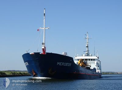
MERCATOR
General Cargo
Current Trip
| Time Travelled | 2 days |
|---|---|
| Remaining Time | --- |
| Distance Travelled | 106.16 nm |
| Remaining Distance | --- |
| AVG Speed | 9.8 Knots |
| MAX Speed | 12.2 Knots |
| AVG Wind | 15.6 knots |
| MAX Wind | 25.8 knots |
| MIN Temp | -4.1°C / 24.62°F |
| MAX Temp | 1.8°C / 35.24°F |
| Draught | 3.5 m |
| Position Received | 2 m ago |
Current Position
| Longitude | 23.21880° |
|---|---|
| Latitude | 69.96087° |
| Status | Under way using engine |
| Speed | |
| Course | 180° |
| Area | Norwegian Sea |
| Station | T-AIS |
| Position Received | 2 m ago |
Info
Information
The current position of MERCATOR is in Norwegian Sea with coordinates 69.96087° / 23.21880° as reported on 2024-05-22 15:28 by AIS to our vessel tracker app. The vessel's current speed is 0 Knots
The vessel MERCATOR (IMO: 7047356, MMSI: 258993000) is a General Cargo that was built in 1971 ( 53 years old ). It's sailing under the flag of [NO] Norway.
In this page you can find informations about the vessels current position, last detected port calls, and current voyage information. If the vessels is not in coverage by AIS you will find the latest position.
The current position of MERCATOR is detected by our AIS receivers and we are not responsible for the reliability of the data. The last position was recorded while the vessel was in Coverage by the Ais receivers of our vessel tracking app.
The current draught of MERCATOR as reported by AIS is 3.5 meters
Weather
| Temperature | 0.3°C / 32.54°F |
|---|---|
| Wind Speed | 2 knots |
| Direction | 2° N |
| Pressure | 1026 hPa |
| Humidity | 96.2 % |
| Cloud Coverage | 80 % |
Featured Company
Last Port Calls
| Port | Arrival | Departure | Time In Port |
|---|---|---|---|
| 2024-05-20 07:59 | 2024-05-20 09:14 | 1 h | |
| 2024-05-20 00:15 | 2024-05-20 01:47 | 1 h | |
| 2024-05-17 22:41 | 2024-05-18 00:17 | 1 h | |
| 2024-05-12 15:30 | 2024-05-12 16:51 | 1 h | |
| 2024-05-10 23:49 | 2024-05-11 03:08 | 3 h | |
| 2024-05-09 13:41 | 2024-05-09 16:58 | 3 h | |
| 2024-05-07 20:12 | 2024-05-08 14:25 | 18 h | |
| 2024-05-05 21:29 | 2024-05-06 15:16 | 17 h | |
| 2024-05-03 23:33 | 2024-05-04 00:57 | 1 h | |
| 2024-05-02 05:49 | 2024-05-02 06:54 | 1 h |
Last Trips
| Origin | Departure | Destination | Arrival | Distance | |
|---|---|---|---|---|---|
| 2024-05-20 03:47 | 2024-05-20 09:59 | 5.73 nm | |||
| 2024-05-18 02:17 | 2024-05-20 02:15 | 348.70 nm | |||
| 2024-05-12 18:51 | 2024-05-18 00:41 | 724.42 nm | |||
| 2024-05-11 05:08 | 2024-05-12 17:30 | 65.23 nm | |||
| 2024-05-09 18:58 | 2024-05-11 01:49 | 208.09 nm | |||
| 2024-05-08 16:25 | 2024-05-09 15:41 | 64.74 nm | |||
| 2024-05-06 17:16 | 2024-05-07 22:12 | 93.35 nm | |||
| 2024-05-04 02:57 | 2024-05-05 23:29 | 279.13 nm | |||
| 2024-05-02 08:54 | 2024-05-04 01:33 | 318.52 nm | |||
| 2024-03-18 17:29 | 2024-05-02 07:49 | 103.90 nm |
Events
| Time | Event | Details | Position / Dest | Info |
|---|---|---|---|---|
| 2024-05-21 22:50 | ETA Changed | 2024/05/20 21:00 2024/05/21 21:00 |
69.96083 / 23.21880
ALTA
|
Speed: Course: 180° |
| 2024-05-21 22:26 | ETA Changed | 2024/05/21 21:00 2024/05/20 21:00 |
69.96083 / 23.21879
ALTA
|
Speed: Course: 180° |
| 2024-05-20 20:49 | STOP Moving | 2.64 nm, South West of ALTA |
69.96091 / 23.21866
ALTA
|
Speed: 0.1 kn Course: 174° |
| 2024-05-20 10:30 | Change Sea Area | Norwegian part of the Norwegian Sea Norwegian part of the Barentsz Sea |
70.94821 / 25.48691
Norwegian Sea
ALTA
|
Speed: 6.1 kn Course: 319.2° |
| 2024-05-20 09:14 | PORT DEPARTURE |
|
70.97069 / 25.93534
ALTA
|
Speed: 10.4 kn Course: 201° |
| 2024-05-20 09:14 | Draught Changed | 3.5 4 |
70.97611 / 25.94147
[NO] HONNINGSVAAG
|
Speed: 10.4 kn Course: 201° |
| 2024-05-20 09:14 | Destination Changed | ALTA HONNINGSVAG |
70.97611 / 25.94147
[NO] HONNINGSVAAG
|
Speed: 10.4 kn Course: 201° |
| 2024-05-20 09:14 | ETA Changed | 2024/05/20 21:00 2024/05/20 01:00 |
70.97611 / 25.94147
[NO] HONNINGSVAAG
|
Speed: 10.4 kn Course: 201° |
| 2024-05-20 09:08 | START Moving |
70.98729 / 25.95408
[NO] HONNINGSVAAG
|
Speed: 9.6 kn Course: 202° |
|
| 2024-05-20 08:12 | STOP Moving |
70.99186 / 25.96521
[NO] HONNINGSVAAG
|
Speed: Course: 51° |