
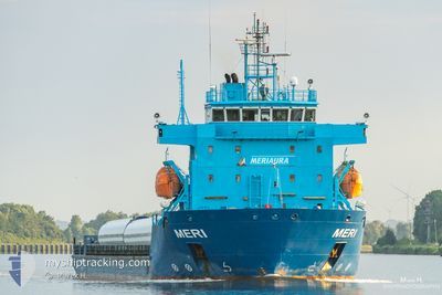
MERI
Heavy Load Carrier
Current Trip
| Time Travelled | 16 h, 50 mins |
|---|---|
| Remaining Time | --- |
| Distance Travelled | 197.52 nm |
| Remaining Distance | --- |
| AVG Speed | 11.7 Knots |
| MAX Speed | 12.2 Knots |
| AVG Wind | 9 knots |
| MAX Wind | 13 knots |
| MIN Temp | 8.5°C / 47.3°F |
| MAX Temp | 10.9°C / 51.62°F |
| Draught | 4 m |
| Position Received | 9 h, 32 m ago |
Current Position
| Longitude | 22.10854° |
|---|---|
| Latitude | 59.04838° |
| Status | Under way using engine |
| Speed | 11.8 Knots |
| Course | 233.5° |
| Area | Baltic Sea |
| Station | T-AIS |
| Position Received | 9 h, 32 m ago |
Info
Information
The current position of MERI is in Baltic Sea with coordinates 59.04838° / 22.10854° as reported on 2024-05-17 00:26 by AIS to our vessel tracker app. The vessel's current speed is 11.8 Knots and is heading at the port of STORD. The estimated time of arrival as calculated by vessel tracking app is 2024-05-20 03:00 LT
The vessel MERI (IMO: 9622502, MMSI: 230941700) is a Heavy Load Carrier that was built in 2012 ( 12 years old ). It's sailing under the flag of [FI] Finland.
In this page you can find informations about the vessels current position, last detected port calls, and current voyage information. If the vessels is not in coverage by AIS you will find the latest position.
The current position of MERI is detected by our AIS receivers and we are not responsible for the reliability of the data. The last position was recorded while the vessel was in Coverage by the Ais receivers of our vessel tracking app.
The current draught of MERI as reported by AIS is 4 meters
Weather
| Temperature | 10.2°C / 50.36°F |
|---|---|
| Wind Speed | 5 knots |
| Direction | 170° S |
| Pressure | 1024.9 hPa |
| Humidity | 82.7 % |
| Cloud Coverage | 7 % |
Featured Company
Last Port Calls
| Port | Arrival | Departure | Time In Port |
|---|---|---|---|
| 2024-05-15 14:01 | 2024-05-16 17:08 | 1 d | |
| 2024-05-11 19:14 | 2024-05-12 21:18 | 1 d | |
| 2024-05-10 10:21 | 2024-05-10 17:17 | 6 h | |
| 2024-05-09 11:25 | 2024-05-09 23:04 | 11 h | |
| 2024-05-08 06:05 | 2024-05-08 15:18 | 9 h | |
| 2024-05-03 17:11 | 2024-05-06 21:29 | 3 d | |
| 2024-04-21 11:40 | 2024-04-30 10:40 | 8 d | |
| 2024-04-16 03:36 | 2024-04-17 10:37 | 1 d | |
| 2024-04-13 20:03 | 2024-04-14 13:51 | 17 h | |
| 2024-04-11 03:53 | 2024-04-11 18:24 | 14 h |
Last Trips
| Origin | Departure | Destination | Arrival | Distance | |
|---|---|---|---|---|---|
| 2024-05-12 23:18 | 2024-05-15 17:01 | 692.24 nm | |||
| 2024-05-10 19:17 | 2024-05-11 21:14 | 281.16 nm | |||
| 2024-05-10 01:04 | 2024-05-10 12:21 | 130.67 nm | |||
| 2024-05-08 16:18 | 2024-05-09 13:25 | 208.30 nm | |||
| 2024-05-06 23:29 | 2024-05-08 07:05 | 327.47 nm | |||
| 2024-04-30 13:40 | 2024-05-03 19:11 | 941.56 nm | |||
| 2024-04-17 12:37 | 2024-04-21 14:40 | 1000.62 nm | |||
| 2024-04-14 15:51 | 2024-04-16 05:36 | 339.83 nm | |||
| 2024-04-11 20:24 | 2024-04-13 22:03 | 462.72 nm | |||
| 2024-04-08 16:05 | 2024-04-11 05:53 | 589.56 nm |
Events
| Time | Event | Details | Position / Dest | Info |
|---|---|---|---|---|
| 2024-05-17 00:32 | Status Changed | Default Under way using engine |
59.03611 / 22.07567
STORD
|
Speed: 11.8 kn Course: 233.5° |
| 2024-05-17 00:26 | OUT of Coverage |
59.04838 / 22.10854
Baltic Sea
STORD
|
Speed: 11.8 kn Course: 233.5° |
|
| 2024-05-17 00:21 | Status Changed | Under way using engine Default |
59.05784 / 22.13324
STORD
|
Speed: 11.8 kn Course: 233° |
| 2024-05-17 00:17 | Status Changed | Default Under way using engine |
59.06538 / 22.15266
STORD
|
Speed: 11.8 kn Course: 233.9° |
| 2024-05-16 23:41 | Status Changed | Under way using engine Default |
59.12479 / 22.35177
STORD
|
Speed: 12 kn Course: 246° |
| 2024-05-16 23:23 | Status Changed | Default Under way using engine |
59.14915 / 22.45787
STORD
|
Speed: 11.9 kn Course: 245.7° |
| 2024-05-16 23:23 | Status Changed | Under way using engine Default |
59.15005 / 22.46178
STORD
|
Speed: 11.8 kn Course: 245° |
| 2024-05-16 23:17 | Status Changed | Default Under way using engine |
59.15793 / 22.49566
STORD
|
Speed: 11.8 kn Course: 245.3° |
| 2024-05-16 20:56 | Detected in Sea | Estonian part of the Baltic Sea |
59.33529 / 23.33834
Baltic Sea
STORD
|
Speed: 11.8 kn Course: 252° |
| 2024-05-16 17:12 | Status Changed | Under way using engine Moored |
59.45445 / 24.65225
STORD
|
Speed: 0.8 kn Course: 288° |