
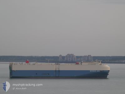
MERMAID ACE
Vehicles Carrier
Current Trip
| Time Travelled | 15 days |
|---|---|
| Remaining Time | --- |
| Distance Travelled | 5923.85 nm |
| Remaining Distance | --- |
| AVG Speed | 16 Knots |
| MAX Speed | 19.7 Knots |
| AVG Wind | 10.7 knots |
| MAX Wind | 35 knots |
| MIN Temp | 17.6°C / 63.68°F |
| MAX Temp | 30.5°C / 86.9°F |
| Draught | 9.4 m |
| Position Received | 8 d ago |
Current Position
| Longitude | 103.36773° |
|---|---|
| Latitude | 1.26795° |
| Status | Under way using engine |
| Speed | 17.5 Knots |
| Course | 305° |
| Area | Malacca Strait |
| Station | T-AIS |
| Position Received | 8 d ago |
Info
Information
The current position of MERMAID ACE is in Malacca Strait with coordinates 1.26795° / 103.36773° as reported on 2024-05-20 18:57 by AIS to our vessel tracker app. The vessel's current speed is 17.5 Knots and is heading at the port of PORTBURY. The estimated time of arrival as calculated by vessel tracking app is 2024-06-17 05:00 LT
The vessel MERMAID ACE (IMO: 9561289, MMSI: 355139000) is a Vehicles Carrier that was built in 2010 ( 14 years old ). It's sailing under the flag of [PA] Panama.
In this page you can find informations about the vessels current position, last detected port calls, and current voyage information. If the vessels is not in coverage by AIS you will find the latest position.
The current position of MERMAID ACE is detected by our AIS receivers and we are not responsible for the reliability of the data. The last position was recorded while the vessel was in Coverage by the Ais receivers of our vessel tracking app.
The current draught of MERMAID ACE as reported by AIS is 9.4 meters
Weather
| Temperature | 23.1°C / 73.58°F |
|---|---|
| Wind Speed | 16 knots |
| Direction | 130° SE |
| Pressure | 1022.4 hPa |
| Humidity | 68.2 % |
| Cloud Coverage | 3 % |
Featured Company
Last Port Calls
| Port | Arrival | Departure | Time In Port |
|---|---|---|---|
| 2024-05-13 20:20 | 2024-05-14 08:04 | 11 h | |
| 2024-05-09 16:05 | 2024-05-10 03:18 | 11 h | |
| 2024-05-06 21:40 | 2024-05-08 08:48 | 1 d | |
| 2024-04-19 04:00 | 2024-04-19 16:59 | 12 h | |
| 2024-04-17 08:41 | 2024-04-18 07:41 | 23 h | |
| 2024-04-07 20:44 | 2024-04-08 05:51 | 9 h | |
| 2024-04-06 08:34 | 2024-04-06 15:29 | 6 h | |
| 2024-03-31 15:16 | 2024-04-01 04:39 | 13 h | |
| 2024-03-28 11:45 | 2024-03-28 20:15 | 8 h | |
| 2024-03-25 18:38 | 2024-03-26 04:42 | 10 h |
Last Trips
| Origin | Departure | Destination | Arrival | Distance | |
|---|---|---|---|---|---|
| 2024-05-10 12:18 | 2024-05-14 04:20 | 627.12 nm | |||
| 2024-05-08 17:48 | 2024-05-10 01:05 | 506.45 nm | |||
| 2024-04-19 10:59 | 2024-05-07 06:40 | 7434.81 nm | |||
| 2024-04-18 01:41 | 2024-04-18 22:00 | 66.35 nm | |||
| 2024-04-07 23:51 | 2024-04-17 02:41 | 179.13 nm | |||
| 2024-04-06 09:29 | 2024-04-07 14:44 | 87.65 nm | |||
| 2024-03-31 23:39 | 2024-04-06 02:34 | 711.12 nm | |||
| 2024-03-28 15:15 | 2024-03-31 10:16 | 606.83 nm | |||
| 2024-03-25 23:42 | 2024-03-28 06:45 | 781.09 nm | |||
| 2024-03-22 15:27 | 2024-03-25 13:38 | 1335.84 nm |
Events
| Time | Event | Details | Position / Dest | Info |
|---|---|---|---|---|
| 2024-05-20 19:05 | Status Changed | Default Under way using engine |
1.28968 / 103.33627
GBBRS
|
Speed: 17.5 kn Course: 305° |
| 2024-05-20 18:57 | OUT of Coverage |
1.26795 / 103.36773
Malacca Strait
GBBRS
|
Speed: 17.5 kn Course: 305° |
|
| 2024-05-20 18:37 | Change Sea Area | Malaysian part of the Malacca Strait Malaysian part of the Singapore Strait |
1.22052 / 103.45163
Malacca Strait
GBBRS
|
Speed: 17.4 kn Course: 292° |
| 2024-05-20 18:08 | Change Sea Area | Malaysian part of the Singapore Strait Indonesian part of the Singapore Strait |
1.19390 / 103.58402
Singapore Strait
GBBRS
|
Speed: 15.3 kn Course: 277° |
| 2024-05-20 17:43 | Change Sea Area | Indonesian part of the Singapore Strait Singaporean part of the Singapore Strait |
1.17625 / 103.67473
Singapore Strait
GBBRS
|
Speed: 11.7 kn Course: 289° |
| 2024-05-20 15:28 | Change Sea Area | Singaporean part of the Singapore Strait Malaysian part of the Singapore Strait |
1.28095 / 104.05380
Singapore Strait
GBBRS
|
Speed: 8.2 kn Course: 257° |
| 2024-05-20 14:44 | START Moving | 2.9 nm, East of TANAH MERAH |
1.32977 / 104.06275
GBBRS
|
Speed: 3.1 kn Course: 102° |
| 2024-05-20 14:36 | Destination Changed | GBBRS SGSIN PJSB |
1.33092 / 104.06013
GBBRS
|
Speed: 0.3 kn Course: 177° |
| 2024-05-20 14:36 | ETA Changed | 2024/06/17 05:00 2024/05/20 19:00 |
1.33092 / 104.06013
GBBRS
|
Speed: 0.3 kn Course: 177° |
| 2024-05-20 14:35 | Status Changed | Under way using engine At anchor |
1.33092 / 104.06013
SGSIN PJSB
|
Speed: 0.3 kn Course: 170° |