
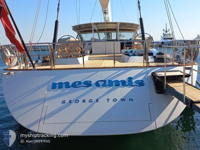
MES AMIS
Sailing Vessel
Current Trip
| Time Travelled | 7 days |
|---|---|
| Remaining Time | --- |
| Distance Travelled | 394.00 nm |
| Remaining Distance | --- |
| AVG Speed | 8.5 Knots |
| MAX Speed | 10.8 Knots |
| AVG Wind | 5.4 knots |
| MAX Wind | 12 knots |
| MIN Temp | 13.2°C / 55.76°F |
| MAX Temp | 24.1°C / 75.38°F |
| Draught | 4.8 m |
| Position Received | 1 m ago |
Current Position
| Longitude | 7.44895° |
|---|---|
| Latitude | 43.74382° |
| Status | Under way using engine |
| Speed | |
| Course | 243° |
| Area | Mediterranean Sea - Western Basin |
| Station | T-AIS |
| Position Received | 1 m ago |
Info
Information
The current position of MES AMIS is in Mediterranean Sea - Western Basin with coordinates 43.74382° / 7.44895° as reported on 2024-05-24 18:47 by AIS to our vessel tracker app. The vessel's current speed is 0 Knots
The vessel MES AMIS (IMO: 1009273, MMSI: 319629000) is a Sailing Vessel that was built in 2007 ( 17 years old ). It's sailing under the flag of [KY] Cayman Is.
In this page you can find informations about the vessels current position, last detected port calls, and current voyage information. If the vessels is not in coverage by AIS you will find the latest position.
The current position of MES AMIS is detected by our AIS receivers and we are not responsible for the reliability of the data. The last position was recorded while the vessel was in Coverage by the Ais receivers of our vessel tracking app.
The current draught of MES AMIS as reported by AIS is 4.8 meters
Weather
| Temperature | 17.7°C / 63.86°F |
|---|---|
| Wind Speed | 6 knots |
| Direction | 203° SSW |
| Pressure | 1016.5 hPa |
| Humidity | 78 % |
| Cloud Coverage | 75 % |
Featured Company
Last Port Calls
| Port | Arrival | Departure | Time In Port |
|---|---|---|---|
| 2024-05-07 06:11 | 2024-05-17 11:10 | 10 d | |
| 2024-04-11 19:15 | 2024-04-17 14:36 | 5 d | |
| 2024-04-06 20:57 | 2024-04-07 14:35 | 17 h | |
| 2024-04-05 20:52 | 2024-04-06 13:32 | 16 h | |
| 2024-03-29 18:20 | 2024-04-04 14:34 | 5 d | |
| 2024-03-29 17:31 | 2024-03-29 18:19 | 47 m | |
| 2024-03-29 12:56 | 2024-03-29 17:29 | 4 h | |
| 2024-03-21 19:19 | 2024-03-29 12:46 | 7 d | |
| 2024-03-09 20:56 | 2024-03-10 13:41 | 16 h | |
| 2024-03-08 15:41 | 2024-03-09 14:38 | 22 h |
Most Visited Ports (Last year)
| Port | Arrivals | |
|---|---|---|
| 7 | ||
| 7 | ||
| 5 | ||
| 3 | ||
| 3 | ||
| 2 |
Last Trips
| Origin | Departure | Destination | Arrival | Distance | |
|---|---|---|---|---|---|
| 2024-04-17 10:36 | 2024-05-07 08:11 | 3804.52 nm | |||
| 2024-04-07 10:35 | 2024-04-11 15:15 | 223.45 nm | |||
| 2024-04-06 09:32 | 2024-04-06 16:57 | 27.93 nm | |||
| 2024-04-04 10:34 | 2024-04-05 16:52 | 46.24 nm | |||
| 2024-03-29 14:19 | 2024-03-29 14:20 | 0.43 nm | |||
| 2024-03-29 13:29 | 2024-03-29 13:31 | 0.78 nm | |||
| 2024-03-29 08:46 | 2024-03-29 08:56 | 14.77 nm | |||
| 2024-03-10 09:41 | 2024-03-21 15:19 | 605.34 nm | |||
| 2024-03-09 10:38 | 2024-03-09 16:56 | 4.16 nm | |||
| 2024-03-03 10:36 | 2024-03-08 11:41 | 110.89 nm |
Events
| Time | Event | Details | Position / Dest | Info |
|---|---|---|---|---|
| 2024-05-24 08:41 | STOP Moving | 1.43 nm, North East of MONACO |
43.74300 / 7.44824
MONACO
|
Speed: 0.2 kn Course: 195° |
| 2024-05-24 08:17 | Change Sea Area | Mon�gasque part of the Mediterranean Sea - Western Basin French part of the Mediterranean Sea - Western Basin |
43.71517 / 7.42528
Mediterranean Sea - Western Basin
|
Speed: 10.1 kn Course: 53.6° |
| 2024-05-24 07:53 | START Moving | 0.54 nm, North East of SAINTJEAN CAP FERRAT |
43.69787 / 7.34309
MONACO
|
Speed: 3.2 kn Course: 98° |
| 2024-05-24 07:46 | Destination Changed | MONACO CAP FERRAT |
43.69772 / 7.34116
MONACO
|
Speed: 0.1 kn Course: 147° |
| 2024-05-24 07:33 | Status Changed | Under way using engine At anchor |
43.69759 / 7.34065
CAP FERRAT
|
Speed: Course: 142° |
| 2024-05-20 17:43 | Status Changed | At anchor Under way using engine |
43.69728 / 7.33983
CAP FERRAT
|
Speed: Course: 66° |
| 2024-05-20 17:16 | STOP Moving | 0.46 nm, North East of SAINTJEAN CAP FERRAT |
43.69759 / 7.34007
CAP FERRAT
|
Speed: 0.2 kn Course: 4° |
| 2024-05-20 16:49 | Change Sea Area | French part of the Mediterranean Sea - Western Basin Mon�gasque part of the Mediterranean Sea - Western Basin |
43.71616 / 7.42255
Mediterranean Sea - Western Basin
CAP FERRAT
|
Speed: 9.6 kn Course: 232.2° |
| 2024-05-20 16:35 | START Moving | 1.3 nm, North East of MONACO |
43.74115 / 7.44633
CAP FERRAT
|
Speed: 3.1 kn Course: 164° |
| 2024-05-20 16:27 | Destination Changed | CAP FERRAT MONACO |
43.74307 / 7.44776
CAP FERRAT
|
Speed: 1.5 kn Course: 225° |