
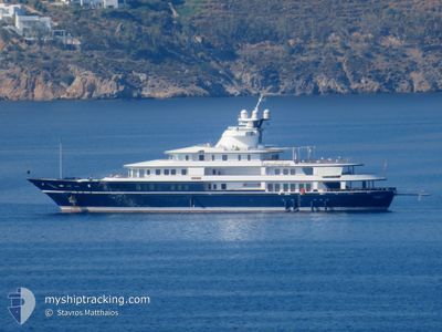
MESERRET 3
Yacht
Current Trip
CRUISING
| Time Travelled | 25 days |
|---|---|
| Remaining Time | --- |
| Distance Travelled | 1659.09 nm |
| Remaining Distance | --- |
| AVG Speed | 11.3 Knots |
| MAX Speed | 15.6 Knots |
| AVG Wind | 7.6 knots |
| MAX Wind | 20.6 knots |
| MIN Temp | 13.2°C / 55.76°F |
| MAX Temp | 28°C / 82.4°F |
| Draught | 4.5 m |
| Position Received | 32 m ago |
Current Position
| Longitude | 1.46536° |
|---|---|
| Latitude | 38.90404° |
| Status | Under way using engine |
| Speed | 0.8 Knots |
| Course | 346° |
| Area | Balearic Sea |
| Station | T-AIS |
| Position Received | 32 m ago |
Info
Information
The current position of MESERRET 3 is in Balearic Sea with coordinates 38.90404° / 1.46536° as reported on 2024-06-02 10:16 by AIS to our vessel tracker app. The vessel's current speed is 0.8 Knots
The vessel MESERRET 3 (IMO: 1002445, MMSI: 319203900) is a Yacht that was built in 1992 ( 32 years old ). It's sailing under the flag of [KY] Cayman Is.
In this page you can find informations about the vessels current position, last detected port calls, and current voyage information. If the vessels is not in coverage by AIS you will find the latest position.
The current position of MESERRET 3 is detected by our AIS receivers and we are not responsible for the reliability of the data. The last position was recorded while the vessel was in Coverage by the Ais receivers of our vessel tracking app.
The current draught of MESERRET 3 as reported by AIS is 4.5 meters
Weather
| Temperature | 21.1°C / 69.98°F |
|---|---|
| Wind Speed | 8 knots |
| Direction | 77° ENE |
| Pressure | 1019.2 hPa |
| Humidity | 59.8 % |
| Cloud Coverage | --- |
Featured Company
Events
| Time | Event | Details | Position / Dest | Info |
|---|---|---|---|---|
| 2024-06-02 10:12 | IN Coverage |
38.90368 / 1.46750
Balearic Sea
CRUISING
|
Speed: 2.3 kn Course: 270.3° |
|
| 2024-06-02 06:21 | OUT of Coverage |
39.29035 / 2.26715
Balearic Sea
CRUISING
|
Speed: 12 kn Course: 235.8° |
|
| 2024-06-02 05:12 | ETA Changed | 2024/06/02 10:00 2025/05/27 13:00 |
39.42437 / 2.52392
CRUISING
|
Speed: 12.6 kn Course: 238.7° |
| 2024-06-02 04:36 | START Moving | 0.52 nm, South of PORTALS NOUS |
39.52157 / 2.56655
CRUISING
|
Speed: 3.4 kn Course: 164° |
| 2024-06-02 04:27 | Status Changed | Under way using engine At anchor |
39.52330 / 2.56555
CRUISING
|
Speed: 0.7 kn Course: 113° |
| 2024-06-02 04:26 | Destination Changed | CRUISING PALMA |
39.52340 / 2.56512
CRUISING
|
Speed: 0.7 kn Course: 113° |
| 2024-06-01 00:04 | ETA Changed | 2025/05/27 13:00 2024/05/27 13:00 |
39.52279 / 2.56407
PALMA
|
Speed: Course: 33° |
| 2024-05-27 18:39 | Status Changed | At anchor Under way using engine |
39.52406 / 2.56646
PALMA
|
Speed: Course: 201° |
| 2024-05-27 15:36 | STOP Moving | 0.42 nm, South of PORTALS NOUS |
39.52340 / 2.56583
PALMA
|
Speed: 0.2 kn Course: 273° |
| 2024-05-27 13:25 | Change Sea Area | Spanish part of the Balearic Sea Spanish part of the Mediterranean Sea - Western Basin |
39.16305 / 2.72939
Balearic Sea
PALMA
|
Speed: 13.2 kn Course: 344° |