
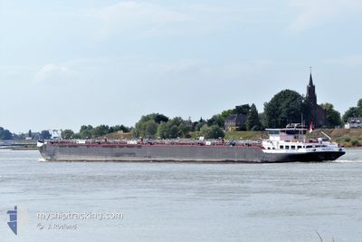
MESSINA
Tanker
Current Trip
| Time Travelled | 2 days |
|---|---|
| Remaining Time | 13 h, 28 mins |
| Distance Travelled | 136.21 nm |
| Remaining Distance | 78.48 nm |
| AVG Speed | 4.6 Knots |
| MAX Speed | 6.6 Knots |
| AVG Wind | 4.8 knots |
| MAX Wind | 7 knots |
| MIN Temp | 11.6°C / 52.88°F |
| MAX Temp | 18.8°C / 65.84°F |
| Draught | 1.9 m |
| Position Received | Now |
Current Position
| Longitude | 8.10607° |
|---|---|
| Latitude | 50.01905° |
| Status | Under way using engine |
| Speed | 5.4 Knots |
| Course | 73.9° |
| Area | North Sea |
| Station | T-AIS |
| Position Received | Now |
Info
Information
The current position of MESSINA is in North Sea with coordinates 50.01905° / 8.10607° as reported on 2024-05-19 06:38 by AIS to our vessel tracker app. The vessel's current speed is 5.4 Knots and is heading at the port of KARLSRUHE. The estimated time of arrival as calculated by vessel tracking app is 2024-05-19 20:07 LT
The vessel MESSINA (MMSI: 244722317) is a Tanker It's sailing under the flag of [NL] Netherlands.
In this page you can find informations about the vessels current position, last detected port calls, and current voyage information. If the vessels is not in coverage by AIS you will find the latest position.
The current position of MESSINA is detected by our AIS receivers and we are not responsible for the reliability of the data. The last position was recorded while the vessel was in Coverage by the Ais receivers of our vessel tracking app.
The current draught of MESSINA as reported by AIS is 1.9 meters
Weather
| Temperature | 12.4°C / 54.32°F |
|---|---|
| Wind Speed | 3 knots |
| Direction | 230° SW |
| Pressure | 1011 hPa |
| Humidity | 91.6 % |
| Cloud Coverage | 96 % |
Featured Company
Last Port Calls
| Port | Arrival | Departure | Time In Port |
|---|---|---|---|
| 2024-05-16 17:56 | 2024-05-17 05:37 | 11 h | |
| 2024-05-13 22:51 | 2024-05-15 17:52 | 1 d | |
| 2024-05-11 12:28 | 2024-05-12 05:26 | 16 h | |
| 2024-05-08 18:59 | 2024-05-08 20:02 | 1 h | |
| 2024-05-06 16:21 | 2024-05-08 02:36 | 1 d | |
| 2024-05-05 08:57 | 2024-05-05 09:55 | 57 m | |
| 2024-05-05 06:00 | 2024-05-05 06:23 | 22 m | |
| 2024-05-05 04:13 | 2024-05-05 05:41 | 1 h | |
| 2024-05-05 02:18 | 2024-05-05 03:01 | 43 m | |
| 2024-05-04 06:12 | 2024-05-04 07:48 | 1 h |
Most Visited Ports (Last year)
| Port | Arrivals | |
|---|---|---|
| 37 | ||
| 35 | ||
| 33 | ||
| 26 | ||
| 23 | ||
| 17 |
Last Trips
| Origin | Departure | Destination | Arrival | Distance | |
|---|---|---|---|---|---|
| 2024-05-15 19:52 | 2024-05-16 19:56 | 140.11 nm | |||
| 2024-05-12 07:26 | 2024-05-14 00:51 | 355.35 nm | |||
| 2024-05-08 22:02 | 2024-05-11 14:28 | 264.50 nm | |||
| 2024-05-08 04:36 | 2024-05-08 20:59 | 94.51 nm | |||
| 2024-05-05 11:55 | 2024-05-06 18:21 | 288.34 nm | |||
| 2024-05-05 08:23 | 2024-05-05 10:57 | 11.48 nm | |||
| 2024-05-05 07:41 | 2024-05-05 08:00 | 1.14 nm | |||
| 2024-05-05 05:01 | 2024-05-05 06:13 | 5.09 nm | |||
| 2024-05-04 09:48 | 2024-05-05 04:18 | 1.42 nm | |||
| 2024-05-04 06:48 | 2024-05-04 08:12 | 6.40 nm |
Events
| Time | Event | Details | Position / Dest | Info |
|---|---|---|---|---|
| 2024-05-19 05:11 | IN Coverage |
49.97180 / 7.92226
North Sea
|
Speed: 3.1 kn Course: 95.6° |
|
| 2024-05-18 19:08 | OUT of Coverage |
49.97169 / 7.92009
North Sea
|
Speed: Course: 99° |
|
| 2024-05-18 19:05 | STOP Moving | 11.3 nm, West of SCHIERSTEIN |
49.97169 / 7.92007
KARLSRUHE
|
Speed: Course: 98° |
| 2024-05-18 18:47 | IN Coverage |
49.97266 / 7.88755
North Sea
|
Speed: 3.2 kn Course: 95.7° |
|
| 2024-05-18 09:24 | Status Changed | Default Under way using engine |
50.44667 / 7.38833
KARLSRUHE
|
Speed: 4.2 kn Course: 156° |
| 2024-05-18 08:54 | OUT of Coverage |
50.47222 / 7.34819
North Sea
|
Speed: 4.2 kn Course: 151.7° |
|
| 2024-05-18 07:30 | Status Changed | Under way using engine Default |
50.56417 / 7.27555
KARLSRUHE
|
Speed: 5 kn Course: 111° |
| 2024-05-18 07:18 | Status Changed | Default Under way using engine |
50.57667 / 7.25667
KARLSRUHE
|
Speed: 5.6 kn Course: 102.4° |
| 2024-05-18 04:20 | START Moving | 0.57 nm, South East of MONDORF |
50.76478 / 7.07941
KARLSRUHE
|
Speed: 3.6 kn Course: 127° |
| 2024-05-18 04:18 | Status Changed | Under way using engine Moored |
50.76570 / 7.07683
KARLSRUHE
|
Speed: 0.1 kn Course: 126° |