
METIN HUSEYNOV
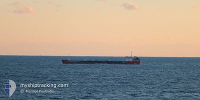
Oil Products Tanker
Current Trip
| Time Travelled | 12 days |
|---|---|
| Remaining Time | --- |
| Distance Travelled | 887.67 nm |
| Remaining Distance | --- |
| AVG Speed | 6.2 Knots |
| MAX Speed | 8.6 Knots |
| AVG Wind | 8.4 knots |
| MAX Wind | 23 knots |
| MIN Temp | 13.8°C / 56.84°F |
| MAX Temp | 29.6°C / 85.28°F |
| Draught | 5 m |
| Position Received | 4 d ago |
Current Position
| Longitude | 28.92840° |
|---|---|
| Latitude | 41.45057° |
| Status | Under way using engine |
| Speed | 5.9 Knots |
| Course | 302.6° |
| Area | Black Sea |
| Station | T-AIS |
| Position Received | 4 d ago |
Info
Information
The current position of METIN HUSEYNOV is in Black Sea with coordinates 41.45057° / 28.92840° as reported on 2024-05-28 05:20 by AIS to our vessel tracker app. The vessel's current speed is 5.9 Knots and is heading at the port of GIURGIULESTI. The estimated time of arrival as calculated by vessel tracking app is 2024-05-25 23:00 LT
The vessel METIN HUSEYNOV (IMO: 9175171, MMSI: 636021744) is a Oil Products Tanker that was built in 2000 ( 24 years old ). It's sailing under the flag of [LR] Liberia.
In this page you can find informations about the vessels current position, last detected port calls, and current voyage information. If the vessels is not in coverage by AIS you will find the latest position.
The current position of METIN HUSEYNOV is detected by our AIS receivers and we are not responsible for the reliability of the data. The last position was recorded while the vessel was in Coverage by the Ais receivers of our vessel tracking app.
The current draught of METIN HUSEYNOV as reported by AIS is 5 meters
Weather
| Temperature | 21.1°C / 69.98°F |
|---|---|
| Wind Speed | 11 knots |
| Direction | 182° S |
| Pressure | 1015.3 hPa |
| Humidity | 65.5 % |
| Cloud Coverage | 48 % |
Featured Company
Events
| Time | Event | Details | Position / Dest | Info |
|---|---|---|---|---|
| 2024-06-01 17:54 | STOP Moving | 1.26 nm, South East of VYLKOVE |
45.39910 / 29.57312
MDGIU
|
Speed: 0.1 kn Course: 290° |
| 2024-06-01 12:42 | START Moving | 8.43 nm, North of TULCEA |
45.31493 / 28.85668
MDGIU
|
Speed: 6.8 kn Course: 85° |
| 2024-05-30 14:17 | STOP Moving | 8.55 nm, North of TULCEA |
45.31797 / 28.85152
MDGIU
|
Speed: 0.3 kn Course: 292° |
| 2024-05-29 19:09 | STOP Moving | 7.42 nm, East of SULINA |
45.17003 / 29.82171
MDGIU
|
Speed: 0.3 kn Course: 219° |
| 2024-05-28 05:22 | Status Changed | Default Under way using engine |
41.45248 / 28.92477
MDGIU
|
Speed: 5.9 kn Course: 302.6° |
| 2024-05-28 05:20 | OUT of Coverage |
41.45057 / 28.92840
Black Sea
|
Speed: 5.9 kn Course: 302.6° |
|
| 2024-05-28 04:52 | Status Changed | Under way using engine Default |
41.42326 / 28.97565
MDGIU
|
Speed: 5.8 kn Course: 296° |
| 2024-05-28 04:36 | Status Changed | Default Under way using engine |
41.41223 / 29.00220
MDGIU
|
Speed: 5.7 kn Course: 297.1° |
| 2024-05-28 01:32 | Change Sea Area | Turkish part of the Black Sea Turkish part of the Sea of Marmara |
41.23116 / 29.13976
Black Sea
|
Speed: 6.1 kn Course: 38.3° |
| 2024-05-27 18:08 | START Moving | 13.47 nm, South of AMBARLI |
40.73623 / 28.64528
MDGIU
|
Speed: 3.7 kn Course: 48° |