
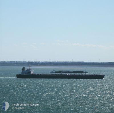
MEZAIRA'A
Oil Products Tanker
Current Trip
GB SHV
| Time Travelled | 33 days |
|---|---|
| Remaining Time | --- |
| Distance Travelled | 9615.64 nm |
| Remaining Distance | --- |
| AVG Speed | 12 Knots |
| MAX Speed | 14.8 Knots |
| AVG Wind | 13.8 knots |
| MAX Wind | 40.2 knots |
| MIN Temp | 14.2°C / 57.56°F |
| MAX Temp | 30.5°C / 86.9°F |
| Draught | 13 m |
| Position Received | 2 d ago |
Current Position
| Longitude | -14.72859° |
|---|---|
| Latitude | 28.70231° |
| Status | Under way using engine |
| Speed | 11.5 Knots |
| Course | 12.2° |
| Area | North Atlantic Ocean |
| Station | T-AIS |
| Position Received | 2 d ago |
Info
Information
The current position of MEZAIRA'A is in North Atlantic Ocean with coordinates 28.70231° / -14.72859° as reported on 2024-06-25 02:05 by AIS to our vessel tracker app. The vessel's current speed is 11.5 Knots
The vessel MEZAIRA'A (IMO: 9487275, MMSI: 636014947) is a Oil Products Tanker that was built in 2011 ( 13 years old ). It's sailing under the flag of [LR] Liberia.
In this page you can find informations about the vessels current position, last detected port calls, and current voyage information. If the vessels is not in coverage by AIS you will find the latest position.
The current position of MEZAIRA'A is detected by our AIS receivers and we are not responsible for the reliability of the data. The last position was recorded while the vessel was in Coverage by the Ais receivers of our vessel tracking app.
The current draught of MEZAIRA'A as reported by AIS is 13 meters
Weather
| Temperature | 18.2°C / 64.76°F |
|---|---|
| Wind Speed | 20 knots |
| Direction | 10° N |
| Pressure | 1012.2 hPa |
| Humidity | 91.8 % |
| Cloud Coverage | 1 % |
Featured Company
Last Port Calls
| Port | Arrival | Departure | Time In Port |
|---|---|---|---|
| 2024-05-22 13:48 | 2024-05-24 15:56 | 2 d | |
| 2024-05-12 11:42 | 2024-05-14 09:19 | 1 d | |
| 2024-04-25 02:17 | 2024-04-27 03:10 | 2 d | |
| 2024-04-21 03:36 | 2024-04-21 12:20 | 8 h | |
| 2024-04-01 20:00 | 2024-04-07 15:27 | 5 d |
Most Visited Ports (Last year)
| Port | Arrivals | |
|---|---|---|
| 3 | ||
| 3 | ||
| 2 | ||
| 2 | ||
| 2 | ||
| 1 |
Last Trips
| Origin | Departure | Destination | Arrival | Distance | |
|---|---|---|---|---|---|
| 2024-05-14 17:19 | 2024-05-22 19:18 | 2159.85 nm | |||
| 2024-04-27 06:10 | 2024-05-12 19:42 | 4639.47 nm | |||
| 2024-04-07 17:27 | 2024-04-25 05:17 | 4150.71 nm | |||
| 2024-04-07 17:27 | 2024-04-21 05:36 | 3483.36 nm | |||
| 2024-02-26 13:07 | 2024-04-01 22:00 | 4455.62 nm |
Events
| Time | Event | Details | Position / Dest | Info |
|---|---|---|---|---|
| 2024-06-25 02:10 | Status Changed | Default Under way using engine |
28.71849 / -14.72437
GB SHV
|
Speed: 11.5 kn Course: 12.2° |
| 2024-06-25 02:05 | Status Changed | Under way using engine Default |
28.70231 / -14.72859
GB SHV
|
Speed: 11.6 kn Course: 12° |
| 2024-06-25 02:05 | OUT of Coverage |
28.70231 / -14.72859
North Atlantic Ocean
GB SHV
|
Speed: 11.5 kn Course: 12.2° |
|
| 2024-06-25 02:03 | Status Changed | Default Under way using engine |
28.69439 / -14.73056
GB SHV
|
Speed: 11.6 kn Course: 13.5° |
| 2024-06-25 01:17 | Status Changed | Under way using engine Default |
28.55060 / -14.76847
GB SHV
|
Speed: 11.8 kn Course: 13° |
| 2024-06-25 01:15 | Status Changed | Default Under way using engine |
28.54467 / -14.77005
GB SHV
|
Speed: 11.8 kn Course: 14.3° |
| 2024-06-24 19:21 | Status Changed | Under way using engine Default |
27.52206 / -15.20585
GB SHV
|
Speed: 10.8 kn Course: 26° |
| 2024-06-24 19:12 | Status Changed | Default Under way using engine |
27.49737 / -15.21974
GB SHV
|
Speed: 10.8 kn Course: 27.1° |
| 2024-06-24 18:56 | Change Sea Area | Spanish (Canary Islands) part of the North Atlantic Ocean South African part of the South Atlantic Ocean |
27.45595 / -15.24327
North Atlantic Ocean
GB SHV
|
Speed: 10.8 kn Course: 27° |
| 2024-06-24 18:56 | Status Changed | Under way using engine Default |
27.45595 / -15.24327
GB SHV
|
Speed: 10.8 kn Course: 26° |