
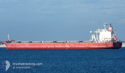
MG KRONOS
Cargo
Current Trip
VN GDB
| Time Travelled | 5 days |
|---|---|
| Remaining Time | --- |
| Distance Travelled | 1216.87 nm |
| Remaining Distance | --- |
| AVG Speed | 9.5 Knots |
| MAX Speed | 12 Knots |
| AVG Wind | 11.5 knots |
| MAX Wind | 27.9 knots |
| MIN Temp | 5.4°C / 41.72°F |
| MAX Temp | 14.9°C / 58.82°F |
| Draught | 14.4 m |
| Position Received | 3 d ago |
Current Position
| Longitude | -127.49905° |
|---|---|
| Latitude | 47.33803° |
| Status | Under way using engine |
| Speed | 10.4 Knots |
| Course | 233.7° |
| Area | North Pacific Ocean |
| Station | T-AIS |
| Position Received | 3 d ago |
Info
Information
The current position of MG KRONOS is in North Pacific Ocean with coordinates 47.33803° / -127.49905° as reported on 2024-05-14 21:37 by AIS to our vessel tracker app. The vessel's current speed is 10.4 Knots
The vessel MG KRONOS (IMO: 9774288, MMSI: 371207000) is a Cargo It's sailing under the flag of [PA] Panama.
In this page you can find informations about the vessels current position, last detected port calls, and current voyage information. If the vessels is not in coverage by AIS you will find the latest position.
The current position of MG KRONOS is detected by our AIS receivers and we are not responsible for the reliability of the data. The last position was recorded while the vessel was in Coverage by the Ais receivers of our vessel tracking app.
The current draught of MG KRONOS as reported by AIS is 14.4 meters
Weather
| Temperature | 6.7°C / 44.06°F |
|---|---|
| Wind Speed | 24 knots |
| Direction | 205° SSW |
| Pressure | 1016.2 hPa |
| Humidity | 97.2 % |
| Cloud Coverage | 100 % |
Featured Company
Last Port Calls
| Port | Arrival | Departure | Time In Port |
|---|---|---|---|
| 2024-05-12 07:59 | 2024-05-13 20:39 | 1 d | |
| 2024-04-20 02:20 | 2024-04-23 01:56 | 2 d | |
| 2024-03-24 04:39 | 2024-03-25 01:41 | 21 h | |
| 2024-03-11 04:41 | 2024-03-12 18:55 | 1 d |
Most Visited Ports (Last year)
| Port | Arrivals | |
|---|---|---|
| 2 | ||
| 2 | ||
| 1 | ||
| 1 | ||
| 1 | ||
| 1 |
Last Trips
| Origin | Departure | Destination | Arrival | Distance | |
|---|---|---|---|---|---|
| 2024-04-23 10:56 | 2024-05-12 00:59 | 4860.95 nm | |||
| 2024-03-25 11:41 | 2024-04-20 11:20 | 4301.92 nm | |||
| 2024-03-13 07:55 | 2024-03-24 14:39 | 1989.38 nm | |||
| 2024-02-18 18:03 | 2024-03-11 17:41 | 6006.74 nm |
Events
| Time | Event | Details | Position / Dest | Info |
|---|---|---|---|---|
| 2024-05-14 21:42 | Status Changed | Default Under way using engine |
47.32910 / -127.51718
VN GDB
|
Speed: 10.4 kn Course: 233.7° |
| 2024-05-14 21:37 | OUT of Coverage |
47.33803 / -127.49905
North Pacific Ocean
VN GDB
|
Speed: 10.4 kn Course: 233.7° |
|
| 2024-05-14 21:20 | Status Changed | Under way using engine Default |
47.36622 / -127.44119
VN GDB
|
Speed: 10.4 kn Course: 234° |
| 2024-05-14 21:20 | IN Coverage |
47.36568 / -127.44228
North Pacific Ocean
VN GDB
|
Speed: 10.4 kn Course: 233.8° |
|
| 2024-05-14 18:51 | Status Changed | Default Under way using engine |
47.61841 / -126.94469
VN GDB
|
Speed: 9.9 kn Course: 237.3° |
| 2024-05-14 18:47 | Status Changed | Under way using engine Default |
47.62510 / -126.93186
VN GDB
|
Speed: 10 kn Course: 236° |
| 2024-05-14 18:47 | OUT of Coverage |
47.62510 / -126.93186
North Pacific Ocean
VN GDB
|
Speed: 9.9 kn Course: 237.3° |
|
| 2024-05-14 18:42 | IN Coverage |
47.62510 / -126.93186
North Pacific Ocean
VN GDB
|
Speed: 9.9 kn Course: 237.3° |
|
| 2024-05-14 13:06 | Status Changed | Default Under way using engine |
48.17857 / -125.82237
VN GDB
|
Speed: 9.8 kn Course: 232.5° |
| 2024-05-14 13:01 | OUT of Coverage |
48.18581 / -125.80773
North Pacific Ocean
VN GDB
|
Speed: 9.8 kn Course: 232.5° |