
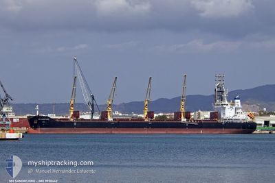
MH SANDEFJORD
Cargo
Current Trip
| Time Travelled | 25 days |
|---|---|
| Remaining Time | 8 h, 53 mins |
| Distance Travelled | 7543.68 nm |
| Remaining Distance | 103.12 nm |
| AVG Speed | 11.9 Knots |
| MAX Speed | 15 Knots |
| AVG Wind | 12 knots |
| MAX Wind | 30 knots |
| MIN Temp | 13.9°C / 57.02°F |
| MAX Temp | 32.6°C / 90.68°F |
| Draught | 10 m |
| Position Received | 8 d ago |
Current Position
| Longitude | 17.71262° |
|---|---|
| Latitude | -33.60039° |
| Status | Under way using engine |
| Speed | 11.7 Knots |
| Course | 331.3° |
| Area | South Atlantic Ocean |
| Station | T-AIS |
| Position Received | 8 d ago |
Info
Information
The current position of MH SANDEFJORD is in South Atlantic Ocean with coordinates -33.60039° / 17.71262° as reported on 2024-05-31 08:33 by AIS to our vessel tracker app. The vessel's current speed is 11.7 Knots and is heading at the port of COTONOU. The estimated time of arrival as calculated by vessel tracking app is 2024-06-09 10:27 LT
The vessel MH SANDEFJORD (IMO: 9950442, MMSI: 636021584) is a Cargo It's sailing under the flag of [LR] Liberia.
In this page you can find informations about the vessels current position, last detected port calls, and current voyage information. If the vessels is not in coverage by AIS you will find the latest position.
The current position of MH SANDEFJORD is detected by our AIS receivers and we are not responsible for the reliability of the data. The last position was recorded while the vessel was in Coverage by the Ais receivers of our vessel tracking app.
The current draught of MH SANDEFJORD as reported by AIS is 10 meters
Weather
| Temperature | 27.4°C / 81.32°F |
|---|---|
| Wind Speed | 15 knots |
| Direction | 219° SW |
| Pressure | 1012.5 hPa |
| Humidity | 76.8 % |
| Cloud Coverage | 100 % |
Featured Company
Last Port Calls
| Port | Arrival | Departure | Time In Port |
|---|---|---|---|
| 2024-05-07 03:37 | 2024-05-14 07:24 | 7 d | |
| 2024-04-28 11:56 | 2024-05-02 10:31 | 3 d |
Most Visited Ports (Last year)
| Port | Arrivals | |
|---|---|---|
| 4 | ||
| 1 | ||
| 1 | ||
| 1 | ||
| 1 | ||
| 1 |
Last Trips
| Origin | Departure | Destination | Arrival | Distance | |
|---|---|---|---|---|---|
| 2024-05-02 16:01 | 2024-05-07 08:37 | 504.46 nm |
Events
| Time | Event | Details | Position / Dest | Info |
|---|---|---|---|---|
| 2024-05-31 08:41 | Status Changed | Default Under way using engine |
-33.57751 / 17.69864
BJCOO
|
Speed: 11.7 kn Course: 331.3° |
| 2024-05-31 08:33 | Status Changed | Under way using engine Default |
-33.60039 / 17.71262
BJCOO
|
Speed: 12 kn Course: 336° |
| 2024-05-31 08:33 | OUT of Coverage |
-33.60039 / 17.71262
South Atlantic Ocean
BJCOO
|
Speed: 11.7 kn Course: 331.3° |
|
| 2024-05-31 08:22 | Status Changed | Default Under way using engine |
-33.63366 / 17.73280
BJCOO
|
Speed: 11.8 kn Course: 331.5° |
| 2024-05-31 07:38 | Status Changed | Under way using engine Default |
-33.76049 / 17.81477
BJCOO
|
Speed: 11.9 kn Course: 330° |
| 2024-05-31 07:33 | Status Changed | Default Under way using engine |
-33.77473 / 17.82433
BJCOO
|
Speed: 11.7 kn Course: 333.1° |
| 2024-05-31 06:19 | Status Changed | Under way using engine Default |
-33.99536 / 17.94205
BJCOO
|
Speed: 11 kn Course: 342° |
| 2024-05-31 06:15 | Status Changed | Default Under way using engine |
-34.00500 / 17.94667
BJCOO
|
Speed: 11.9 kn Course: 336.6° |
| 2024-05-31 06:02 | Status Changed | Under way using engine Default |
-34.04639 / 17.96614
BJCOO
|
Speed: 12 kn Course: 339° |
| 2024-05-31 05:53 | Status Changed | Default Under way using engine |
-34.07428 / 17.98053
BJCOO
|
Speed: 12.1 kn Course: 336.4° |