
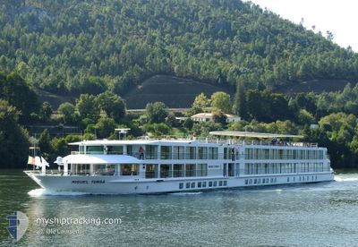
MIGUEL TORGA
Passenger
Current Trip
PTBDA00001DOCKX0207
| Time Travelled | 5 days |
|---|---|
| Remaining Time | --- |
| Distance Travelled | 25.76 nm |
| Remaining Distance | --- |
| AVG Speed | 8.7 Knots |
| MAX Speed | 11.4 Knots |
| AVG Wind | 7.5 knots |
| MAX Wind | 12 knots |
| MIN Temp | 14.1°C / 57.38°F |
| MAX Temp | 25.4°C / 77.72°F |
| Draught | 1.6 m |
| Position Received | Now |
Current Position
| Longitude | -8.59600° |
|---|---|
| Latitude | 41.13774° |
| Status | Moored |
| Speed | |
| Course | --- |
| Area | North Sea |
| Station | T-AIS |
| Position Received | Now |
Info
Information
The current position of MIGUEL TORGA is in North Sea with coordinates 41.13774° / -8.59600° as reported on 2024-05-10 01:48 by AIS to our vessel tracker app. The vessel's current speed is 0 Knots
The vessel MIGUEL TORGA (MMSI: 226011970) is a Passenger It's sailing under the flag of [FR] France.
In this page you can find informations about the vessels current position, last detected port calls, and current voyage information. If the vessels is not in coverage by AIS you will find the latest position.
The current position of MIGUEL TORGA is detected by our AIS receivers and we are not responsible for the reliability of the data. The last position was recorded while the vessel was in Coverage by the Ais receivers of our vessel tracking app.
The current draught of MIGUEL TORGA as reported by AIS is 1.6 meters
Weather
| Temperature | 17.7°C / 63.86°F |
|---|---|
| Wind Speed | 2 knots |
| Direction | 167° SSE |
| Pressure | 1014.1 hPa |
| Humidity | 63.8 % |
| Cloud Coverage | 5 % |
Featured Company
Last Port Calls
| Port | Arrival | Departure | Time In Port |
|---|---|---|---|
| 2024-05-03 16:28 | 2024-05-04 12:15 | 19 h | |
| 2024-04-26 16:26 | 2024-04-27 17:16 | 1 d | |
| 2024-04-19 20:15 | 2024-04-19 20:54 | 38 m | |
| 2024-04-11 18:41 | 2024-04-11 19:05 | 24 m | |
| 2024-04-08 07:57 | 2024-04-08 08:24 | 27 m | |
| 2024-04-03 14:07 | 2024-04-03 14:46 | 38 m | |
| 2024-03-27 13:12 | 2024-03-27 13:52 | 39 m |
Most Visited Ports (Last year)
| Port | Arrivals | |
|---|---|---|
| 17 |
Last Trips
| Origin | Departure | Destination | Arrival | Distance | |
|---|---|---|---|---|---|
| 2024-04-27 18:16 | 2024-05-03 17:28 | 33.58 nm | |||
| 2024-04-19 21:54 | 2024-04-26 17:26 | 25.47 nm | |||
| 2024-04-11 20:05 | 2024-04-19 21:15 | 28.60 nm | |||
| 2024-04-08 09:24 | 2024-04-11 19:41 | 31.45 nm | |||
| 2024-04-03 15:46 | 2024-04-08 08:57 | 33.33 nm | |||
| 2024-03-27 13:52 | 2024-04-03 15:07 | 25.88 nm | |||
| 2023-12-31 23:36 | 2024-03-27 13:12 | 47.95 nm |
Events
| Time | Event | Details | Position / Dest | Info |
|---|---|---|---|---|
| 2024-05-09 17:41 | Status Changed | Moored Under way using engine |
41.13773 / -8.59600
PTBDA00001DOCKX0207
|
Speed: Course: 511° |
| 2024-05-09 17:38 | STOP Moving | 2.77 nm, East of PORTO |
41.13772 / -8.59599
PTBDA00001DOCKX0207
|
Speed: 0.2 kn Course: 511° |
| 2024-05-09 16:16 | IN Coverage |
41.06132 / -8.45810
North Sea
|
Speed: 10.9 kn Course: 319.5° |
|
| 2024-05-05 12:38 | OUT of Coverage |
41.05152 / -8.39661
North Sea
|
Speed: 10.3 kn Course: 115.2° |
|
| 2024-05-05 12:03 | IN Coverage |
41.05960 / -8.45647
North Sea
|
Speed: 10.3 kn Course: 136.5° |
|
| 2024-05-04 18:44 | OUT of Coverage |
41.07612 / -8.47181
North Sea
|
Speed: Course: 511° |
|
| 2024-05-04 18:03 | STOP Moving | 8.75 nm, South East of PORTO |
41.07027 / -8.49015
PTBDA00001DOCKX0207
|
Speed: Course: 511° |
| 2024-05-04 17:03 | START Moving | 2.9 nm, East of PORTO |
41.13826 / -8.59313
PTBDA00001DOCKX0207
|
Speed: 5.5 kn Course: 71.8° |
| 2024-05-04 12:31 | STOP Moving | 2.78 nm, East of PORTO |
41.13799 / -8.59571
PTBDA00001DOCKX0207
|
Speed: Course: 511° |
| 2024-05-04 12:15 | PORT DEPARTURE |
|
41.14146 / -8.62224
PTBDA00001DOCKX0207
|
Speed: 6.2 kn Course: 131° |