
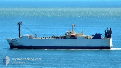
MINDORO
Vehicles Carrier
Current Trip
| Time Travelled | 4 days |
|---|---|
| Remaining Time | -3 mins |
| Distance Travelled | 848.19 nm |
| Remaining Distance | 2.16 nm |
| AVG Speed | 10.9 Knots |
| MAX Speed | 14.7 Knots |
| AVG Wind | 15.2 knots |
| MAX Wind | 28 knots |
| MIN Temp | 24.3°C / 75.74°F |
| MAX Temp | 30.8°C / 87.44°F |
| Draught | 6.1 m |
| Position Received | 1 m ago |
Current Position
| Longitude | 106.79548° |
|---|---|
| Latitude | 20.83124° |
| Status | Under way using engine |
| Speed | 7.1 Knots |
| Course | 269.2° |
| Area | South China Sea |
| Station | T-AIS |
| Position Received | 1 m ago |
Info
Information
The current position of MINDORO is in South China Sea with coordinates 20.83124° / 106.79548° as reported on 2024-06-01 09:45 by AIS to our vessel tracker app. The vessel's current speed is 7.1 Knots and is heading at the port of HAI PHONG. The estimated time of arrival as calculated by vessel tracking app is 2024-06-01 09:44 LT
The vessel MINDORO (IMO: 9310795, MMSI: 351287000) is a Vehicles Carrier that was built in 2004 ( 20 years old ). It's sailing under the flag of [PA] Panama.
In this page you can find informations about the vessels current position, last detected port calls, and current voyage information. If the vessels is not in coverage by AIS you will find the latest position.
The current position of MINDORO is detected by our AIS receivers and we are not responsible for the reliability of the data. The last position was recorded while the vessel was in Coverage by the Ais receivers of our vessel tracking app.
The current draught of MINDORO as reported by AIS is 6.1 meters
Weather
| Temperature | 29.5°C / 85.1°F |
|---|---|
| Wind Speed | 8 knots |
| Direction | 148° SSE |
| Pressure | 1005.2 hPa |
| Humidity | 74 % |
| Cloud Coverage | 86 % |
Featured Company
Last Port Calls
| Port | Arrival | Departure | Time In Port |
|---|---|---|---|
| 2024-05-28 01:02 | 2024-05-28 08:17 | 7 h | |
| 2024-05-26 19:32 | 2024-05-27 05:25 | 9 h | |
| 2024-05-21 21:46 | 2024-05-22 07:17 | 9 h | |
| 2024-05-19 22:47 | 2024-05-20 08:19 | 9 h | |
| 2024-05-17 02:56 | 2024-05-18 04:36 | 1 d | |
| 2024-05-10 03:35 | 2024-05-11 01:50 | 22 h | |
| 2024-05-05 07:03 | 2024-05-05 12:45 | 5 h | |
| 2024-05-04 06:08 | 2024-05-04 12:40 | 6 h | |
| 2024-04-25 22:32 | 2024-04-26 09:17 | 10 h | |
| 2024-04-22 22:19 | 2024-04-23 07:08 | 8 h |
Last Trips
| Origin | Departure | Destination | Arrival | Distance | |
|---|---|---|---|---|---|
| 2024-05-27 13:25 | 2024-05-28 09:02 | 209.17 nm | |||
| 2024-05-22 16:17 | 2024-05-27 03:32 | 1224.72 nm | |||
| 2024-05-20 17:19 | 2024-05-22 06:46 | 370.91 nm | |||
| 2024-05-18 13:36 | 2024-05-20 07:47 | 381.25 nm | |||
| 2024-05-11 08:50 | 2024-05-17 11:56 | 1669.34 nm | |||
| 2024-05-05 20:45 | 2024-05-10 10:35 | 885.84 nm | |||
| 2024-05-04 20:40 | 2024-05-05 15:03 | 206.33 nm | |||
| 2024-04-26 18:17 | 2024-05-04 14:08 | 1238.20 nm | |||
| 2024-04-23 16:08 | 2024-04-26 07:32 | 368.54 nm | |||
| 2024-04-20 14:08 | 2024-04-23 07:19 | 617.62 nm |
Events
| Time | Event | Details | Position / Dest | Info |
|---|---|---|---|---|
| 2024-06-01 08:35 | Status Changed | Under way using engine Default |
20.75522 / 106.94386
VN HPH
|
Speed: 8.8 kn Course: 324° |
| 2024-06-01 08:22 | Status Changed | Default Under way using engine |
20.72662 / 106.96647
VN HPH
|
Speed: 10.5 kn Course: 321.6° |
| 2024-06-01 08:18 | Status Changed | Under way using engine Default |
20.71795 / 106.97353
VN HPH
|
Speed: 10.3 kn Course: 325° |
| 2024-06-01 08:14 | Status Changed | Default Under way using engine |
20.70771 / 106.98128
VN HPH
|
Speed: 10.2 kn Course: 340.5° |
| 2024-06-01 07:41 | ETA Changed | 2025/05/31 23:00 2024/05/31 23:00 |
20.66133 / 106.91950
VN HPH
|
Speed: 10.4 kn Course: 78.2° |
| 2024-06-01 07:31 | Status Changed | Under way using engine Default |
20.65642 / 106.89181
VN HPH
|
Speed: 8.3 kn Course: 40° |
| 2024-06-01 07:22 | Status Changed | Default Under way using engine |
20.64518 / 106.87427
VN HPH
|
Speed: 5.3 kn Course: 307.8° |
| 2024-06-01 07:16 | Status Changed | Under way using engine Default |
20.63814 / 106.87637
VN HPH
|
Speed: 5.6 kn Course: 304° |
| 2024-06-01 07:10 | IN Coverage |
20.63814 / 106.87637
South China Sea
|
Speed: 5.3 kn Course: 307.8° |
|
| 2024-06-01 06:18 | START Moving | 21.22 nm, South East of HAI PHONG |
20.56541 / 106.95015
VN HPH
|
Speed: 3.7 kn Course: 343° |