
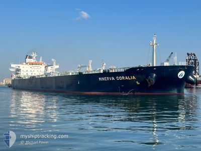
MINERVA CORALIA
Tanker
Current Trip
| Time Travelled | 2 days |
|---|---|
| Remaining Time | --- |
| Distance Travelled | 895.71 nm |
| Remaining Distance | --- |
| AVG Speed | 12.5 Knots |
| MAX Speed | 15.5 Knots |
| AVG Wind | 17.3 knots |
| MAX Wind | 24 knots |
| MIN Temp | 25.8°C / 78.44°F |
| MAX Temp | 28.6°C / 83.48°F |
| Draught | 12 m |
| Position Received | 2 d ago |
Current Position
| Longitude | -61.82563° |
|---|---|
| Latitude | 10.65958° |
| Status | Under way using engine |
| Speed | 13.4 Knots |
| Course | 354.9° |
| Area | Caribbean Sea |
| Station | T-AIS |
| Position Received | 2 d ago |
Info
Information
The current position of MINERVA CORALIA is in Caribbean Sea with coordinates 10.65958° / -61.82563° as reported on 2024-05-31 09:28 by AIS to our vessel tracker app. The vessel's current speed is 13.4 Knots and is heading at the port of CORPUS CHRISTI. The estimated time of arrival as calculated by vessel tracking app is 2024-06-08 03:00 LT
The vessel MINERVA CORALIA (IMO: 9728239, MMSI: 249878000) is a Tanker It's sailing under the flag of [MT] Malta.
In this page you can find informations about the vessels current position, last detected port calls, and current voyage information. If the vessels is not in coverage by AIS you will find the latest position.
The current position of MINERVA CORALIA is detected by our AIS receivers and we are not responsible for the reliability of the data. The last position was recorded while the vessel was in Coverage by the Ais receivers of our vessel tracking app.
The current draught of MINERVA CORALIA as reported by AIS is 12 meters
Weather
| Temperature | 28.2°C / 82.76°F |
|---|---|
| Wind Speed | 17 knots |
| Direction | 71° ENE |
| Pressure | 1010.7 hPa |
| Humidity | 87.1 % |
| Cloud Coverage | 100 % |
Featured Company
Last Port Calls
| Port | Arrival | Departure | Time In Port |
|---|---|---|---|
| 2024-05-29 15:11 | 2024-05-31 06:52 | 1 d | |
| 2024-05-12 03:13 | 2024-05-13 20:37 | 1 d | |
| 2024-05-07 04:09 | 2024-05-09 02:32 | 1 d | |
| 2024-04-13 15:51 | 2024-04-16 00:05 | 2 d |
Most Visited Ports (Last year)
| Port | Arrivals | |
|---|---|---|
| 3 | ||
| 2 | ||
| 1 | ||
| 1 | ||
| 1 | ||
| 1 |
Last Trips
| Origin | Departure | Destination | Arrival | Distance | |
|---|---|---|---|---|---|
| 2024-05-13 22:37 | 2024-05-29 11:11 | 4235.45 nm | |||
| 2024-05-09 04:32 | 2024-05-12 05:13 | 830.19 nm | |||
| 2024-04-15 19:05 | 2024-05-07 06:09 | 5490.06 nm | |||
| 2024-03-19 23:43 | 2024-04-13 10:51 | 5093.34 nm |
Events
| Time | Event | Details | Position / Dest | Info |
|---|---|---|---|---|
| 2024-05-31 09:36 | Status Changed | Default Under way using engine |
10.69046 / -61.82806
US CRP
|
Speed: 13.4 kn Course: 354.9° |
| 2024-05-31 09:28 | OUT of Coverage |
10.65958 / -61.82563
Caribbean Sea
US CRP
|
Speed: 13.4 kn Course: 354.9° |
|
| 2024-05-31 09:25 | Status Changed | Under way using engine Default |
10.64725 / -61.82362
US CRP
|
Speed: 13 kn Course: 356° |
| 2024-05-31 09:20 | Status Changed | Default Under way using engine |
10.63010 / -61.82088
US CRP
|
Speed: 12.9 kn Course: 4.4° |
| 2024-05-31 09:10 | Change Sea Area | Venezuelan part of the Caribbean Sea Trinidad and Tobago part of the Caribbean Sea |
10.59516 / -61.82116
Caribbean Sea
US CRP
|
Speed: 12.9 kn Course: 10.1° |
| 2024-05-31 09:06 | Draught Changed | 12 8.5 |
10.56869 / -61.82368
US CRP
|
Speed: 12.9 kn Course: 8.2° |
| 2024-05-31 09:06 | Destination Changed | US CRP USG |
10.56869 / -61.82368
US CRP
|
Speed: 12.9 kn Course: 8.2° |
| 2024-05-31 09:06 | ETA Changed | 2024/06/08 03:00 2024/06/05 06:00 |
10.56869 / -61.82368
US CRP
|
Speed: 12.9 kn Course: 8.2° |
| 2024-05-31 08:41 | Change Sea Area | Trinidad and Tobago part of the Caribbean Sea Venezuelan part of the Caribbean Sea |
10.48942 / -61.82691
Caribbean Sea
USG
|
Speed: 11.9 kn Course: 4.2° |
| 2024-05-31 08:38 | Status Changed | Under way using engine Default |
10.48094 / -61.82671
USG
|
Speed: 13.2 kn Course: 305° |