
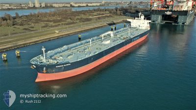
MINERVA OLYMPIA
Tanker
Current Trip
| Time Travelled | 14 h, 58 mins |
|---|---|
| Remaining Time | 2 days |
| Distance Travelled | 163.22 nm |
| Remaining Distance | 531.87 nm |
| AVG Speed | 10.1 Knots |
| MAX Speed | 11.6 Knots |
| AVG Wind | 6.3 knots |
| MAX Wind | 12 knots |
| MIN Temp | 10.4°C / 50.72°F |
| MAX Temp | 13.4°C / 56.12°F |
| Draught | 13 m |
| Position Received | Now |
Current Position
| Longitude | 3.24404° |
|---|---|
| Latitude | 55.74815° |
| Status | Under way using engine |
| Speed | 11 Knots |
| Course | 68.1° |
| Area | North Sea |
| Station | T-AIS |
| Position Received | Now |
Info
Information
The current position of MINERVA OLYMPIA is in North Sea with coordinates 55.74815° / 3.24404° as reported on 2024-05-18 00:03 by AIS to our vessel tracker app. The vessel's current speed is 11 Knots and is heading at the port of ROSTOCK. The estimated time of arrival as calculated by vessel tracking app is 2024-05-20 00:26 LT
The vessel MINERVA OLYMPIA (IMO: 9787194, MMSI: 241614000) is a Tanker It's sailing under the flag of [GR] Greece.
In this page you can find informations about the vessels current position, last detected port calls, and current voyage information. If the vessels is not in coverage by AIS you will find the latest position.
The current position of MINERVA OLYMPIA is detected by our AIS receivers and we are not responsible for the reliability of the data. The last position was recorded while the vessel was in Coverage by the Ais receivers of our vessel tracking app.
The current draught of MINERVA OLYMPIA as reported by AIS is 13 meters
Weather
| Temperature | 12.7°C / 54.86°F |
|---|---|
| Wind Speed | 11 knots |
| Direction | 80° E |
| Pressure | 1014.1 hPa |
| Humidity | 85.6 % |
| Cloud Coverage | 26 % |
Featured Company
Last Port Calls
| Port | Arrival | Departure | Time In Port |
|---|---|---|---|
| 2024-05-16 04:26 | 2024-05-17 09:05 | 1 d | |
| 2024-05-09 22:42 | 2024-05-11 07:01 | 1 d | |
| 2024-04-09 09:51 | 2024-04-09 22:38 | 12 h |
Most Visited Ports (Last year)
| Port | Arrivals | |
|---|---|---|
| 3 | ||
| 1 | ||
| 1 | ||
| 1 | ||
| 1 | ||
| 1 |
Last Trips
| Origin | Departure | Destination | Arrival | Distance | |
|---|---|---|---|---|---|
| 2024-05-11 09:01 | 2024-05-16 05:26 | 1026.22 nm | |||
| 2024-04-09 23:38 | 2024-05-10 00:42 | 7359.74 nm | |||
| 2024-02-17 14:32 | 2024-04-09 10:51 | 8357.33 nm |
Events
| Time | Event | Details | Position / Dest | Info |
|---|---|---|---|---|
| 2024-05-17 22:40 | Status Changed | Under way using engine Default |
55.65238 / 2.83358
DE RSK
|
Speed: 10.7 kn Course: 69° |
| 2024-05-17 22:32 | IN Coverage |
55.65687 / 2.85209
North Sea
DE RSK
|
Speed: 10.7 kn Course: 67.4° |
|
| 2024-05-17 11:00 | Status Changed | Default Under way using engine |
54.83688 / -.71061
DE RSK
|
Speed: 11.6 kn Course: 67.6° |
| 2024-05-17 10:50 | OUT of Coverage |
54.82628 / -.75879
North Sea
DE RSK
|
Speed: 11.6 kn Course: 67.6° |
|
| 2024-05-17 10:48 | Status Changed | Under way using engine Default |
54.82370 / -.76990
DE RSK
|
Speed: 11.6 kn Course: 65° |
| 2024-05-17 10:44 | Status Changed | Default Under way using engine |
54.81905 / -.78980
DE RSK
|
Speed: 11.5 kn Course: 64.2° |
| 2024-05-17 09:35 | ETA Changed | 2024/05/20 03:00 2024/05/20 06:00 |
54.70804 / -1.09550
DE RSK
|
Speed: 8.3 kn Course: 35.2° |
| 2024-05-17 09:33 | Draught Changed | 13 12.8 |
54.70526 / -1.09813
DE RSK
|
Speed: 8.6 kn Course: 20.8° |
| 2024-05-17 09:05 | PORT DEPARTURE |
|
54.64841 / -1.14174
DE RSK
|
Speed: 7.1 kn Course: 31° |
| 2024-05-17 08:49 | START Moving |
54.62721 / -1.16271
[GB] TEES
|
Speed: 3.1 kn Course: 32° |