
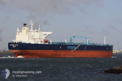
MINERVA SOPHIA
Tanker
Current Trip
| Time Travelled | 1 day |
|---|---|
| Remaining Time | --- |
| Distance Travelled | 132.60 nm |
| Remaining Distance | --- |
| AVG Speed | 9.9 Knots |
| MAX Speed | 13.3 Knots |
| AVG Wind | 17.7 knots |
| MAX Wind | 22.8 knots |
| MIN Temp | 16.9°C / 62.42°F |
| MAX Temp | 27.3°C / 81.14°F |
| Draught | 11.9 m |
| Position Received | Now |
Current Position
| Longitude | 26.55561° |
|---|---|
| Latitude | 40.29022° |
| Status | Under way using engine |
| Speed | 13.3 Knots |
| Course | 231° |
| Area | Sea of Marmara |
| Station | T-AIS |
| Position Received | Now |
Info
Information
The current position of MINERVA SOPHIA is in Sea of Marmara with coordinates 40.29022° / 26.55561° as reported on 2024-06-23 03:17 by AIS to our vessel tracker app. The vessel's current speed is 13.3 Knots and is heading at the port of ALIAGA. The estimated time of arrival as calculated by vessel tracking app is 2024-06-23 04:00 LT
The vessel MINERVA SOPHIA (IMO: 9382762, MMSI: 215466000) is a Tanker It's sailing under the flag of [MT] Malta.
In this page you can find informations about the vessels current position, last detected port calls, and current voyage information. If the vessels is not in coverage by AIS you will find the latest position.
The current position of MINERVA SOPHIA is detected by our AIS receivers and we are not responsible for the reliability of the data. The last position was recorded while the vessel was in Coverage by the Ais receivers of our vessel tracking app.
The current draught of MINERVA SOPHIA as reported by AIS is 11.9 meters
Weather
| Temperature | 19.1°C / 66.38°F |
|---|---|
| Wind Speed | 13 knots |
| Direction | 61° ENE |
| Pressure | 1008 hPa |
| Humidity | 77.4 % |
| Cloud Coverage | --- |
Featured Company
Last Port Calls
| Port | Arrival | Departure | Time In Port |
|---|---|---|---|
| 2024-06-21 13:00 | 2024-06-21 14:08 | 1 h | |
| 2024-06-13 03:39 | 2024-06-13 04:59 | 1 h | |
| 2024-06-02 05:20 | 2024-06-04 08:58 | 2 d | |
| 2024-05-20 04:57 | 2024-05-20 06:12 | 1 h | |
| 2024-05-11 03:20 | 2024-05-11 04:51 | 1 h | |
| 2024-05-03 13:48 | 2024-05-04 16:36 | 1 d | |
| 2024-04-22 08:50 | 2024-04-22 10:07 | 1 h | |
| 2024-04-02 05:55 | 2024-04-04 09:27 | 2 d |
Last Trips
| Origin | Departure | Destination | Arrival | Distance | |
|---|---|---|---|---|---|
| 2024-06-13 07:59 | 2024-06-21 16:00 | 985.19 nm | |||
| 2024-06-04 10:58 | 2024-06-13 06:39 | 1763.78 nm | |||
| 2024-05-20 09:12 | 2024-06-02 07:20 | 1447.64 nm | |||
| 2024-05-11 07:51 | 2024-05-20 07:57 | 1022.52 nm | |||
| 2024-05-04 18:36 | 2024-05-11 06:20 | 1263.60 nm | |||
| 2024-04-22 13:07 | 2024-05-03 15:48 | 1235.74 nm | |||
| 2024-04-04 11:27 | 2024-04-22 11:50 | 2428.32 nm | |||
| 2024-03-12 16:22 | 2024-04-02 07:55 | 2063.44 nm |
Events
| Time | Event | Details | Position / Dest | Info |
|---|---|---|---|---|
| 2024-06-23 03:04 | Status Changed | Under way using engine Default |
40.32173 / 26.60332
TR ALI
|
Speed: 12.9 kn Course: 216° |
| 2024-06-23 03:04 | IN Coverage |
40.31923 / 26.59978
Sea of Marmara
TR ALI
|
Speed: 13.2 kn Course: 226.9° |
|
| 2024-06-23 01:12 | START Moving | 7.42 nm, North East of CARDAK |
40.44120 / 26.85177
TR ALI
|
Speed: 5.2 kn Course: 302° |
| 2024-06-22 13:57 | STOP Moving | 7.45 nm, North East of CARDAK |
40.43219 / 26.85850
TR ALI
|
Speed: 0.1 kn Course: 96° |
| 2024-06-22 11:01 | Status Changed | Default Under way using engine |
40.54539 / 27.05397
TR ALI
|
Speed: 7.3 kn Course: 245.7° |
| 2024-06-22 10:59 | OUT of Coverage |
40.54712 / 27.05891
Sea of Marmara
TR ALI
|
Speed: 7.3 kn Course: 245.7° |
|
| 2024-06-22 10:24 | START Moving | 3.93 nm, North of ICDAS |
40.51878 / 27.14647
TR ALI
|
Speed: 5.5 kn Course: 316.6° |
| 2024-06-22 10:16 | Status Changed | Under way using engine Default |
40.51125 / 27.15104
TR ALI
|
Speed: 1.5 kn Course: 30° |
| 2024-06-22 10:10 | IN Coverage |
40.51125 / 27.15104
Sea of Marmara
TR ALI
|
Speed: 2.9 kn Course: 0.8° |
|
| 2024-06-21 23:13 | OUT of Coverage |
40.50463 / 27.14777
Sea of Marmara
TR ALI
|
Speed: Course: 79.6° |