
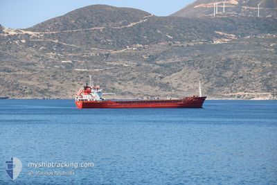
MIRA AKAY
General Cargo
Current Trip
| Time Travelled | 1 day |
|---|---|
| Remaining Time | --- |
| Distance Travelled | 202.36 nm |
| Remaining Distance | --- |
| AVG Speed | 11.3 Knots |
| MAX Speed | 13.8 Knots |
| AVG Wind | 4.7 knots |
| MAX Wind | 9.9 knots |
| MIN Temp | 17.4°C / 63.32°F |
| MAX Temp | 24.7°C / 76.46°F |
| Draught | 8.4 m |
| Position Received | 5 h, 24 m ago |
Current Position
| Longitude | 27.06685° |
|---|---|
| Latitude | 40.55355° |
| Status | Under way using engine |
| Speed | 11 Knots |
| Course | 243° |
| Area | Sea of Marmara |
| Station | T-AIS |
| Position Received | 5 h, 24 m ago |
Info
Information
The current position of MIRA AKAY is in Sea of Marmara with coordinates 40.55355° / 27.06685° as reported on 2024-06-01 01:14 by AIS to our vessel tracker app. The vessel's current speed is 11 Knots and is heading at the port of ALMERIA. The estimated time of arrival as calculated by vessel tracking app is 2024-06-07 02:00 LT
The vessel MIRA AKAY (IMO: 9045663, MMSI: 271000766) is a General Cargo that was built in 2004 ( 20 years old ). It's sailing under the flag of [TR] Turkey.
In this page you can find informations about the vessels current position, last detected port calls, and current voyage information. If the vessels is not in coverage by AIS you will find the latest position.
The current position of MIRA AKAY is detected by our AIS receivers and we are not responsible for the reliability of the data. The last position was recorded while the vessel was in Coverage by the Ais receivers of our vessel tracking app.
The current draught of MIRA AKAY as reported by AIS is 8.4 meters
Weather
| Temperature | 21.9°C / 71.42°F |
|---|---|
| Wind Speed | 2 knots |
| Direction | 189° S |
| Pressure | 1017.3 hPa |
| Humidity | 61.2 % |
| Cloud Coverage | 19 % |
Featured Company
Last Port Calls
| Port | Arrival | Departure | Time In Port |
|---|---|---|---|
| 2024-05-29 16:44 | 2024-05-31 06:04 | 1 d | |
| 2024-05-21 10:30 | 2024-05-25 06:05 | 3 d | |
| 2024-05-17 05:31 | 2024-05-17 13:37 | 8 h | |
| 2024-05-11 02:03 | 2024-05-12 10:28 | 1 d | |
| 2024-05-06 17:25 | 2024-05-09 09:33 | 2 d | |
| 2024-04-25 23:45 | 2024-04-28 11:36 | 2 d | |
| 2024-04-22 20:31 | 2024-04-25 11:28 | 2 d | |
| 2024-04-08 17:43 | 2024-04-15 21:59 | 7 d | |
| 2024-04-01 10:29 | 2024-04-03 22:45 | 2 d |
Last Trips
| Origin | Departure | Destination | Arrival | Distance | |
|---|---|---|---|---|---|
| 2024-05-25 09:05 | 2024-05-29 19:44 | 205.70 nm | |||
| 2024-05-17 16:37 | 2024-05-21 13:30 | 247.41 nm | |||
| 2024-05-12 12:28 | 2024-05-17 08:31 | 1228.58 nm | |||
| 2024-05-09 11:33 | 2024-05-11 04:03 | 513.24 nm | |||
| 2024-04-28 14:36 | 2024-05-06 19:25 | 1432.82 nm | |||
| 2024-04-25 14:28 | 2024-04-26 02:45 | 150.94 nm | |||
| 2024-04-16 01:59 | 2024-04-22 23:31 | 869.07 nm | |||
| 2024-04-04 01:45 | 2024-04-08 21:43 | 633.61 nm | |||
| 2024-03-30 08:53 | 2024-04-01 13:29 | 599.42 nm |
Events
| Time | Event | Details | Position / Dest | Info |
|---|---|---|---|---|
| 2024-06-01 02:53 | STOP Moving | 5.82 nm, North East of CARDAK |
40.46558 / 26.77006
ALMERIA
|
Speed: 0.3 kn Course: 160° |
| 2024-06-01 01:22 | Status Changed | Default Under way using engine |
40.54245 / 27.03687
ALMERIA
|
Speed: 11 kn Course: 243° |
| 2024-06-01 01:14 | OUT of Coverage |
40.55355 / 27.06685
Sea of Marmara
ALMERIA
|
Speed: 11 kn Course: 243° |
|
| 2024-06-01 00:41 | Status Changed | Under way using engine Default |
40.59958 / 27.19005
ALMERIA
|
Speed: 11.2 kn Course: 242° |
| 2024-06-01 00:29 | Status Changed | Default Under way using engine |
40.61587 / 27.23127
ALMERIA
|
Speed: 11.2 kn Course: 242° |
| 2024-05-31 20:53 | Status Changed | Under way using engine Default |
40.82742 / 28.06493
ALMERIA
|
Speed: 10.9 kn Course: 262° |
| 2024-05-31 20:31 | Status Changed | Default Under way using engine |
40.83665 / 28.15288
ALMERIA
|
Speed: 11 kn Course: 261° |
| 2024-05-31 20:16 | Status Changed | Under way using engine Default |
40.84477 / 28.20953
ALMERIA
|
Speed: 11 kn Course: 259° |
| 2024-05-31 20:07 | Status Changed | Default Under way using engine |
40.85075 / 28.24585
ALMERIA
|
Speed: 11.1 kn Course: 261° |
| 2024-05-31 15:25 | Change Sea Area | Turkish part of the Sea of Marmara Turkish part of the Black Sea |
41.22928 / 29.12988
Sea of Marmara
ALMERIA
|
Speed: 9.8 kn Course: 197° |