
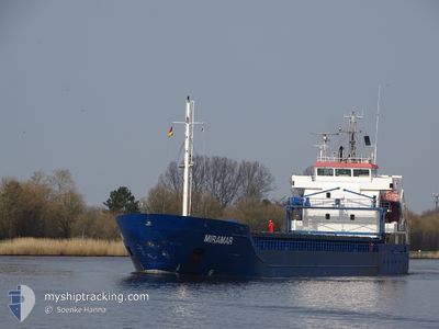
MIRAMAR
General Cargo
Current Trip
| Time Travelled | 1 day |
|---|---|
| Remaining Time | 23 h, 51 mins |
| Distance Travelled | 425.90 nm |
| Remaining Distance | 269.13 nm |
| AVG Speed | 11 Knots |
| MAX Speed | 11.9 Knots |
| AVG Wind | 10.4 knots |
| MAX Wind | 19.9 knots |
| MIN Temp | 8.2°C / 46.76°F |
| MAX Temp | 13.8°C / 56.84°F |
| Draught | 5.9 m |
| Position Received | 1 m ago |
Current Position
| Longitude | 19.86435° |
|---|---|
| Latitude | 58.75259° |
| Status | Under way using engine |
| Speed | 11.1 Knots |
| Course | 186° |
| Area | Baltic Sea |
| Station | T-AIS |
| Position Received | 1 m ago |
Info
Information
The current position of MIRAMAR is in Baltic Sea with coordinates 58.75259° / 19.86435° as reported on 2024-06-16 13:57 by AIS to our vessel tracker app. The vessel's current speed is 11.1 Knots and is heading at the port of GDYNIA. The estimated time of arrival as calculated by vessel tracking app is 2024-06-17 13:49 LT
The vessel MIRAMAR (IMO: 9552044, MMSI: 212584000) is a General Cargo that was built in 2011 ( 13 years old ). It's sailing under the flag of [CY] Cyprus.
In this page you can find informations about the vessels current position, last detected port calls, and current voyage information. If the vessels is not in coverage by AIS you will find the latest position.
The current position of MIRAMAR is detected by our AIS receivers and we are not responsible for the reliability of the data. The last position was recorded while the vessel was in Coverage by the Ais receivers of our vessel tracking app.
The current draught of MIRAMAR as reported by AIS is 5.9 meters
Weather
| Temperature | 13.7°C / 56.66°F |
|---|---|
| Wind Speed | 7 knots |
| Direction | 187° S |
| Pressure | 1013.1 hPa |
| Humidity | 87.5 % |
| Cloud Coverage | 100 % |
Featured Company
Last Port Calls
| Port | Arrival | Departure | Time In Port |
|---|---|---|---|
| 2024-06-13 13:05 | 2024-06-14 23:15 | 1 d | |
| 2024-06-11 17:19 | 2024-06-11 18:05 | 45 m | |
| 2024-06-06 14:45 | 2024-06-11 12:09 | 4 d | |
| 2024-06-06 09:45 | 2024-06-06 10:06 | 21 m | |
| 2024-06-03 16:55 | 2024-06-03 16:58 | 2 m | |
| 2024-05-30 16:24 | 2024-05-31 22:56 | 1 d | |
| 2024-05-28 08:21 | 2024-05-29 19:10 | 1 d | |
| 2024-05-26 19:41 | 2024-05-26 20:28 | 47 m | |
| 2024-05-21 13:40 | 2024-05-23 12:27 | 1 d | |
| 2024-05-19 06:53 | 2024-05-20 20:04 | 1 d |
Last Trips
| Origin | Departure | Destination | Arrival | Distance | |
|---|---|---|---|---|---|
| 2024-06-11 20:05 | 2024-06-13 16:05 | 504.57 nm | |||
| 2024-06-11 14:09 | 2024-06-11 19:19 | 48.70 nm | |||
| 2024-06-06 12:06 | 2024-06-06 16:45 | 48.67 nm | |||
| 2024-06-03 18:58 | 2024-06-06 11:45 | 468.58 nm | |||
| 2024-05-31 23:56 | 2024-06-03 18:55 | 447.60 nm | |||
| 2024-05-29 21:10 | 2024-05-30 17:24 | 173.91 nm | |||
| 2024-05-26 22:28 | 2024-05-28 10:21 | 341.39 nm | |||
| 2024-05-23 15:27 | 2024-05-26 21:41 | 849.55 nm | |||
| 2024-05-20 23:04 | 2024-05-21 16:40 | 185.06 nm | |||
| 2024-05-16 14:52 | 2024-05-19 09:53 | 642.71 nm |
Events
| Time | Event | Details | Position / Dest | Info |
|---|---|---|---|---|
| 2024-06-16 13:12 | Status Changed | Under way using engine Default |
58.89190 / 19.89591
PLGDY
|
Speed: 11.1 kn Course: 188° |
| 2024-06-16 12:29 | Status Changed | Default Under way using engine |
59.02081 / 19.92754
PLGDY
|
Speed: 11.1 kn Course: 186.3° |
| 2024-06-16 12:21 | Status Changed | Under way using engine Default |
59.04763 / 19.93376
PLGDY
|
Speed: 11 kn Course: 186° |
| 2024-06-16 11:29 | Status Changed | Default Under way using engine |
59.20341 / 19.97228
PLGDY
|
Speed: 11.1 kn Course: 186.9° |
| 2024-06-16 11:22 | Status Changed | Under way using engine Default |
59.22680 / 19.97823
PLGDY
|
Speed: 11.2 kn Course: 186° |
| 2024-06-16 11:05 | IN Coverage |
59.22680 / 19.97823
Baltic Sea
PLGDY
|
Speed: 11.2 kn Course: 187.6° |
|
| 2024-06-16 09:57 | Status Changed | Default Under way using engine |
59.48703 / 20.04462
PLGDY
|
Speed: 11.3 kn Course: 181.9° |
| 2024-06-16 09:50 | Change Sea Area | Swedish part of the Baltic Sea Finnish part of the Baltic Sea |
59.51123 / 20.04983
Baltic Sea
PLGDY
|
Speed: 11.3 kn Course: 181.9° |
| 2024-06-16 09:50 | OUT of Coverage |
59.51123 / 20.04983
Baltic Sea
PLGDY
|
Speed: 11.3 kn Course: 181.9° |
|
| 2024-06-16 09:47 | Status Changed | Under way using engine Default |
59.51964 / 20.05026
PLGDY
|
Speed: 11.3 kn Course: 181° |