
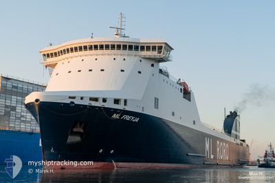
ML FREYJA
Cargo
Current Trip
| Time Travelled | 1 day |
|---|---|
| Remaining Time | 5 h, 37 mins |
| Distance Travelled | 324.61 nm |
| Remaining Distance | 102.50 nm |
| AVG Speed | 12.6 Knots |
| MAX Speed | 18.8 Knots |
| AVG Wind | 19.4 knots |
| MAX Wind | 25 knots |
| MIN Temp | 10.6°C / 51.08°F |
| MAX Temp | 15.7°C / 60.26°F |
| Draught | 6.5 m |
| Position Received | 3 m ago |
Current Position
| Longitude | 6.04864° |
|---|---|
| Latitude | 53.68601° |
| Status | Under way using engine |
| Speed | 17.5 Knots |
| Course | 74.4° |
| Area | North Sea |
| Station | T-AIS |
| Position Received | 3 m ago |
Info
Information
The current position of ML FREYJA is in North Sea with coordinates 53.68601° / 6.04864° as reported on 2024-06-02 00:41 by AIS to our vessel tracker app. The vessel's current speed is 17.5 Knots and is heading at the port of CUXHAVEN. The estimated time of arrival as calculated by vessel tracking app is 2024-06-02 06:22 LT
The vessel ML FREYJA (IMO: 9799977, MMSI: 247386800) is a Cargo It's sailing under the flag of [IT] Italy.
In this page you can find informations about the vessels current position, last detected port calls, and current voyage information. If the vessels is not in coverage by AIS you will find the latest position.
The current position of ML FREYJA is detected by our AIS receivers and we are not responsible for the reliability of the data. The last position was recorded while the vessel was in Coverage by the Ais receivers of our vessel tracking app.
The current draught of ML FREYJA as reported by AIS is 6.5 meters
Weather
| Temperature | 13.7°C / 56.66°F |
|---|---|
| Wind Speed | 22 knots |
| Direction | 353° N |
| Pressure | 1021 hPa |
| Humidity | 83 % |
| Cloud Coverage | 40 % |
Featured Company
Last Port Calls
| Port | Arrival | Departure | Time In Port |
|---|---|---|---|
| 2024-05-31 18:44 | 2024-05-31 19:28 | 43 m | |
| 2024-05-31 08:42 | 2024-05-31 18:44 | 10 h | |
| 2024-05-31 07:50 | 2024-05-31 08:33 | 43 m | |
| 2024-05-30 02:29 | 2024-05-30 15:47 | 13 h | |
| 2024-05-27 02:50 | 2024-05-27 14:09 | 11 h | |
| 2024-05-26 04:21 | 2024-05-26 14:18 | 9 h | |
| 2024-05-23 04:46 | 2024-05-23 11:26 | 6 h | |
| 2024-05-22 04:35 | 2024-05-22 11:48 | 7 h | |
| 2024-05-22 03:45 | 2024-05-22 04:27 | 42 m | |
| 2024-05-19 23:01 | 2024-05-20 17:03 | 18 h |
Last Trips
| Origin | Departure | Destination | Arrival | Distance | |
|---|---|---|---|---|---|
| 2024-05-31 10:33 | 2024-05-31 20:44 | 1.91 nm | |||
| 2024-05-31 10:33 | 2024-05-31 10:42 | 0.40 nm | |||
| 2024-05-30 17:47 | 2024-05-31 09:50 | 261.27 nm | |||
| 2024-05-27 17:09 | 2024-05-30 04:29 | 983.64 nm | |||
| 2024-05-26 17:18 | 2024-05-27 05:50 | 156.57 nm | |||
| 2024-05-23 13:26 | 2024-05-26 07:21 | 977.46 nm | |||
| 2024-05-22 13:48 | 2024-05-23 06:46 | 254.48 nm | |||
| 2024-05-22 06:27 | 2024-05-22 06:35 | 0.41 nm | |||
| 2024-05-20 19:03 | 2024-05-22 05:45 | 430.26 nm | |||
| 2024-05-17 23:12 | 2024-05-20 01:01 | 727.39 nm |
Events
| Time | Event | Details | Position / Dest | Info |
|---|---|---|---|---|
| 2024-06-01 20:20 | Status Changed | Under way using engine Default |
53.08839 / 4.42253
DECUX
|
Speed: 15.5 kn Course: 26° |
| 2024-06-01 20:10 | Status Changed | Default Under way using engine |
53.05125 / 4.39349
DECUX
|
Speed: 15.5 kn Course: 25.5° |
| 2024-06-01 18:43 | Status Changed | Under way using engine Default |
52.73243 / 4.08327
DECUX
|
Speed: 15 kn Course: 54° |
| 2024-06-01 18:23 | Status Changed | Default Under way using engine |
52.68439 / 3.97468
DECUX
|
Speed: 16.1 kn Course: 59.9° |
| 2024-06-01 18:10 | Status Changed | Under way using engine Default |
52.65349 / 3.89048
DECUX
|
Speed: 16 kn Course: 59° |
| 2024-06-01 18:10 | IN Coverage |
52.65993 / 3.90676
North Sea
DECUX
|
Speed: 16.2 kn Course: 56.5° |
|
| 2024-06-01 17:10 | Status Changed | Default Under way using engine |
52.50677 / 3.52081
DECUX
|
Speed: 16.1 kn Course: 57.4° |
| 2024-06-01 17:06 | Status Changed | Under way using engine Default |
52.49761 / 3.49729
DECUX
|
Speed: 16.2 kn Course: 56° |
| 2024-06-01 17:06 | OUT of Coverage |
52.49761 / 3.49729
North Sea
DECUX
|
Speed: 16.1 kn Course: 57.4° |
|
| 2024-06-01 16:54 | Status Changed | Default Under way using engine |
52.46772 / 3.41965
DECUX
|
Speed: 16 kn Course: 57.5° |