
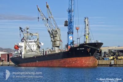
MNTALOS
General Cargo
Current Trip
BG BOJ
| Time Travelled | 1 h, 26 mins |
|---|---|
| Remaining Time | --- |
| Distance Travelled | 3.24 nm |
| Remaining Distance | --- |
| AVG Speed | 9.5 Knots |
| MAX Speed | 9.5 Knots |
| AVG Wind | 7.7 knots |
| MAX Wind | 7.9 knots |
| MIN Temp | 21.3°C / 70.34°F |
| MAX Temp | 21.5°C / 70.7°F |
| Draught | 4.2 m |
| Position Received | 2 d ago |
Current Position
| Longitude | 29.11385° |
|---|---|
| Latitude | 41.45112° |
| Status | Under way using engine |
| Speed | 10.7 Knots |
| Course | 322° |
| Area | Black Sea |
| Station | T-AIS |
| Position Received | 2 d ago |
Info
Information
The current position of MNTALOS is in Black Sea with coordinates 41.45112° / 29.11385° as reported on 2024-06-26 07:01 by AIS to our vessel tracker app. The vessel's current speed is 10.7 Knots
The vessel MNTALOS (IMO: 9182411, MMSI: 314585000) is a General Cargo that was built in 1998 ( 26 years old ). It's sailing under the flag of [BB] Barbados.
In this page you can find informations about the vessels current position, last detected port calls, and current voyage information. If the vessels is not in coverage by AIS you will find the latest position.
The current position of MNTALOS is detected by our AIS receivers and we are not responsible for the reliability of the data. The last position was recorded while the vessel was in Coverage by the Ais receivers of our vessel tracking app.
The current draught of MNTALOS as reported by AIS is 4.2 meters
Weather
| Temperature | 24°C / 75.2°F |
|---|---|
| Wind Speed | 12 knots |
| Direction | 36° NE |
| Pressure | 1014.1 hPa |
| Humidity | 76.1 % |
| Cloud Coverage | 3 % |
Featured Company
Last Port Calls
| Port | Arrival | Departure | Time In Port |
|---|---|---|---|
| 2024-06-26 16:25 | 2024-06-28 20:17 | 2 d | |
| 2024-05-26 15:02 | 2024-06-02 06:25 | 6 d | |
| 2024-04-20 06:02 | 2024-05-18 15:06 | 28 d | |
| 2024-04-18 03:10 | 2024-04-18 04:30 | 1 h | |
| 2024-04-08 20:32 | 2024-04-11 15:13 | 2 d | |
| 2024-04-01 09:34 | 2024-04-03 03:50 | 1 d |
Last Trips
| Origin | Departure | Destination | Arrival | Distance | |
|---|---|---|---|---|---|
| 2024-06-02 09:25 | 2024-06-26 19:25 | 231.98 nm | |||
| 2024-05-18 18:06 | 2024-05-26 18:02 | 38.22 nm | |||
| 2024-04-18 07:30 | 2024-04-20 09:02 | 40.96 nm | |||
| 2024-04-11 18:13 | 2024-04-18 06:10 | 1196.58 nm | |||
| 2024-04-03 06:50 | 2024-04-08 23:32 | 362.56 nm | |||
| 2024-03-28 19:51 | 2024-04-01 12:34 | 87.55 nm |
Events
| Time | Event | Details | Position / Dest | Info |
|---|---|---|---|---|
| 2024-06-28 20:17 | PORT DEPARTURE |
|
42.47603 / 27.52893
BG BOJ
|
Speed: 9.7 kn Course: 81° |
| 2024-06-28 19:45 | START Moving |
42.48421 / 27.45687
[BG] BURGAS
|
Speed: 3.8 kn Course: 206° |
|
| 2024-06-27 13:45 | STOP Moving |
42.48808 / 27.45848
[BG] BURGAS
|
Speed: Course: 127° |
|
| 2024-06-27 12:58 | START Moving |
42.46622 / 27.49618
[BG] BURGAS
|
Speed: 5.7 kn Course: 290° |
|
| 2024-06-26 16:35 | STOP Moving |
42.46352 / 27.50433
[BG] BURGAS
|
Speed: 0.3 kn Course: 262° |
|
| 2024-06-26 16:25 | PORT ARRIVAL |
|
42.46598 / 27.51683
[BG] BURGAS
|
Speed: 7.7 kn Course: 232° |
| 2024-06-26 07:05 | Status Changed | Default Under way using engine |
41.45963 / 29.10508
BG BOJ
|
Speed: 10.7 kn Course: 322° |
| 2024-06-26 07:01 | OUT of Coverage |
41.45112 / 29.11385
Black Sea
BG BOJ
|
Speed: 10.7 kn Course: 322° |
|
| 2024-06-26 05:34 | Change Sea Area | Turkish part of the Black Sea Turkish part of the Sea of Marmara |
41.23885 / 29.15153
Black Sea
BG BOJ
|
Speed: 10.3 kn Course: 32° |
| 2024-06-26 01:27 | ETA Changed | 2024/06/26 20:00 2024/06/26 18:00 |
40.74513 / 28.93078
BG BOJ
|
Speed: 5.4 kn Course: 30° |