
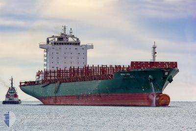
MONA LISA
Container Ship
Current Trip
| Time Travelled | 6 days |
|---|---|
| Remaining Time | 3 days |
| Distance Travelled | 4.11 nm |
| Remaining Distance | 2896.63 nm |
| AVG Speed | 12 Knots |
| MAX Speed | 12.3 Knots |
| AVG Wind | 1.7 knots |
| MAX Wind | 1.8 knots |
| MIN Temp | 14.7°C / 58.46°F |
| MAX Temp | 15.1°C / 59.18°F |
| Draught | 11 m |
| Position Received | 6 d ago |
Current Position
| Longitude | -8.82103° |
|---|---|
| Latitude | 42.23300° |
| Status | Moored |
| Speed | 12.8 Knots |
| Course | 274.2° |
| Area | North Atlantic Ocean |
| Station | T-AIS |
| Position Received | 6 d ago |
Info
Information
The current position of MONA LISA is in North Atlantic Ocean with coordinates 42.23300° / -8.82103° as reported on 2024-05-11 07:10 by AIS to our vessel tracker app. The vessel's current speed is 12.8 Knots and is heading at the port of MONTREAL. The estimated time of arrival as calculated by vessel tracking app is 2024-05-21 08:50 LT
The vessel MONA LISA (IMO: 9309277, MMSI: 636016852) is a Container Ship that was built in 2006 ( 18 years old ). It's sailing under the flag of [LR] Liberia.
In this page you can find informations about the vessels current position, last detected port calls, and current voyage information. If the vessels is not in coverage by AIS you will find the latest position.
The current position of MONA LISA is detected by our AIS receivers and we are not responsible for the reliability of the data. The last position was recorded while the vessel was in Coverage by the Ais receivers of our vessel tracking app.
The current draught of MONA LISA as reported by AIS is 11 meters
Weather
| Temperature | 13.5°C / 56.3°F |
|---|---|
| Wind Speed | 24 knots |
| Direction | 305° NW |
| Pressure | 1017 hPa |
| Humidity | 81.2 % |
| Cloud Coverage | 91 % |
Featured Company
Last Port Calls
| Port | Arrival | Departure | Time In Port |
|---|---|---|---|
| 2024-05-10 22:39 | 2024-05-11 06:42 | 8 h | |
| 2024-05-08 04:20 | 2024-05-08 16:09 | 11 h | |
| 2024-05-07 00:37 | |||
| 2024-05-05 00:52 | 2024-05-05 14:11 | 13 h | |
| 2024-04-30 22:38 | 2024-05-02 23:15 | 2 d | |
| 2024-04-29 03:44 | 2024-04-30 15:45 | 1 d | |
| 2024-04-25 00:37 | 2024-04-26 02:56 | 1 d | |
| 2024-04-22 11:55 | 2024-04-22 22:25 | 10 h | |
| 2024-04-19 23:40 | 2024-04-21 00:34 | 1 d | |
| 2024-04-18 03:33 | 2024-04-19 02:38 | 23 h |
Most Visited Ports (Last year)
| Port | Arrivals | |
|---|---|---|
| 10 | ||
| 7 | ||
| 7 | ||
| 6 | ||
| 6 | ||
| 5 |
Last Trips
| Origin | Departure | Destination | Arrival | Distance | |
|---|---|---|---|---|---|
| 2024-05-08 18:09 | 2024-05-11 00:39 | 564.22 nm | |||
| 2024-05-07 02:37 | 2024-05-08 06:20 | 399.27 nm | |||
| 2024-05-03 01:15 | 2024-05-05 02:52 | 235.07 nm | |||
| 2024-04-30 17:45 | 2024-05-01 00:38 | 82.67 nm | |||
| 2024-04-26 04:56 | 2024-04-29 05:44 | 1440.58 nm | |||
| 2024-04-23 01:25 | 2024-04-25 02:37 | 586.40 nm | |||
| 2024-04-21 03:34 | 2024-04-22 14:55 | 205.27 nm | |||
| 2024-04-19 05:38 | 2024-04-20 02:40 | 303.37 nm | |||
| 2024-04-18 01:13 | 2024-04-18 06:33 | 60.82 nm | |||
| 2024-04-16 07:04 | 2024-04-17 09:52 | 363.79 nm |
Events
| Time | Event | Details | Position / Dest | Info |
|---|---|---|---|---|
| 2024-05-11 07:10 | OUT of Coverage |
42.23300 / -8.82103
North Atlantic Ocean
CAMTR
|
Speed: 12.8 kn Course: 274.2° |
|
| 2024-05-11 06:47 | Destination Changed | CAMTR VGO |
42.24776 / -8.73185
CAMTR
|
Speed: 8.9 kn Course: 251.9° |
| 2024-05-11 06:47 | ETA Changed | 2024/05/19 23:00 2024/05/10 22:00 |
42.24776 / -8.73185
CAMTR
|
Speed: 8.9 kn Course: 251.9° |
| 2024-05-11 06:42 | PORT DEPARTURE |
|
42.25052 / -8.72066
VGO
|
Speed: 5.2 kn Course: 253° |
| 2024-05-11 06:36 | Status Changed | Moored Default |
42.25061 / -8.71208
[ES] VIGO
|
Speed: Course: 2° |
| 2024-05-11 06:36 | START Moving |
42.25061 / -8.71208
[ES] VIGO
|
Speed: 3.2 kn Course: 301° |
|
| 2024-05-11 06:36 | IN Coverage |
42.25061 / -8.71208
North Atlantic Ocean
[ES] VIGO
|
Speed: 3.2 kn Course: 323.4° |
|
| 2024-05-10 22:39 | Status Changed | Default Under way using engine |
42.24847 / -8.71037
[ES] VIGO
|
Speed: 1.7 kn Course: 34° |
| 2024-05-10 22:39 | STOP Moving |
42.24847 / -8.71037
[ES] VIGO
|
Speed: 0.1 kn Course: 2° |
|
| 2024-05-10 22:28 | OUT of Coverage |
42.24821 / -8.71312
North Atlantic Ocean
[ES] VIGO
|
Speed: 1.7 kn Course: 69.8° |