
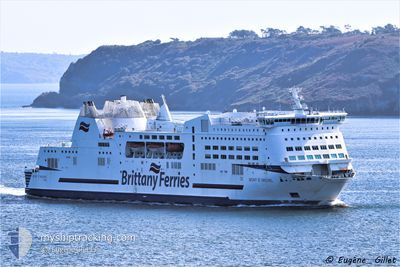
MONT SAINT MICHEL
Ro-Ro/Passenger Ship
Current Trip
| Time Travelled | 4 h, 51 mins |
|---|---|
| Remaining Time | 29 mins |
| Distance Travelled | 85.55 nm |
| Remaining Distance | 13.21 nm |
| AVG Speed | 17.7 Knots |
| MAX Speed | 20.3 Knots |
| AVG Wind | 15.2 knots |
| MAX Wind | 16 knots |
| MIN Temp | 12.9°C / 55.22°F |
| MAX Temp | 14.1°C / 57.38°F |
| Draught | 6 m |
| Position Received | 1 m ago |
Current Position
| Longitude | -0.31290° |
|---|---|
| Latitude | 49.44504° |
| Status | Under way using engine |
| Speed | 16.1 Knots |
| Course | 157.1° |
| Area | English Channel |
| Station | T-AIS |
| Position Received | 1 m ago |
Info
Information
The current position of MONT SAINT MICHEL is in English Channel with coordinates 49.44504° / -0.31290° as reported on 2024-05-27 19:07 by AIS to our vessel tracker app. The vessel's current speed is 16.1 Knots and is heading at the port of OUISTREHAM. The estimated time of arrival as calculated by vessel tracking app is 2024-05-27 19:37 LT
The vessel MONT SAINT MICHEL (IMO: 9238337, MMSI: 227023100) is a Ro-Ro/Passenger Ship that was built in 2002 ( 22 years old ). It's sailing under the flag of [FR] France.
In this page you can find informations about the vessels current position, last detected port calls, and current voyage information. If the vessels is not in coverage by AIS you will find the latest position.
The current position of MONT SAINT MICHEL is detected by our AIS receivers and we are not responsible for the reliability of the data. The last position was recorded while the vessel was in Coverage by the Ais receivers of our vessel tracking app.
The current draught of MONT SAINT MICHEL as reported by AIS is 6 meters
Weather
| Temperature | 14.1°C / 57.38°F |
|---|---|
| Wind Speed | 15 knots |
| Direction | 255° WSW |
| Pressure | 1018.2 hPa |
| Humidity | 76.1 % |
| Cloud Coverage | --- |
Featured Company
Last Port Calls
| Port | Arrival | Departure | Time In Port |
|---|---|---|---|
| 2024-05-27 12:07 | 2024-05-27 14:17 | 2 h | |
| 2024-05-27 04:29 | 2024-05-27 06:54 | 2 h | |
| 2024-05-26 20:11 | 2024-05-26 22:07 | 1 h | |
| 2024-05-26 12:39 | 2024-05-26 14:38 | 1 h | |
| 2024-05-26 05:03 | 2024-05-26 07:00 | 1 h | |
| 2024-05-25 19:41 | 2024-05-25 21:26 | 1 h | |
| 2024-05-25 12:08 | 2024-05-25 14:18 | 2 h | |
| 2024-05-25 04:30 | 2024-05-25 07:02 | 2 h | |
| 2024-05-24 20:11 | 2024-05-24 22:27 | 2 h | |
| 2024-05-24 12:40 | 2024-05-24 14:59 | 2 h |
Most Visited Ports (Last year)
| Port | Arrivals | |
|---|---|---|
| 505 | ||
| 496 | ||
| 8 | ||
| 1 |
Last Trips
| Origin | Departure | Destination | Arrival | Distance | |
|---|---|---|---|---|---|
| 2024-05-27 08:54 | 2024-05-27 13:07 | 96.46 nm | |||
| 2024-05-26 23:07 | 2024-05-27 06:29 | 96.61 nm | |||
| 2024-05-26 16:38 | 2024-05-26 21:11 | 99.48 nm | |||
| 2024-05-26 08:00 | 2024-05-26 14:39 | 99.10 nm | |||
| 2024-05-25 23:26 | 2024-05-26 06:03 | 100.70 nm | |||
| 2024-05-25 15:18 | 2024-05-25 21:41 | 96.55 nm | |||
| 2024-05-25 09:02 | 2024-05-25 13:08 | 95.44 nm | |||
| 2024-05-24 23:27 | 2024-05-25 06:30 | 99.04 nm | |||
| 2024-05-24 16:59 | 2024-05-24 21:11 | 96.89 nm | |||
| 2024-05-24 08:14 | 2024-05-24 14:40 | 99.13 nm |
Events
| Time | Event | Details | Position / Dest | Info |
|---|---|---|---|---|
| 2024-05-27 16:41 | Change Sea Area | French part of the English Channel United Kingdom part of the English Channel |
50.11633 / -.73515
English Channel
FR OUI
|
Speed: 19 kn Course: 157.1° |
| 2024-05-27 15:49 | Status Changed | Under way using engine Default |
50.36466 / -.91393
FR OUI
|
Speed: 19.7 kn Course: 155° |
| 2024-05-27 15:47 | Status Changed | Default Under way using engine |
50.37498 / -.92166
FR OUI
|
Speed: 19 kn Course: 155° |
| 2024-05-27 14:17 | PORT DEPARTURE |
|
50.78669 / -1.10826
FR OUI
|
Speed: 11.1 kn Course: 160° |
| 2024-05-27 14:06 | START Moving |
50.81127 / -1.10253
[GB] PORTSMOUTH
|
Speed: 6.6 kn Course: 261° |
|
| 2024-05-27 13:28 | Destination Changed | FR OUI GB PME |
50.81141 / -1.09711
[GB] PORTSMOUTH
|
Speed: Course: 259° |
| 2024-05-27 13:28 | ETA Changed | 2024/05/27 20:00 2024/05/27 12:30 |
50.81141 / -1.09711
[GB] PORTSMOUTH
|
Speed: Course: 259° |
| 2024-05-27 12:14 | STOP Moving |
50.81081 / -1.09952
[GB] PORTSMOUTH
|
Speed: 0.3 kn Course: 203° |
|
| 2024-05-27 12:07 | PORT ARRIVAL |
|
50.80845 / -1.11266
[GB] PORTSMOUTH
|
Speed: 7.5 kn Course: 41.4° |
| 2024-05-27 09:43 | Change Sea Area | United Kingdom part of the English Channel French part of the English Channel |
50.13035 / -.69188
English Channel
GB PME
|
Speed: 19.9 kn Course: 345.2° |