
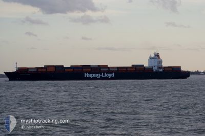
MONTREAL EXPRESS
Container Ship
Current Trip
| Time Travelled | 4 days |
|---|---|
| Remaining Time | --- |
| Distance Travelled | 1722.29 nm |
| Remaining Distance | --- |
| AVG Speed | 13.7 Knots |
| MAX Speed | 18.6 Knots |
| AVG Wind | 11.8 knots |
| MAX Wind | 24.4 knots |
| MIN Temp | 6.8°C / 44.24°F |
| MAX Temp | 12.6°C / 54.68°F |
| Draught | 10.6 m |
| Position Received | 3 d ago |
Current Position
| Longitude | -4.67711° |
|---|---|
| Latitude | 58.71939° |
| Status | Under way using engine |
| Speed | 12.8 Knots |
| Course | 270.4° |
| Area | North Atlantic Ocean |
| Station | T-AIS |
| Position Received | 3 d ago |
Info
Information
The current position of MONTREAL EXPRESS is in North Atlantic Ocean with coordinates 58.71939° / -4.67711° as reported on 2024-05-12 19:58 by AIS to our vessel tracker app. The vessel's current speed is 12.8 Knots and is heading at the port of MONTREAL. The estimated time of arrival as calculated by vessel tracking app is 2024-05-20 13:30 LT
The vessel MONTREAL EXPRESS (IMO: 9253741, MMSI: 310750000) is a Container Ship that was built in 2003 ( 21 years old ). It's sailing under the flag of [BM] Bermuda.
In this page you can find informations about the vessels current position, last detected port calls, and current voyage information. If the vessels is not in coverage by AIS you will find the latest position.
The current position of MONTREAL EXPRESS is detected by our AIS receivers and we are not responsible for the reliability of the data. The last position was recorded while the vessel was in Coverage by the Ais receivers of our vessel tracking app.
The current draught of MONTREAL EXPRESS as reported by AIS is 10.6 meters
Weather
| Temperature | 7.1°C / 44.78°F |
|---|---|
| Wind Speed | 12 knots |
| Direction | 288° WNW |
| Pressure | 1024.2 hPa |
| Humidity | 82.4 % |
| Cloud Coverage | 33 % |
Featured Company
Last Port Calls
| Port | Arrival | Departure | Time In Port |
|---|---|---|---|
| 2024-05-09 11:18 | 2024-05-10 22:52 | 1 d | |
| 2024-05-04 12:00 | 2024-05-05 14:12 | 1 d | |
| 2024-05-01 18:35 | 2024-05-02 08:33 | 13 h | |
| 2024-04-16 01:02 | 2024-04-19 11:53 | 3 d | |
| 2024-03-31 07:08 | 2024-04-01 20:44 | 1 d | |
| 2024-03-28 23:06 | 2024-03-29 20:58 | 21 h | |
| 2024-03-27 04:07 | 2024-03-27 20:06 | 15 h | |
| 2024-03-12 21:50 | 2024-03-16 11:26 | 3 d |
Most Visited Ports (Last year)
| Port | Arrivals | |
|---|---|---|
| 11 | ||
| 10 | ||
| 10 | ||
| 10 |
Last Trips
| Origin | Departure | Destination | Arrival | Distance | |
|---|---|---|---|---|---|
| 2024-05-05 16:12 | 2024-05-09 13:18 | 519.68 nm | |||
| 2024-05-02 09:33 | 2024-05-04 14:00 | 329.51 nm | |||
| 2024-04-19 07:53 | 2024-05-01 19:35 | 3107.12 nm | |||
| 2024-04-01 22:44 | 2024-04-15 21:02 | 4184.70 nm | |||
| 2024-03-29 21:58 | 2024-03-31 09:08 | 400.23 nm | |||
| 2024-03-27 20:06 | 2024-03-29 00:06 | 302.13 nm | |||
| 2024-03-16 07:26 | 2024-03-27 04:07 | 3105.27 nm | |||
| 2024-02-27 15:15 | 2024-03-12 17:50 | 4521.94 nm |
Events
| Time | Event | Details | Position / Dest | Info |
|---|---|---|---|---|
| 2024-05-12 20:03 | Status Changed | Default Under way using engine |
58.71954 / -4.71248
DEHAM>>>CAMTR
|
Speed: 12.8 kn Course: 270.4° |
| 2024-05-12 19:58 | OUT of Coverage |
58.71939 / -4.67711
North Atlantic Ocean
DEHAM>>>CAMTR
|
Speed: 12.8 kn Course: 270.4° |
|
| 2024-05-12 17:08 | Change Sea Area | United Kingdom part of the North Atlantic Ocean United Kingdom part of the North Sea |
58.72009 / -3.41588
North Atlantic Ocean
DEHAM>>>CAMTR
|
Speed: 15.8 kn Course: 267.9° |
| 2024-05-12 12:25 | ETA Changed | 2024/05/20 13:30 2024/05/20 15:00 |
58.11292 / -1.81957
DEHAM>>>CAMTR
|
Speed: 13.2 kn Course: 309.2° |
| 2024-05-11 20:24 | Status Changed | Under way using engine Default |
55.89890 / 3.07808
DEHAM>>>CAMTR
|
Speed: 13.5 kn Course: 306° |
| 2024-05-11 20:20 | Status Changed | Default Under way using engine |
55.89005 / 3.09944
DEHAM>>>CAMTR
|
Speed: 13.4 kn Course: 306.6° |
| 2024-05-11 19:30 | Change Sea Area | United Kingdom part of the North Sea German part of the North Sea |
55.78043 / 3.36578
North Sea
DEHAM>>>CAMTR
|
Speed: 13.5 kn Course: 305.9° |
| 2024-05-11 08:35 | Status Changed | Under way using engine Default |
54.45415 / 6.95031
DEHAM>>>CAMTR
|
Speed: 13.2 kn Course: 304° |
| 2024-05-11 08:33 | Status Changed | Default Under way using engine |
54.44952 / 6.96228
DEHAM>>>CAMTR
|
Speed: 13.1 kn Course: 303.6° |
| 2024-05-10 22:52 | PORT DEPARTURE |
|
53.54505 / 9.85554
DEHAM>>>CAMTR
|
Speed: 10.5 kn Course: 287° |