
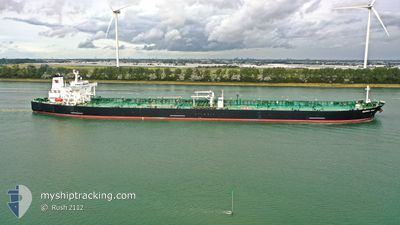
MONTREAL SPIRIT
Tanker
Current Trip
| Time Travelled | 59 days |
|---|---|
| Remaining Time | --- |
| Distance Travelled | 5384.54 nm |
| Remaining Distance | --- |
| AVG Speed | 10 Knots |
| MAX Speed | 15.5 Knots |
| AVG Wind | 11.6 knots |
| MAX Wind | 22.9 knots |
| MIN Temp | 18.6°C / 65.48°F |
| MAX Temp | 29.1°C / 84.38°F |
| Draught | 11.5 m |
| Position Received | 13 h, 54 m ago |
Current Position
| Longitude | -42.14738° |
|---|---|
| Latitude | -23.62368° |
| Status | Under way using engine |
| Speed | 1.3 Knots |
| Course | 286° |
| Area | South Atlantic Ocean |
| Station | T-AIS |
| Position Received | 13 h, 54 m ago |
Info
Information
The current position of MONTREAL SPIRIT is in South Atlantic Ocean with coordinates -23.62368° / -42.14738° as reported on 2024-05-19 17:05 by AIS to our vessel tracker app. The vessel's current speed is 1.3 Knots and is heading at the port of ANGRA DOS REIS. The estimated time of arrival as calculated by vessel tracking app is 2024-05-12 21:30 LT
The vessel MONTREAL SPIRIT (IMO: 9296389, MMSI: 311000454) is a Tanker It's sailing under the flag of [BS] Bahamas.
In this page you can find informations about the vessels current position, last detected port calls, and current voyage information. If the vessels is not in coverage by AIS you will find the latest position.
The current position of MONTREAL SPIRIT is detected by our AIS receivers and we are not responsible for the reliability of the data. The last position was recorded while the vessel was in Coverage by the Ais receivers of our vessel tracking app.
The current draught of MONTREAL SPIRIT as reported by AIS is 11.5 meters
Weather
| Temperature | 23.6°C / 74.48°F |
|---|---|
| Wind Speed | 8 knots |
| Direction | 17° NNE |
| Pressure | 1016.1 hPa |
| Humidity | 88.9 % |
| Cloud Coverage | --- |
Featured Company
Last Port Calls
| Port | Arrival | Departure | Time In Port |
|---|---|---|---|
| 2024-03-20 18:42 | 2024-03-22 05:13 | 1 d |
Last Trips
| Origin | Departure | Destination | Arrival | Distance | |
|---|---|---|---|---|---|
| 2024-02-05 19:53 | 2024-03-20 19:42 | 10478.41 nm |
Events
| Time | Event | Details | Position / Dest | Info |
|---|---|---|---|---|
| 2024-05-19 17:12 | Status Changed | Default Under way using engine |
-23.62167 / -42.14500
BRADR
|
Speed: 1.3 kn Course: 286° |
| 2024-05-19 17:05 | OUT of Coverage |
-23.62368 / -42.14738
South Atlantic Ocean
|
Speed: 1.3 kn Course: 43° |
|
| 2024-05-19 16:59 | Status Changed | Under way using engine Default |
-23.62512 / -42.14875
BRADR
|
Speed: 1.2 kn Course: 285° |
| 2024-05-19 16:46 | IN Coverage |
-23.62445 / -42.14812
South Atlantic Ocean
|
Speed: 1.1 kn Course: 43° |
|
| 2024-05-19 02:33 | STOP Moving |
-23.77333 / -42.19833
BRADR
|
Speed: Course: -1° |
|
| 2024-05-18 18:21 | START Moving | 19.09 nm, South of ARRAIAL DO CABO |
-23.27110 / -41.89290
BRADR
|
Speed: 4.6 kn Course: 201° |
| 2024-05-18 13:35 | Status Changed | Default Under way using engine |
-23.27920 / -41.98803
BRADR
|
Speed: 1.1 kn Course: 284° |
| 2024-05-18 13:31 | OUT of Coverage |
-23.27925 / -41.98942
South Atlantic Ocean
|
Speed: 1.1 kn Course: 97° |
|
| 2024-05-18 13:16 | Status Changed | Under way using engine Default |
-23.27975 / -41.99467
BRADR
|
Speed: 1 kn Course: -1° |
| 2024-05-18 12:57 | IN Coverage |
-23.27975 / -41.99467
South Atlantic Ocean
|
Speed: 1.1 kn Course: 92° |