
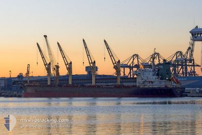
MOOKDA NAREE
Bulk Carrier
Current Trip
GO DAU
| Time Travelled | 4 days |
|---|---|
| Remaining Time | --- |
| Distance Travelled | 599.71 nm |
| Remaining Distance | --- |
| AVG Speed | 10.2 Knots |
| MAX Speed | 12.3 Knots |
| AVG Wind | 7.1 knots |
| MAX Wind | 12.9 knots |
| MIN Temp | 27.7°C / 81.86°F |
| MAX Temp | 30.6°C / 87.08°F |
| Draught | 5.7 m |
| Position Received | 1 d ago |
Current Position
| Longitude | 107.04403° |
|---|---|
| Latitude | 10.21266° |
| Status | At anchor |
| Speed | |
| Course | 311° |
| Area | South China Sea |
| Station | T-AIS |
| Position Received | 1 d ago |
Info
Information
The current position of MOOKDA NAREE is in South China Sea with coordinates 10.21266° / 107.04403° as reported on 2024-05-22 00:11 by AIS to our vessel tracker app. The vessel's current speed is 0 Knots
The vessel MOOKDA NAREE (IMO: 9354741, MMSI: 567097000) is a Bulk Carrier that was built in 2009 ( 15 years old ). It's sailing under the flag of [TH] Thailand.
In this page you can find informations about the vessels current position, last detected port calls, and current voyage information. If the vessels is not in coverage by AIS you will find the latest position.
The current position of MOOKDA NAREE is detected by our AIS receivers and we are not responsible for the reliability of the data. The last position was recorded while the vessel was in Coverage by the Ais receivers of our vessel tracking app.
The current draught of MOOKDA NAREE as reported by AIS is 5.7 meters
Weather
| Temperature | --- |
|---|---|
| Wind Speed | --- |
| Direction | --- |
| Pressure | --- |
| Humidity | --- |
| Cloud Coverage | --- |
Featured Company
Last Port Calls
| Port | Arrival | Departure | Time In Port |
|---|---|---|---|
| 2024-05-12 09:23 | 2024-05-18 20:36 | 6 d | |
| 2024-05-02 03:59 | 2024-05-03 16:19 | 1 d | |
| 2024-04-01 10:36 | 2024-04-04 10:23 | 2 d | |
| 2024-03-28 13:04 | 2024-03-30 12:44 | 1 d | |
| 2024-03-14 12:34 | 2024-03-18 04:52 | 3 d | |
| 2024-03-02 11:44 |
Most Visited Ports (Last year)
| Port | Arrivals | |
|---|---|---|
| 2 | ||
| 1 | ||
| 1 | ||
| 1 | ||
| 1 | ||
| 1 |
Last Trips
| Origin | Departure | Destination | Arrival | Distance | |
|---|---|---|---|---|---|
| 2024-05-04 00:19 | 2024-05-12 17:23 | 1776.46 nm | |||
| 2024-04-04 17:23 | 2024-05-02 11:59 | 3993.78 nm | |||
| 2024-03-30 19:44 | 2024-04-01 17:36 | 489.88 nm | |||
| 2024-03-18 12:52 | 2024-03-28 20:04 | 1731.42 nm | |||
| 2024-03-02 18:44 | 2024-03-14 20:34 | 2803.34 nm |
Events
| Time | Event | Details | Position / Dest | Info |
|---|---|---|---|---|
| 2024-05-22 00:21 | Status Changed | Default At anchor |
10.21260 / 107.04398
GO DAU
|
Speed: Course: 311° |
| 2024-05-22 00:11 | OUT of Coverage |
10.21266 / 107.04403
South China Sea
|
Speed: Course: 342.3° |
|
| 2024-05-21 23:50 | Status Changed | At anchor Default |
10.21264 / 107.04409
GO DAU
|
Speed: Course: 303° |
| 2024-05-21 23:15 | Status Changed | Default At anchor |
10.21279 / 107.04420
GO DAU
|
Speed: Course: 305° |
| 2024-05-21 22:27 | Status Changed | At anchor Default |
10.21293 / 107.04426
GO DAU
|
Speed: Course: 295° |
| 2024-05-21 21:44 | Status Changed | Default At anchor |
10.21297 / 107.04429
GO DAU
|
Speed: Course: 297° |
| 2024-05-21 21:37 | Status Changed | At anchor Default |
10.21298 / 107.04429
GO DAU
|
Speed: 0.1 kn Course: 295° |
| 2024-05-21 21:33 | Status Changed | Default At anchor |
10.21297 / 107.04430
GO DAU
|
Speed: Course: 297° |
| 2024-05-21 21:26 | Status Changed | At anchor Default |
10.21297 / 107.04431
GO DAU
|
Speed: Course: 297° |
| 2024-05-21 21:00 | Status Changed | Default At anchor |
10.21300 / 107.04434
GO DAU
|
Speed: Course: 300° |