
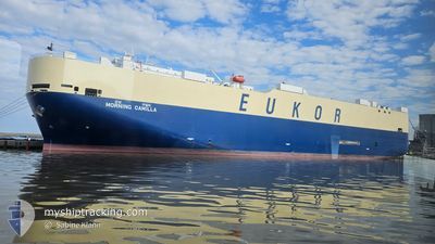
MORNING CAMILLA
Vehicles Carrier
Current Trip
| Time Travelled | 3 days |
|---|---|
| Remaining Time | 1 day |
| Distance Travelled | 1039.85 nm |
| Remaining Distance | 684.92 nm |
| AVG Speed | 12.8 Knots |
| MAX Speed | 15.2 Knots |
| AVG Wind | 8.6 knots |
| MAX Wind | 18.4 knots |
| MIN Temp | 24.2°C / 75.56°F |
| MAX Temp | 29.6°C / 85.28°F |
| Draught | 7.3 m |
| Position Received | 2 d ago |
Current Position
| Longitude | -78.44477° |
|---|---|
| Latitude | 29.86378° |
| Status | Under way using engine |
| Speed | 14.4 Knots |
| Course | 117° |
| Area | North Atlantic Ocean |
| Station | T-AIS |
| Position Received | 2 d ago |
Info
Information
The current position of MORNING CAMILLA is in North Atlantic Ocean with coordinates 29.86378° / -78.44477° as reported on 2024-06-09 14:06 by AIS to our vessel tracker app. The vessel's current speed is 14.4 Knots and is heading at the port of CRISTOBAL. The estimated time of arrival as calculated by vessel tracking app is 2024-06-13 22:57 LT
The vessel MORNING CAMILLA (IMO: 9477919, MMSI: 440104000) is a Vehicles Carrier that was built in 2009 ( 15 years old ). It's sailing under the flag of [KR] Korea.
In this page you can find informations about the vessels current position, last detected port calls, and current voyage information. If the vessels is not in coverage by AIS you will find the latest position.
The current position of MORNING CAMILLA is detected by our AIS receivers and we are not responsible for the reliability of the data. The last position was recorded while the vessel was in Coverage by the Ais receivers of our vessel tracking app.
The current draught of MORNING CAMILLA as reported by AIS is 7.3 meters
Weather
| Temperature | 28.6°C / 83.48°F |
|---|---|
| Wind Speed | 18 knots |
| Direction | 109° ESE |
| Pressure | 1013.9 hPa |
| Humidity | 85.1 % |
| Cloud Coverage | 45 % |
Featured Company
Last Port Calls
| Port | Arrival | Departure | Time In Port |
|---|---|---|---|
| 2024-06-08 08:16 | 2024-06-09 01:44 | 17 h | |
| 2024-06-05 13:00 | 2024-06-06 06:15 | 17 h | |
| 2024-06-02 15:06 | 2024-06-03 20:13 | 1 d | |
| 2024-05-25 06:37 | 2024-05-26 00:00 | 17 h | |
| 2024-05-20 19:28 | 2024-05-23 14:03 | 2 d | |
| 2024-05-17 20:18 | 2024-05-19 21:09 | 2 d | |
| 2024-05-15 20:22 | 2024-05-17 01:17 | 1 d | |
| 2024-05-08 09:02 | 2024-05-08 22:10 | 13 h | |
| 2024-05-04 15:46 | 2024-05-05 06:18 | 14 h | |
| 2024-05-03 04:44 | 2024-05-03 19:27 | 14 h |
Most Visited Ports (Last year)
| Port | Arrivals | |
|---|---|---|
| 1 | ||
| 1 | ||
| 1 | ||
| 1 | ||
| 1 | ||
| 1 |
Last Trips
| Origin | Departure | Destination | Arrival | Distance | |
|---|---|---|---|---|---|
| 2024-06-06 02:15 | 2024-06-08 04:16 | 774.81 nm | |||
| 2024-06-03 17:13 | 2024-06-05 09:00 | 593.88 nm | |||
| 2024-05-26 01:00 | 2024-06-02 12:06 | 2667.05 nm | |||
| 2024-05-23 16:03 | 2024-05-25 07:37 | 465.69 nm | |||
| 2024-05-19 23:09 | 2024-05-20 21:28 | 134.52 nm | |||
| 2024-05-17 03:17 | 2024-05-17 22:18 | 293.95 nm | |||
| 2024-05-08 22:10 | 2024-05-15 22:22 | 2664.94 nm | |||
| 2024-05-05 06:18 | 2024-05-08 09:02 | 1214.39 nm | |||
| 2024-05-03 19:27 | 2024-05-04 15:46 | 302.74 nm | |||
| 2024-04-30 02:11 | 2024-05-03 04:44 | 1229.99 nm |
Events
| Time | Event | Details | Position / Dest | Info |
|---|---|---|---|---|
| 2024-06-09 14:11 | Status Changed | Default Under way using engine |
29.85437 / -78.42384
USSSI>PA_CTB
|
Speed: 14.4 kn Course: 117° |
| 2024-06-09 14:06 | Status Changed | Under way using engine Default |
29.86378 / -78.44477
USSSI>PA_CTB
|
Speed: 14.4 kn Course: 117° |
| 2024-06-09 14:06 | OUT of Coverage |
29.86378 / -78.44477
North Atlantic Ocean
USSSI>PA_CTB
|
Speed: 14.4 kn Course: 117° |
|
| 2024-06-09 14:03 | IN Coverage |
29.86378 / -78.44477
North Atlantic Ocean
USSSI>PA_CTB
|
Speed: 14.4 kn Course: 117° |
|
| 2024-06-09 12:39 | Status Changed | Default Under way using engine |
30.02577 / -78.81113
USSSI>PA_CTB
|
Speed: 14.5 kn Course: 116° |
| 2024-06-09 12:34 | OUT of Coverage |
30.03430 / -78.83125
North Atlantic Ocean
USSSI>PA_CTB
|
Speed: 14.5 kn Course: 116° |
|
| 2024-06-09 11:23 | Status Changed | Under way using engine Default |
30.16560 / -79.12762
USSSI>PA_CTB
|
Speed: 14.8 kn Course: 118° |
| 2024-06-09 11:15 | Status Changed | Default Under way using engine |
30.18110 / -79.16082
USSSI>PA_CTB
|
Speed: 14.4 kn Course: 115° |
| 2024-06-09 11:03 | Status Changed | Under way using engine Default |
30.20128 / -79.20933
USSSI>PA_CTB
|
Speed: 14.6 kn Course: 113° |
| 2024-06-09 10:55 | Status Changed | Default Under way using engine |
30.21435 / -79.24381
USSSI>PA_CTB
|
Speed: 14.6 kn Course: 114° |