
MORNING CORNET
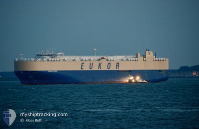
Vehicles Carrier
Current Trip
| Time Travelled | 2 days |
|---|---|
| Remaining Time | --- |
| Distance Travelled | 169.36 nm |
| Remaining Distance | 17.35 nm |
| AVG Speed | 12.4 Knots |
| MAX Speed | 17.3 Knots |
| AVG Wind | 9.2 knots |
| MAX Wind | 21 knots |
| MIN Temp | 6.5°C / 43.7°F |
| MAX Temp | 21.6°C / 70.88°F |
| Draught | 8.7 m |
| Position Received | 3 m ago |
Current Position
| Longitude | -122.51645° |
|---|---|
| Latitude | 47.53350° |
| Status | At anchor |
| Speed | 0.1 Knots |
| Course | 39° |
| Area | The Coastal Waters of Southeast Alaska and British Columbia |
| Station | T-AIS |
| Position Received | 3 m ago |
Info
Information
The current position of MORNING CORNET is in The Coastal Waters of Southeast Alaska and British Columbia with coordinates 47.53350° / -122.51645° as reported on 2024-06-06 22:06 by AIS to our vessel tracker app. The vessel's current speed is 0.1 Knots and is heading at the port of TACOMA. The estimated time of arrival as calculated by vessel tracking app is 2024-06-04 13:45 LT
The vessel MORNING CORNET (IMO: 9329473, MMSI: 636018238) is a Vehicles Carrier that was built in 2007 ( 17 years old ). It's sailing under the flag of [LR] Liberia.
In this page you can find informations about the vessels current position, last detected port calls, and current voyage information. If the vessels is not in coverage by AIS you will find the latest position.
The current position of MORNING CORNET is detected by our AIS receivers and we are not responsible for the reliability of the data. The last position was recorded while the vessel was in Coverage by the Ais receivers of our vessel tracking app.
The current draught of MORNING CORNET as reported by AIS is 8.7 meters
Weather
| Temperature | 21.6°C / 70.88°F |
|---|---|
| Wind Speed | 6 knots |
| Direction | 16° NNE |
| Pressure | 1018.5 hPa |
| Humidity | 35.6 % |
| Cloud Coverage | 36 % |
Featured Company
Last Port Calls
| Port | Arrival | Departure | Time In Port |
|---|---|---|---|
| 2024-06-03 21:55 | 2024-06-04 06:12 | 8 h | |
| 2024-05-20 06:32 | 2024-05-21 08:15 | 1 d | |
| 2024-05-17 09:05 | 2024-05-19 02:24 | 1 d | |
| 2024-05-14 02:50 | 2024-05-15 22:03 | 1 d | |
| 2024-04-27 22:22 | 2024-04-29 00:22 | 1 d |
Most Visited Ports (Last year)
| Port | Arrivals | |
|---|---|---|
| 4 | ||
| 3 | ||
| 3 | ||
| 2 | ||
| 2 | ||
| 2 |
Last Trips
| Origin | Departure | Destination | Arrival | Distance | |
|---|---|---|---|---|---|
| 2024-05-21 17:15 | 2024-06-03 14:55 | 5139.30 nm | |||
| 2024-05-19 11:24 | 2024-05-20 15:32 | 432.54 nm | |||
| 2024-05-16 07:03 | 2024-05-17 18:05 | 512.20 nm | |||
| 2024-04-28 17:22 | 2024-05-14 11:50 | 5712.80 nm | |||
| 2024-03-31 19:28 | 2024-04-27 15:22 | 5648.34 nm |
Events
| Time | Event | Details | Position / Dest | Info |
|---|---|---|---|---|
| 2024-06-06 14:36 | Draught Changed | 8.7 8 |
47.53404 / -122.51508
US TIW
|
Speed: Course: 92° |
| 2024-06-06 14:36 | ETA Changed | 2024/06/04 13:45 |
47.53404 / -122.51508
US TIW
|
Speed: Course: 92° |
| 2024-06-06 14:30 | Draught Changed | 8 8.7 |
47.53403 / -122.51521
US TIW
|
Speed: Course: 96° |
| 2024-06-06 06:06 | Draught Changed | 8.7 8 |
47.53359 / -122.51506
US TIW
|
Speed: Course: 101° |
| 2024-06-06 06:06 | ETA Changed | 2024/06/04 13:45 |
47.53359 / -122.51506
US TIW
|
Speed: Course: 101° |
| 2024-06-06 05:59 | Draught Changed | 8 8.7 |
47.53351 / -122.51504
US TIW
|
Speed: Course: 99° |
| 2024-06-06 04:05 | Draught Changed | 8.7 8 |
47.53339 / -122.51335
US TIW
|
Speed: Course: 357° |
| 2024-06-06 04:05 | ETA Changed | 2024/06/04 13:45 |
47.53339 / -122.51335
US TIW
|
Speed: Course: 357° |
| 2024-06-06 03:59 | Draught Changed | 8 8.7 |
47.53335 / -122.51325
US TIW
|
Speed: Course: 4° |
| 2024-06-05 23:53 | Draught Changed | 8.7 8 |
47.53365 / -122.51464
US TIW
|
Speed: Course: 13° |