
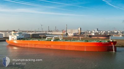
MORNING HOPE
Tanker
Current Trip
| Time Travelled | 16 days |
|---|---|
| Remaining Time | -1 mins |
| Distance Travelled | 4907.52 nm |
| Remaining Distance | 219.03 nm |
| AVG Speed | 12.2 Knots |
| MAX Speed | 16.8 Knots |
| AVG Wind | 14.8 knots |
| MAX Wind | 33.7 knots |
| MIN Temp | 12.1°C / 53.78°F |
| MAX Temp | 29.2°C / 84.56°F |
| Draught | 11 m |
| Position Received | 3 d ago |
Current Position
| Longitude | -79.53654° |
|---|---|
| Latitude | 25.47078° |
| Status | Under way using engine |
| Speed | 11.1 Knots |
| Course | 201.5° |
| Area | North Atlantic Ocean |
| Station | T-AIS |
| Position Received | 3 d ago |
Info
Information
The current position of MORNING HOPE is in North Atlantic Ocean with coordinates 25.47078° / -79.53654° as reported on 2024-06-13 09:22 by AIS to our vessel tracker app. The vessel's current speed is 11.1 Knots and is heading at the port of GALVESTON. The estimated time of arrival as calculated by vessel tracking app is 2024-06-16 10:52 LT
The vessel MORNING HOPE (IMO: 9789283, MMSI: 538009825) is a Tanker It's sailing under the flag of [MH] Marshall Is.
In this page you can find informations about the vessels current position, last detected port calls, and current voyage information. If the vessels is not in coverage by AIS you will find the latest position.
The current position of MORNING HOPE is detected by our AIS receivers and we are not responsible for the reliability of the data. The last position was recorded while the vessel was in Coverage by the Ais receivers of our vessel tracking app.
The current draught of MORNING HOPE as reported by AIS is 11 meters
Weather
| Temperature | 28.7°C / 83.66°F |
|---|---|
| Wind Speed | 16 knots |
| Direction | 140° SE |
| Pressure | 1009.3 hPa |
| Humidity | 72.1 % |
| Cloud Coverage | 6 % |
Featured Company
Last Port Calls
| Port | Arrival | Departure | Time In Port |
|---|---|---|---|
| 2024-05-28 18:24 | 2024-05-31 01:29 | 2 d | |
| 2024-04-23 06:23 | 2024-04-25 06:28 | 2 d | |
| 2024-04-21 09:48 |
Most Visited Ports (Last year)
| Port | Arrivals | |
|---|---|---|
| 3 | ||
| 2 | ||
| 1 | ||
| 1 |
Last Trips
| Origin | Departure | Destination | Arrival | Distance | |
|---|---|---|---|---|---|
| 2024-04-25 08:28 | 2024-05-28 20:24 | 5552.88 nm | |||
| 2024-04-21 11:48 | 2024-04-23 08:23 | 470.83 nm |
Events
| Time | Event | Details | Position / Dest | Info |
|---|---|---|---|---|
| 2024-06-13 09:31 | Status Changed | Default Under way using engine |
25.44333 / -79.54500
GALVESTON
|
Speed: 11.1 kn Course: 201.5° |
| 2024-06-13 09:22 | OUT of Coverage |
25.47078 / -79.53654
North Atlantic Ocean
GALVESTON
|
Speed: 11.1 kn Course: 201.5° |
|
| 2024-06-13 09:17 | Status Changed | Under way using engine Default |
25.48516 / -79.53015
GALVESTON
|
Speed: 11 kn Course: 190° |
| 2024-06-13 08:46 | Status Changed | Default Under way using engine |
25.57667 / -79.51833
GALVESTON
|
Speed: 10.9 kn Course: 183.3° |
| 2024-06-13 08:37 | Status Changed | Under way using engine Default |
25.60491 / -79.51626
GALVESTON
|
Speed: 11 kn Course: 184° |
| 2024-06-13 08:34 | Status Changed | Default Under way using engine |
25.61333 / -79.51500
GALVESTON
|
Speed: 11 kn Course: 184° |
| 2024-06-13 08:22 | Status Changed | Under way using engine Default |
25.65236 / -79.51247
GALVESTON
|
Speed: 11 kn Course: 184° |
| 2024-06-13 08:12 | Status Changed | Default Under way using engine |
25.68193 / -79.50995
GALVESTON
|
Speed: 10.9 kn Course: 183.8° |
| 2024-06-13 08:09 | Status Changed | Under way using engine Default |
25.69011 / -79.50933
GALVESTON
|
Speed: 11 kn Course: 184° |
| 2024-06-13 08:01 | IN Coverage |
25.69011 / -79.50933
North Atlantic Ocean
GALVESTON
|
Speed: 10.9 kn Course: 183.8° |