
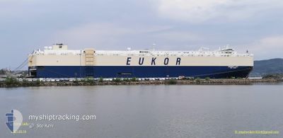
MORNING LADY
Vehicles Carrier
Current Trip
| Time Travelled | 1 day |
|---|---|
| Remaining Time | 15 h, 55 mins |
| Distance Travelled | 394.53 nm |
| Remaining Distance | 270.01 nm |
| AVG Speed | 14.7 Knots |
| MAX Speed | 17.8 Knots |
| AVG Wind | 15.5 knots |
| MAX Wind | 19 knots |
| MIN Temp | 26.6°C / 79.88°F |
| MAX Temp | 28.1°C / 82.58°F |
| Draught | 9.2 m |
| Position Received | 2 h, 16 m ago |
Current Position
| Longitude | -95.02848° |
|---|---|
| Latitude | 23.48754° |
| Status | Under way using engine |
| Speed | 14.7 Knots |
| Course | 192° |
| Area | Gulf of Mexico |
| Station | T-AIS |
| Position Received | 2 h, 16 m ago |
Info
Information
The current position of MORNING LADY is in Gulf of Mexico with coordinates 23.48754° / -95.02848° as reported on 2024-05-26 04:01 by AIS to our vessel tracker app. The vessel's current speed is 14.7 Knots and is heading at the port of VERACRUZ. The estimated time of arrival as calculated by vessel tracking app is 2024-05-26 22:12 LT
The vessel MORNING LADY (IMO: 9445980, MMSI: 441467000) is a Vehicles Carrier that was built in 2010 ( 14 years old ). It's sailing under the flag of [KR] Korea.
In this page you can find informations about the vessels current position, last detected port calls, and current voyage information. If the vessels is not in coverage by AIS you will find the latest position.
The current position of MORNING LADY is detected by our AIS receivers and we are not responsible for the reliability of the data. The last position was recorded while the vessel was in Coverage by the Ais receivers of our vessel tracking app.
The current draught of MORNING LADY as reported by AIS is 9.2 meters
Weather
| Temperature | 28.1°C / 82.58°F |
|---|---|
| Wind Speed | 17 knots |
| Direction | 113° ESE |
| Pressure | 1007.8 hPa |
| Humidity | 92.3 % |
| Cloud Coverage | 57 % |
Featured Company
Last Port Calls
| Port | Arrival | Departure | Time In Port |
|---|---|---|---|
| 2024-05-24 09:52 | 2024-05-25 03:30 | 17 h | |
| 2024-05-20 09:37 | 2024-05-21 02:01 | 16 h | |
| 2024-05-07 07:51 | 2024-05-08 22:56 | 1 d | |
| 2024-05-04 09:59 | 2024-05-04 22:49 | 12 h | |
| 2024-04-30 10:29 | 2024-05-03 18:56 | 3 d | |
| 2024-04-26 14:19 | 2024-04-27 16:43 | 1 d | |
| 2024-04-15 18:07 | 2024-04-17 00:10 | 1 d | |
| 2024-04-11 20:17 | 2024-04-12 22:10 | 1 d | |
| 2024-04-09 13:57 | 2024-04-10 02:22 | 12 h | |
| 2024-03-30 20:50 | 2024-04-01 17:21 | 1 d |
Most Visited Ports (Last year)
| Port | Arrivals | |
|---|---|---|
| 4 | ||
| 4 | ||
| 4 | ||
| 3 | ||
| 3 | ||
| 2 |
Last Trips
| Origin | Departure | Destination | Arrival | Distance | |
|---|---|---|---|---|---|
| 2024-05-20 22:01 | 2024-05-24 04:52 | 1319.69 nm | |||
| 2024-05-09 00:56 | 2024-05-20 05:37 | 4149.74 nm | |||
| 2024-05-04 23:49 | 2024-05-07 09:51 | 491.45 nm | |||
| 2024-05-03 20:56 | 2024-05-04 10:59 | 206.09 nm | |||
| 2024-04-27 18:43 | 2024-04-30 12:29 | 847.92 nm | |||
| 2024-04-16 20:10 | 2024-04-26 16:19 | 3505.18 nm | |||
| 2024-04-12 18:10 | 2024-04-15 14:07 | 821.58 nm | |||
| 2024-04-09 23:22 | 2024-04-11 16:17 | 608.24 nm | |||
| 2024-04-01 18:21 | 2024-04-09 10:57 | 2619.10 nm | |||
| 2024-03-29 00:34 | 2024-03-30 20:50 | 710.01 nm |
Events
| Time | Event | Details | Position / Dest | Info |
|---|---|---|---|---|
| 2024-05-26 04:08 | Status Changed | Default Under way using engine |
23.45684 / -95.03585
MXVER
|
Speed: 14.7 kn Course: 192° |
| 2024-05-26 04:01 | OUT of Coverage |
23.48754 / -95.02848
Gulf of Mexico
MXVER
|
Speed: 14.7 kn Course: 192° |
|
| 2024-05-26 03:29 | ETA Changed | 2024/05/27 09:00 2024/05/27 03:00 |
23.61542 / -94.99567
MXVER
|
Speed: 14.9 kn Course: 193.3° |
| 2024-05-26 03:11 | Status Changed | Under way using engine Default |
23.68941 / -94.97655
MXVER
|
Speed: 14.8 kn Course: 194° |
| 2024-05-26 02:40 | Status Changed | Default Under way using engine |
23.81162 / -94.94588
MXVER
|
Speed: 14.7 kn Course: 192.8° |
| 2024-05-26 02:22 | Change Sea Area | Mexican part of the Gulf of Mexico United States part of the Gulf of Mexico |
23.88538 / -94.92759
Gulf of Mexico
MXVER
|
Speed: 14.8 kn Course: 192.7° |
| 2024-05-26 02:22 | Status Changed | Under way using engine Default |
23.88538 / -94.92759
MXVER
|
Speed: 14.9 kn Course: 193° |
| 2024-05-26 02:19 | IN Coverage |
23.88538 / -94.92759
Gulf of Mexico
MXVER
|
Speed: 14.8 kn Course: 192.7° |
|
| 2024-05-25 12:19 | Status Changed | Default Under way using engine |
27.33102 / -94.41600
MXVER
|
Speed: 14.3 kn Course: 181.2° |
| 2024-05-25 12:11 | OUT of Coverage |
27.36218 / -94.41517
Gulf of Mexico
MXVER
|
Speed: 14.3 kn Course: 181.2° |