
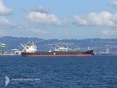
MP MR TANKER1
Oil/Chemical Tanker
Current Trip
FOR ORDERS
| Time Travelled | --- |
|---|---|
| Remaining Time | --- |
| Distance Travelled | --- |
| Remaining Distance | --- |
| AVG Speed | --- |
| MAX Speed | --- |
| AVG Wind | --- |
| MAX Wind | --- |
| MIN Temp | --- |
| MAX Temp | --- |
| Draught | 10.8 m |
| Position Received | 7 h, 33 m ago |
Current Position
| Longitude | 50.20964° |
|---|---|
| Latitude | 26.67074° |
| Status | Under way using engine |
| Speed | 4.4 Knots |
| Course | 130° |
| Area | Persian Gulf |
| Station | T-AIS |
| Position Received | 7 h, 33 m ago |
Info
Information
The current position of MP MR TANKER1 is in Persian Gulf with coordinates 26.67074° / 50.20964° as reported on 2024-06-20 16:54 by AIS to our vessel tracker app. The vessel's current speed is 4.4 Knots
The vessel MP MR TANKER1 (IMO: 9472763, MMSI: 563047700) is a Oil/Chemical Tanker that was built in 2011 ( 13 years old ). It's sailing under the flag of [SG] Singapore.
In this page you can find informations about the vessels current position, last detected port calls, and current voyage information. If the vessels is not in coverage by AIS you will find the latest position.
The current position of MP MR TANKER1 is detected by our AIS receivers and we are not responsible for the reliability of the data. The last position was recorded while the vessel was in Coverage by the Ais receivers of our vessel tracking app.
The current draught of MP MR TANKER1 as reported by AIS is 10.8 meters
Weather
| Temperature | 32.6°C / 90.68°F |
|---|---|
| Wind Speed | 5 knots |
| Direction | 327° NNW |
| Pressure | 995.8 hPa |
| Humidity | 68.6 % |
| Cloud Coverage | --- |
Featured Company
Last Port Calls
| Port | Arrival | Departure | Time In Port |
|---|---|---|---|
| 2024-06-05 01:27 | |||
| 2024-05-24 02:28 | 2024-05-27 00:45 | 2 d | |
| 2024-05-06 22:26 | 2024-05-08 16:33 | 1 d | |
| 2024-04-26 06:33 | 2024-04-29 07:08 | 3 d | |
| 2024-04-12 01:50 | 2024-04-16 03:47 | 4 d |
Most Visited Ports (Last year)
| Port | Arrivals | |
|---|---|---|
| 3 | ||
| 2 | ||
| 2 | ||
| 1 | ||
| 1 | ||
| 1 |
Last Trips
| Origin | Departure | Destination | Arrival | Distance | |
|---|---|---|---|---|---|
| 2024-05-27 04:45 | 2024-06-05 06:57 | 2390.98 nm | |||
| 2024-05-09 00:33 | 2024-05-24 06:28 | 3665.08 nm | |||
| 2024-04-29 13:08 | 2024-05-07 06:26 | 1585.66 nm | |||
| 2024-04-16 11:47 | 2024-04-26 12:33 | 1623.82 nm | |||
| 2024-03-02 23:21 | 2024-04-12 09:50 | 7908.15 nm |
Events
| Time | Event | Details | Position / Dest | Info |
|---|---|---|---|---|
| 2024-06-20 17:58 | STOP Moving | 9.18 nm, East of RAS TANURA |
26.65109 / 50.24237
FOR ORDERS
|
Speed: 0.2 kn Course: 166° |
| 2024-06-20 17:02 | Status Changed | Default Under way using engine |
26.66527 / 50.21798
FOR ORDERS
|
Speed: 4.4 kn Course: 130° |
| 2024-06-20 16:54 | OUT of Coverage |
26.67074 / 50.20964
Persian Gulf
FOR ORDERS
|
Speed: 4.4 kn Course: 126.2° |
|
| 2024-06-20 16:46 | Status Changed | Under way using engine Default |
26.67626 / 50.20096
FOR ORDERS
|
Speed: 4.8 kn Course: 176° |
| 2024-06-20 16:40 | Status Changed | Default Under way using engine |
26.68449 / 50.19960
FOR ORDERS
|
Speed: 4.8 kn Course: 175° |
| 2024-06-20 16:37 | Status Changed | Under way using engine Default |
26.68838 / 50.19936
FOR ORDERS
|
Speed: 4.9 kn Course: 180° |
| 2024-06-20 16:30 | Status Changed | Default Under way using engine |
26.69873 / 50.19962
FOR ORDERS
|
Speed: 4.8 kn Course: 179° |
| 2024-06-20 16:27 | Status Changed | Under way using engine Default |
26.70234 / 50.19955
FOR ORDERS
|
Speed: 4.8 kn Course: 162° |
| 2024-06-20 16:20 | Status Changed | Default Under way using engine |
26.71181 / 50.19664
FOR ORDERS
|
Speed: 4.8 kn Course: 162° |
| 2024-06-20 16:05 | Status Changed | Under way using engine Default |
26.73163 / 50.19002
FOR ORDERS
|
Speed: 4.8 kn Course: 164° |